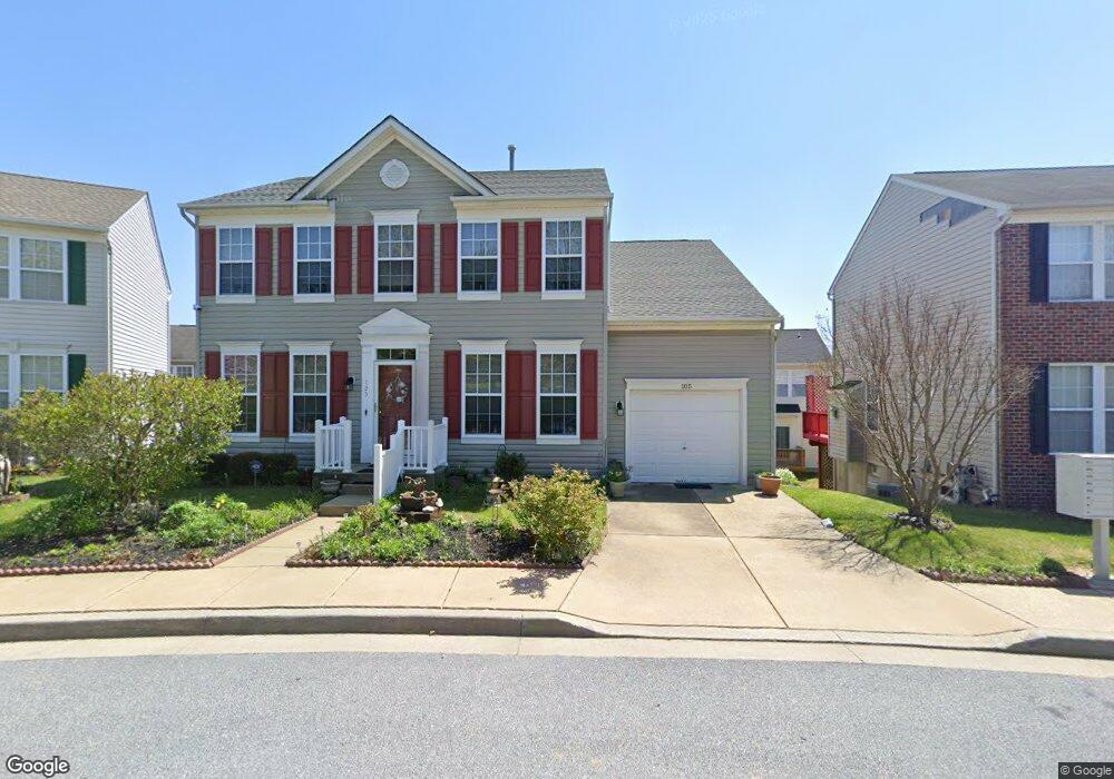
105 Achsah Dr Owings Mills, MD 21117
Estimated Value: $422,000 - $547,000
--
Bed
3
Baths
2,240
Sq Ft
$209/Sq Ft
Est. Value
About This Home
This home is located at 105 Achsah Dr, Owings Mills, MD 21117 and is currently estimated at $469,027, approximately $209 per square foot. 105 Achsah Dr is a home located in Baltimore County with nearby schools including New Town Elementary School, Deer Park Middle Magnet School, and New Town High.
Ownership History
Date
Name
Owned For
Owner Type
Purchase Details
Closed on
Apr 21, 2023
Sold by
Pantin Jemmry
Bought by
Pantin Jemmry and Pantin Kustaa
Current Estimated Value
Purchase Details
Closed on
Dec 6, 2019
Sold by
Edwards Rauti
Bought by
Edwards Rauti and Edwards Janice
Purchase Details
Closed on
Sep 19, 2007
Sold by
Edwards Rauti
Bought by
Edwards Rauti and Edwards Janice
Purchase Details
Closed on
Sep 6, 2006
Sold by
Edwards Rauti
Bought by
Edwards Rauti and Edwards Janice
Purchase Details
Closed on
Oct 24, 2000
Sold by
Ryland Group Inc
Bought by
Edwards Rauti
Purchase Details
Closed on
Jun 13, 2000
Sold by
Jensen Dottie
Bought by
Ryland Group Inc
Create a Home Valuation Report for This Property
The Home Valuation Report is an in-depth analysis detailing your home's value as well as a comparison with similar homes in the area
Home Values in the Area
Average Home Value in this Area
Purchase History
| Date | Buyer | Sale Price | Title Company |
|---|---|---|---|
| Pantin Jemmry | -- | None Listed On Document | |
| Pantin Jemmry | -- | None Listed On Document | |
| Edwards Rauti | -- | None Available | |
| Edwards Rauti | -- | None Available | |
| Edwards Rauti | -- | -- | |
| Edwards Rauti | -- | -- | |
| Edwards Rauti | $212,697 | -- | |
| Ryland Group Inc | $49,050 | -- |
Source: Public Records
Tax History Compared to Growth
Tax History
| Year | Tax Paid | Tax Assessment Tax Assessment Total Assessment is a certain percentage of the fair market value that is determined by local assessors to be the total taxable value of land and additions on the property. | Land | Improvement |
|---|---|---|---|---|
| 2025 | -- | $358,433 | -- | -- |
| 2024 | $4,637 | $332,600 | $78,700 | $253,900 |
| 2023 | $2,415 | $324,233 | $0 | $0 |
| 2022 | $4,825 | $315,867 | $0 | $0 |
| 2021 | $4,433 | $307,500 | $78,700 | $228,800 |
| 2020 | $4,433 | $301,867 | $0 | $0 |
| 2019 | $4,228 | $296,233 | $0 | $0 |
| 2018 | $4,123 | $290,600 | $78,700 | $211,900 |
| 2017 | $3,935 | $279,133 | $0 | $0 |
| 2016 | $3,924 | $267,667 | $0 | $0 |
| 2015 | $3,924 | $256,200 | $0 | $0 |
| 2014 | $3,924 | $256,200 | $0 | $0 |
Source: Public Records
Map
Nearby Homes
- 34 Hawk Rise Ln
- 18 Hawk Rise Ln Unit 205
- 16 Hawk Rise Ln
- 118 Oliver Heights Rd
- 1067 Campbell Meadow Rd
- 5109 Gold Hill Rd
- 9839 Bale Ct
- 8931 Groffs Mill Dr Unit 8931
- 9943 Middle Mill Dr
- 372 Paladium Ct
- 900 Red Brook Blvd Unit 101
- 9339 Paragon Way
- 5206 Stone Shop Cir
- 4828 Stone Shop Cir
- 5114 Wagon Shed Cir
- 5227 Wagon Shed Cir
- 5233 Wagon Shed Cir
- 9473 Ashlyn Cir
- 4400 Silverbrook Ln Unit F003
- 9715 Reese Farm Rd
- 103 Achsah Dr
- 107 Achsah Dr
- 104 Rangeford Dr
- 102 Rangeford Dr
- 106 Rangeford Dr
- 101 Achsah Dr
- 100 Rangeford Dr
- 109 Achsah Dr
- 108 Rangeford Dr
- 110 Rangeford Dr
- 105 Rangeford Dr
- 103 Rangeford Dr
- 107 Rangeford Dr
- 109 Rangeford Dr
- 111 Rangeford Dr
- 101 Rangeford Dr
- 113 Rangeford Dr
- 102 Egypt Farms Rd
- 104 Egypt Farms Rd
- 115 Rangeford Dr