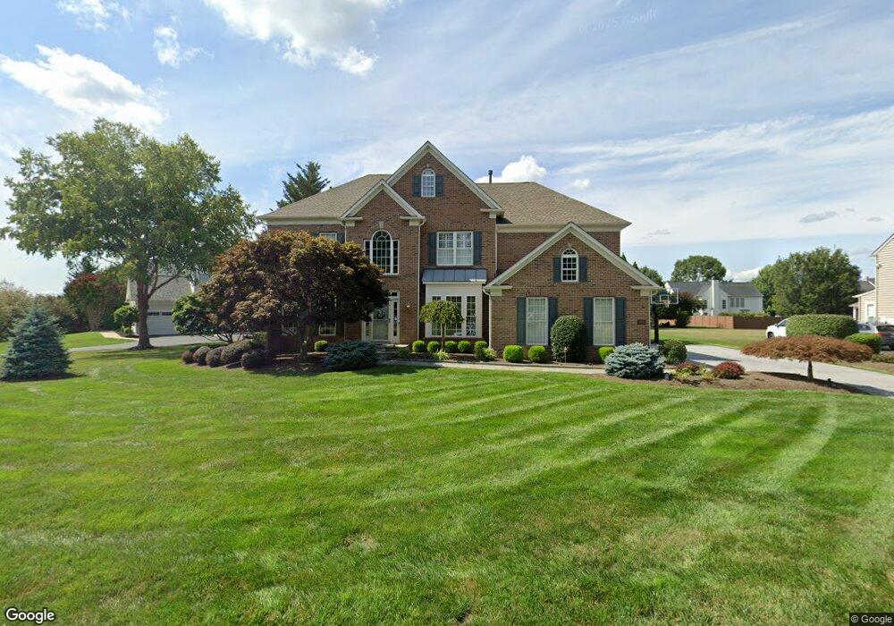
105 Applegate Dr West Chester, PA 19382
Estimated Value: $1,042,000 - $1,217,000
4
Beds
5
Baths
4,120
Sq Ft
$275/Sq Ft
Est. Value
About This Home
This home is located at 105 Applegate Dr, West Chester, PA 19382 and is currently estimated at $1,133,919, approximately $275 per square foot. 105 Applegate Dr is a home located in Chester County with nearby schools including Westtown-Thornbury Elementary School, Stetson Middle School, and Bayard Rustin High School.
Ownership History
Date
Name
Owned For
Owner Type
Purchase Details
Closed on
Jun 17, 1999
Sold by
Pulte Home Corp Of The Delaware Valley
Bought by
Oshaughnessy Timothy G and Oshaughnessy Marianne B
Current Estimated Value
Home Financials for this Owner
Home Financials are based on the most recent Mortgage that was taken out on this home.
Original Mortgage
$375,000
Outstanding Balance
$91,363
Interest Rate
6.12%
Estimated Equity
$1,042,556
Create a Home Valuation Report for This Property
The Home Valuation Report is an in-depth analysis detailing your home's value as well as a comparison with similar homes in the area
Home Values in the Area
Average Home Value in this Area
Purchase History
| Date | Buyer | Sale Price | Title Company |
|---|---|---|---|
| Oshaughnessy Timothy G | $470,113 | Lawyers Title Insurance Corp |
Source: Public Records
Mortgage History
| Date | Status | Borrower | Loan Amount |
|---|---|---|---|
| Open | Oshaughnessy Timothy G | $375,000 |
Source: Public Records
Tax History Compared to Growth
Tax History
| Year | Tax Paid | Tax Assessment Tax Assessment Total Assessment is a certain percentage of the fair market value that is determined by local assessors to be the total taxable value of land and additions on the property. | Land | Improvement |
|---|---|---|---|---|
| 2025 | $9,301 | $320,870 | $51,920 | $268,950 |
| 2024 | $9,301 | $320,870 | $51,920 | $268,950 |
| 2023 | $9,301 | $320,870 | $51,920 | $268,950 |
| 2022 | $9,181 | $320,870 | $51,920 | $268,950 |
| 2021 | $9,053 | $320,870 | $51,920 | $268,950 |
| 2020 | $8,994 | $320,870 | $51,920 | $268,950 |
| 2019 | $8,869 | $320,870 | $51,920 | $268,950 |
| 2018 | $8,681 | $320,870 | $51,920 | $268,950 |
| 2017 | $8,493 | $320,870 | $51,920 | $268,950 |
| 2016 | $9,469 | $320,870 | $51,920 | $268,950 |
| 2015 | $9,469 | $320,870 | $51,920 | $268,950 |
| 2014 | $9,469 | $320,870 | $51,920 | $268,950 |
Source: Public Records
Map
Nearby Homes
- 878 Empress Rd
- 859 Empress Rd
- 45 Sawmill Ct
- 47 Sawmill Ct
- 602 Bowers Dr
- 924 Trellis Ln
- 1626 S Coventry Ln
- 809 Amelia Dr
- 1549 S Coventry Ln
- 404 Warren Rd
- 501 Glen Ave
- 222 Westtown Way
- 1018 Ashley Rd
- 103 Everest Cir
- 400 Falcon Ln
- 521 Valley Dr Unit 521
- 1920 Valley Dr
- 2613 Eagle Rd Unit 2613
- 4 New Countryside Dr
- 202 Larchwood Rd
- 107 Applegate Dr
- 103 Applegate Dr
- 874 Empress Rd
- 876 Empress Rd
- 109 Applegate Dr
- 872 Empress Rd
- 102 Applegate Dr
- 108 Applegate Dr
- 104 Applegate Dr
- 106 Applegate Dr
- 870 Empress Rd
- 110 Applegate Dr
- 100 Applegate Dr
- 111 Applegate Dr
- 880 Empress Rd
- 112 Applegate Dr
- 862 Empress Rd
- 807 Little Shiloh Rd
- 866 Empress Rd
- 882 Empress Rd