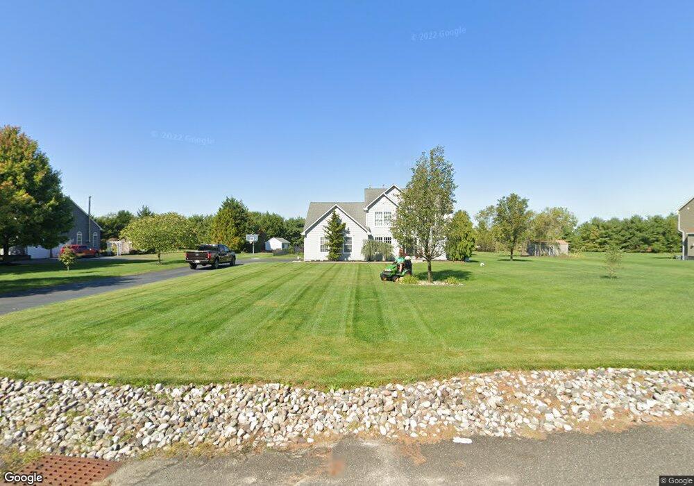
105 Basin Rd Hammonton, NJ 08037
Estimated Value: $509,315 - $696,000
Studio
--
Bath
2,626
Sq Ft
$230/Sq Ft
Est. Value
About This Home
This home is located at 105 Basin Rd, Hammonton, NJ 08037 and is currently estimated at $605,079, approximately $230 per square foot. 105 Basin Rd is a home located in Atlantic County with nearby schools including Hammonton Early Childhood Education Center, Warren E. Sooy Jr. Elementary School, and Hammonton Middle School.
Ownership History
Date
Name
Owned For
Owner Type
Purchase Details
Closed on
May 16, 2003
Sold by
Joseph Continisio Builders Inc
Bought by
Gatto James and Gatto Angela
Current Estimated Value
Home Financials for this Owner
Home Financials are based on the most recent Mortgage that was taken out on this home.
Original Mortgage
$200,000
Outstanding Balance
$85,092
Interest Rate
5.86%
Mortgage Type
Stand Alone First
Estimated Equity
$519,987
Purchase Details
Closed on
Feb 27, 1998
Sold by
Pine Basin Farms Inc
Bought by
Pine Basin Farms Inc
Create a Home Valuation Report for This Property
The Home Valuation Report is an in-depth analysis detailing your home's value as well as a comparison with similar homes in the area
Home Values in the Area
Average Home Value in this Area
Purchase History
| Date | Buyer | Sale Price | Title Company |
|---|---|---|---|
| Gatto James | $254,300 | -- | |
| Gatto James R | $254,300 | -- | |
| Pine Basin Farms Inc | -- | -- | |
| Pine Basin Farms Inc | -- | -- | |
| Pine Basin Farms Inc | -- | -- | |
| Pine Basin Farms Inc | -- | -- | |
| Pine Basin Farms Inc | -- | -- | |
| Pine Basin Farms Inc | -- | -- | |
| Pine Basin Farms Inc | -- | -- | |
| Pine Basin Farms Inc | -- | -- | |
| Pine Basin Farms Inc | -- | -- | |
| Pine Basin Farms Inc | -- | -- | |
| Pine Basin Farms Inc | -- | -- |
Source: Public Records
Mortgage History
| Date | Status | Borrower | Loan Amount |
|---|---|---|---|
| Open | Gatto James R | $200,000 | |
| Closed | Gatto James | $250,000 |
Source: Public Records
Tax History
| Year | Tax Paid | Tax Assessment Tax Assessment Total Assessment is a certain percentage of the fair market value that is determined by local assessors to be the total taxable value of land and additions on the property. | Land | Improvement |
|---|---|---|---|---|
| 2025 | $9,943 | $361,300 | $65,200 | $296,100 |
| 2024 | $9,943 | $361,300 | $65,200 | $296,100 |
Source: Public Records
Map
Nearby Homes
- 119 Basin Rd
- 19 Middle Rd
- 40 Toni Lynn Ct
- 301 N 4th St
- 55 Plymouth Rd
- 425 N Packard St
- 419 N Packard St
- 34 N Packard St
- 26 N Packard St
- 10 N Packard St
- 287 S White Horse Pike
- 327 Pleasant St E
- 721 Central Ave
- 131 N 2nd St
- 201 Grape St
- 415 S White Horse Pike
- 862 Central Ave
- 40 Front St
- 121 W End Ave
- 119 W End Ave
Your Personal Tour Guide
Ask me questions while you tour the home.