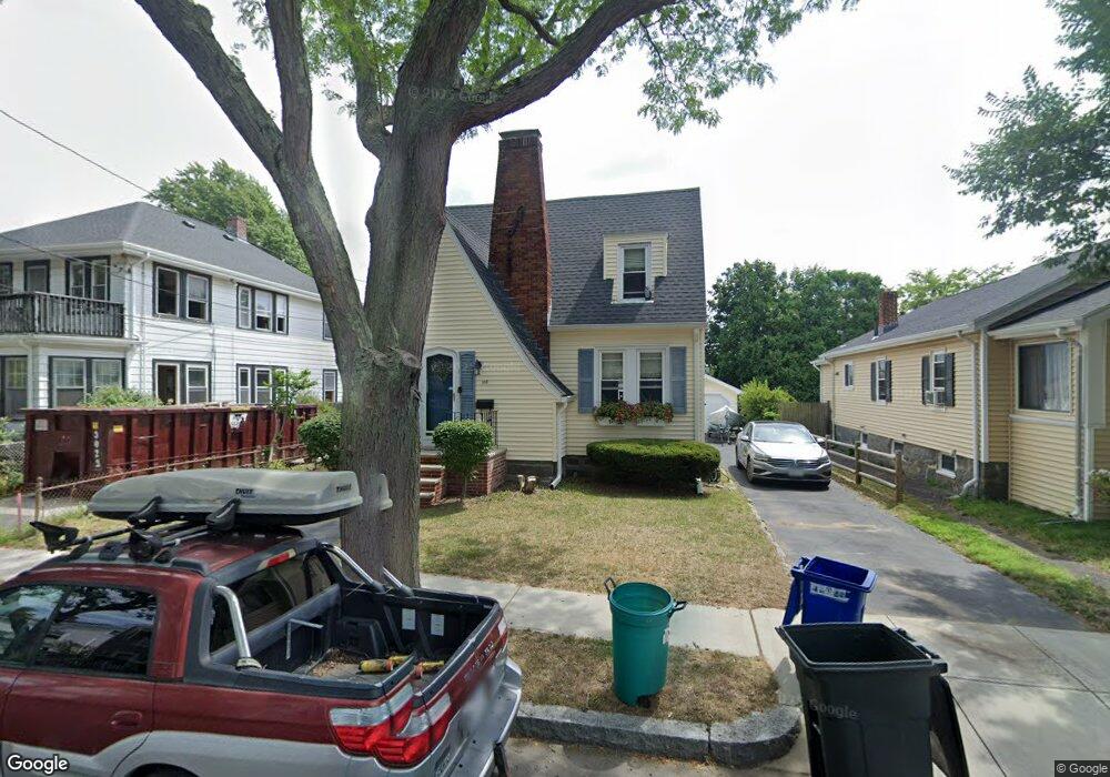
105 Baxter Ave Quincy, MA 02169
Quincy Point NeighborhoodEstimated Value: $565,000 - $635,000
2
Beds
1
Bath
1,107
Sq Ft
$534/Sq Ft
Est. Value
About This Home
This home is located at 105 Baxter Ave, Quincy, MA 02169 and is currently estimated at $590,747, approximately $533 per square foot. 105 Baxter Ave is a home located in Norfolk County with nearby schools including Point Webster Middle School, Clifford H. Marshall Elementary School, and Quincy High School.
Ownership History
Date
Name
Owned For
Owner Type
Purchase Details
Closed on
Nov 5, 2014
Sold by
Macdonald Theresa M
Bought by
Theresa M Macdonald Lt
Current Estimated Value
Purchase Details
Closed on
Dec 20, 1991
Sold by
Emond Mary A
Bought by
Macdonald Theresa M
Create a Home Valuation Report for This Property
The Home Valuation Report is an in-depth analysis detailing your home's value as well as a comparison with similar homes in the area
Home Values in the Area
Average Home Value in this Area
Purchase History
| Date | Buyer | Sale Price | Title Company |
|---|---|---|---|
| Theresa M Macdonald Lt | -- | -- | |
| Macdonald Theresa M | $134,500 | -- |
Source: Public Records
Mortgage History
| Date | Status | Borrower | Loan Amount |
|---|---|---|---|
| Previous Owner | Macdonald Theresa M | $110,000 | |
| Previous Owner | Macdonald Theresa M | $150,000 | |
| Previous Owner | Macdonald Theresa M | $10,000 |
Source: Public Records
Tax History
| Year | Tax Paid | Tax Assessment Tax Assessment Total Assessment is a certain percentage of the fair market value that is determined by local assessors to be the total taxable value of land and additions on the property. | Land | Improvement |
|---|---|---|---|---|
| 2025 | $5,903 | $512,000 | $262,500 | $249,500 |
| 2024 | $5,525 | $490,200 | $250,000 | $240,200 |
| 2023 | $5,065 | $455,100 | $227,300 | $227,800 |
| 2022 | $5,120 | $427,400 | $206,600 | $220,800 |
| 2021 | $4,888 | $402,600 | $206,600 | $196,000 |
| 2020 | $4,624 | $372,000 | $194,900 | $177,100 |
| 2019 | $4,467 | $355,900 | $180,500 | $175,400 |
| 2018 | $4,294 | $321,900 | $164,100 | $157,800 |
| 2017 | $4,099 | $289,300 | $156,200 | $133,100 |
| 2016 | $3,847 | $267,900 | $142,000 | $125,900 |
| 2015 | $3,656 | $250,400 | $134,000 | $116,400 |
| 2014 | $3,448 | $232,000 | $134,000 | $98,000 |
Source: Public Records
Map
Nearby Homes
- 200 Cove Way Unit 304
- 200 Cove Way Unit 614
- 500 Washington St Unit 201
- 585 Washington St Unit model-2
- 585 Washington St Unit model
- 7-9 Kittredge Ave
- 62 Lawn Ave
- 16 Perley Place
- 388 Washington St Unit 301
- 388 Washington St Unit 303
- 388 Washington St Unit 205
- 388 Washington St Unit 101
- 388 Washington St Unit 405
- 388 Washington St Unit 202
- 388 Washington St Unit 203
- 388 Washington St Unit 401
- 388 Washington St Unit 302
- 388 Washington St Unit 204
- 388 Washington St Unit 304
- 161 Sumner St Unit 2
- 101 Baxter Ave
- 97 Baxter Ave
- 111 Baxter Ave Unit 1
- 111 Baxter Ave
- 113 Baxter Ave Unit 113
- 113 Baxter Ave
- 113 Baxter Ave Unit 1
- 111 Baxter Ave
- 46 Harrison St
- 42 Harrison St
- 50 Harrison St
- 38 Harrison St
- 93 Baxter Ave
- 54 Harrison St
- 108 Baxter Ave
- 112 Baxter Ave
- 102 Baxter Ave
- 114 Baxter Ave
- 34 Harrison St
- 34 Harrison St Unit 1