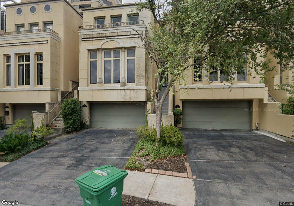
105 Birdsall St Houston, TX 77007
Rice Military NeighborhoodEstimated Value: $674,440 - $704,000
3
Beds
4
Baths
3,347
Sq Ft
$206/Sq Ft
Est. Value
About This Home
This home is located at 105 Birdsall St, Houston, TX 77007 and is currently estimated at $689,360, approximately $205 per square foot. 105 Birdsall St is a home located in Harris County with nearby schools including Memorial Elementary School, Hogg Middle, and Lamar High School.
Ownership History
Date
Name
Owned For
Owner Type
Purchase Details
Closed on
Mar 15, 2004
Sold by
Winston Barry D and Winston Christine
Bought by
Ortiz Albert
Current Estimated Value
Home Financials for this Owner
Home Financials are based on the most recent Mortgage that was taken out on this home.
Original Mortgage
$472,000
Outstanding Balance
$221,210
Interest Rate
5.71%
Mortgage Type
Stand Alone First
Estimated Equity
$468,150
Purchase Details
Closed on
Jun 14, 2000
Sold by
Bayou Bend Cove Associates Ltd
Bought by
Winston Barry D
Home Financials for this Owner
Home Financials are based on the most recent Mortgage that was taken out on this home.
Original Mortgage
$378,750
Interest Rate
8.5%
Create a Home Valuation Report for This Property
The Home Valuation Report is an in-depth analysis detailing your home's value as well as a comparison with similar homes in the area
Home Values in the Area
Average Home Value in this Area
Purchase History
| Date | Buyer | Sale Price | Title Company |
|---|---|---|---|
| Ortiz Albert | -- | Charter Title Company | |
| Winston Barry D | -- | -- |
Source: Public Records
Mortgage History
| Date | Status | Borrower | Loan Amount |
|---|---|---|---|
| Open | Ortiz Albert | $472,000 | |
| Previous Owner | Winston Barry D | $378,750 | |
| Closed | Winston Barry D | $71,000 |
Source: Public Records
Tax History Compared to Growth
Tax History
| Year | Tax Paid | Tax Assessment Tax Assessment Total Assessment is a certain percentage of the fair market value that is determined by local assessors to be the total taxable value of land and additions on the property. | Land | Improvement |
|---|---|---|---|---|
| 2025 | $13,278 | $667,690 | $237,500 | $430,190 |
| 2024 | $13,278 | $634,600 | $212,500 | $422,100 |
| 2023 | $13,278 | $639,625 | $212,500 | $427,125 |
| 2022 | $12,681 | $575,915 | $212,500 | $363,415 |
| 2021 | $12,165 | $521,975 | $212,500 | $309,475 |
| 2020 | $12,640 | $521,975 | $212,500 | $309,475 |
| 2019 | $15,083 | $596,052 | $212,500 | $383,552 |
| 2018 | $15,330 | $605,822 | $150,000 | $455,822 |
| 2017 | $16,838 | $665,896 | $150,000 | $515,896 |
| 2016 | $19,480 | $770,405 | $150,000 | $620,405 |
| 2015 | $16,721 | $0 | $0 | $0 |
| 2014 | $16,721 | $650,464 | $150,000 | $500,464 |
Source: Public Records
Map
Nearby Homes
- 101 Westcott St Unit 1905
- 101 Westcott St Unit 305
- 6015 Glencove St
- 102 Asbury St Unit 2803
- 102 Asbury St Unit 1704
- 102 Asbury St Unit 2202
- 102 Asbury St Unit 3703
- 102 Asbury St Unit 1003
- 102 Asbury St Unit 1901
- 102 Asbury St Unit 3501
- 207 Malone St
- 6017 Memorial Dr Unit 202
- 6017 Memorial Dr Unit 505
- 6024 Memorial Dr
- 38 E Bend Ln
- 229 Knox St
- 210 Glenwood Dr
- 58 E Bend Ln
- 235 Malone St
- 5612 Lacy St
- 107 Birdsall St
- 103 Birdsall St
- 101 Birdsall St
- 5803 Logan Ln
- 5801 Logan Ln
- 5805 Logan Ln
- 5731 Logan Ln
- 101 Westcott St Unit 206
- 101 Westcott St Unit 205
- 101 Westcott St Unit 1002
- 101 Westcott St Unit 405
- 101 Westcott St Unit 801
- 101 Westcott St Unit 1602
- 101 Westcott St Unit 406
- 101 Westcott St Unit 1203
- 101 Westcott St Unit 2105
- 101 Westcott St Unit 1201
- 101 Westcott St Unit 1804
- 101 Westcott St Unit 1206
- 101 Westcott St Unit 1405