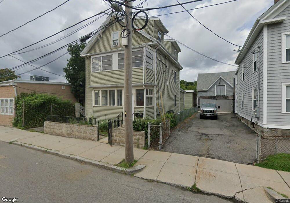
105 Brookside Ave Jamaica Plain, MA 02130
Jamaica Plain NeighborhoodEstimated Value: $896,000 - $1,186,000
2
Beds
2
Baths
750
Sq Ft
$1,441/Sq Ft
Est. Value
About This Home
This home is located at 105 Brookside Ave, Jamaica Plain, MA 02130 and is currently estimated at $1,080,693, approximately $1,440 per square foot. 105 Brookside Ave is a home located in Suffolk County with nearby schools including Neighborhood School and Meridian Academy.
Ownership History
Date
Name
Owned For
Owner Type
Purchase Details
Closed on
Jun 12, 2006
Sold by
Bent Delva V and Bent Glenton A
Bought by
Montesino Ana and Montesino Jose
Current Estimated Value
Home Financials for this Owner
Home Financials are based on the most recent Mortgage that was taken out on this home.
Original Mortgage
$400,000
Outstanding Balance
$235,825
Interest Rate
6.62%
Mortgage Type
Purchase Money Mortgage
Estimated Equity
$844,868
Create a Home Valuation Report for This Property
The Home Valuation Report is an in-depth analysis detailing your home's value as well as a comparison with similar homes in the area
Home Values in the Area
Average Home Value in this Area
Purchase History
| Date | Buyer | Sale Price | Title Company |
|---|---|---|---|
| Montesino Ana | $455,000 | -- |
Source: Public Records
Mortgage History
| Date | Status | Borrower | Loan Amount |
|---|---|---|---|
| Open | Montesino Ana | $400,000 |
Source: Public Records
Tax History Compared to Growth
Tax History
| Year | Tax Paid | Tax Assessment Tax Assessment Total Assessment is a certain percentage of the fair market value that is determined by local assessors to be the total taxable value of land and additions on the property. | Land | Improvement |
|---|---|---|---|---|
| 2025 | $10,262 | $886,200 | $361,700 | $524,500 |
| 2024 | $9,175 | $841,700 | $341,500 | $500,200 |
| 2023 | $8,775 | $817,000 | $331,500 | $485,500 |
| 2022 | $8,082 | $742,800 | $301,400 | $441,400 |
| 2021 | $7,547 | $707,300 | $287,000 | $420,300 |
| 2020 | $6,848 | $648,500 | $255,800 | $392,700 |
| 2019 | $6,466 | $613,500 | $217,200 | $396,300 |
| 2018 | $6,244 | $595,800 | $217,200 | $378,600 |
| 2017 | $6,128 | $578,700 | $217,200 | $361,500 |
| 2016 | $5,895 | $535,900 | $217,200 | $318,700 |
| 2015 | $5,294 | $437,200 | $155,000 | $282,200 |
| 2014 | $4,663 | $370,700 | $155,000 | $215,700 |
Source: Public Records
Map
Nearby Homes
- 172 Green St Unit 1
- 3305 Washington St Unit 201
- 111-121 Green St Unit 301
- 58 Forest Hills St Unit 2
- 3417 Washington St Unit 2
- 285 Lamartine St
- 285 Lamartine St Unit 2
- 10 Forest Hills St Unit 1
- 24 Newbern St
- 66 Seaverns Ave Unit 68B
- 65 Green St Unit 302
- 44 Robeson St Unit 44A
- 44 Newbern St
- 76 Elm St Unit G05
- 60 Williams St Unit 402
- 119 Sedgwick St
- 85 Glen Rd Unit 2
- 29 Gartland St Unit 2
- 40 Gartland St Unit 2
- 196 Chestnut Ave Unit I
- 105 Brookside Ave
- 105 Brookside Ave Unit 105
- 105 Brookside Ave Unit 3
- 105 Brookside Ave Unit 2
- 103 Brookside Ave
- 113 Brookside Ave
- 36 Ophir St
- 108 Brookside Ave
- 112 Brookside Ave Unit 3
- 112 Brookside Ave Unit 2
- 112 Brookside Ave Unit 1
- 112 Brookside Ave Unit Rear
- 112 Brookside Ave
- 112 Brookside Ave Unit CH
- 98 Brookside Ave
- 95 Brookside Ave Unit 97A
- 34 Ophir St Unit 34R
- 94 Brookside Ave
- 91 Brookside Ave
- 93 Brookside Ave