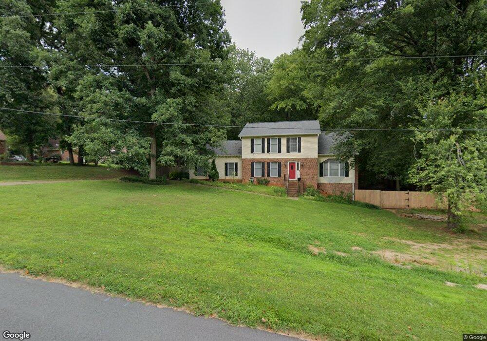
105 Esther Ln Walkertown, NC 27051
Estimated Value: $312,000 - $365,000
3
Beds
3
Baths
2,278
Sq Ft
$152/Sq Ft
Est. Value
About This Home
This home is located at 105 Esther Ln, Walkertown, NC 27051 and is currently estimated at $346,843, approximately $152 per square foot. 105 Esther Ln is a home located in Forsyth County with nearby schools including Middle Fork Elementary, Walkertown Middle, and Walkertown High School.
Ownership History
Date
Name
Owned For
Owner Type
Purchase Details
Closed on
Jul 15, 2022
Sold by
Ramey Properties Llc
Bought by
Lennar Carolinas Llc
Current Estimated Value
Purchase Details
Closed on
Jul 9, 2004
Sold by
Peay Melvin T and Sin Peay Doris M
Bought by
Custer Terry K and Custer Jacqueline
Home Financials for this Owner
Home Financials are based on the most recent Mortgage that was taken out on this home.
Original Mortgage
$140,000
Interest Rate
6.25%
Mortgage Type
Purchase Money Mortgage
Purchase Details
Closed on
Mar 31, 2000
Sold by
Mcneel Keith E and Mcneel Tammy L
Bought by
Peay Melvin T and Sin Peay Doris M
Home Financials for this Owner
Home Financials are based on the most recent Mortgage that was taken out on this home.
Original Mortgage
$105,000
Interest Rate
8.24%
Create a Home Valuation Report for This Property
The Home Valuation Report is an in-depth analysis detailing your home's value as well as a comparison with similar homes in the area
Home Values in the Area
Average Home Value in this Area
Purchase History
| Date | Buyer | Sale Price | Title Company |
|---|---|---|---|
| Lennar Carolinas Llc | $2,970,000 | K&L Gates Llp | |
| Custer Terry K | $163,500 | -- | |
| Peay Melvin T | $100,000 | -- |
Source: Public Records
Mortgage History
| Date | Status | Borrower | Loan Amount |
|---|---|---|---|
| Previous Owner | Custer Terry K | $140,000 | |
| Previous Owner | Peay Melvin T | $105,000 |
Source: Public Records
Tax History Compared to Growth
Tax History
| Year | Tax Paid | Tax Assessment Tax Assessment Total Assessment is a certain percentage of the fair market value that is determined by local assessors to be the total taxable value of land and additions on the property. | Land | Improvement |
|---|---|---|---|---|
| 2025 | $1,699 | $235,900 | $35,200 | $200,700 |
| 2024 | $1,699 | $193,500 | $35,200 | $158,300 |
| 2023 | $1,699 | $193,500 | $35,200 | $158,300 |
| 2022 | $1,699 | $193,500 | $35,200 | $158,300 |
| 2021 | $1,699 | $193,500 | $35,200 | $158,300 |
| 2020 | $1,320 | $139,900 | $24,600 | $115,300 |
| 2019 | $1,334 | $139,900 | $24,600 | $115,300 |
| 2018 | $1,292 | $139,900 | $24,600 | $115,300 |
| 2016 | $1,267 | $136,112 | $15,840 | $120,272 |
| 2015 | $1,267 | $136,112 | $15,840 | $120,272 |
Source: Public Records
Map
Nearby Homes
- 305 High Knoll Dr
- 4928 Cranfill Ln
- 4895 Parnell Ridge Dr
- 2521 Henley Ln
- 2612 Stone Garden Dr
- 851 Morris Rd
- 2618 Stone Garden Dr
- 2630 Stone Garden Dr
- 2624 Stone Garden Dr
- 4211 Gracewood Farm Dr
- 2645 Chari Park Ln
- 769 Morris Rd
- 4212 Gracewood Farm Dr
- 751 Morris Rd
- 4218 Gracewood Farm Dr
- 4217 Gracewood Farm Dr
- 4224 Gracewood Farm Dr
- 4223 Gracewood Farm Dr
- 2722 Darrow Rd
- 0 Morris Rd Rd