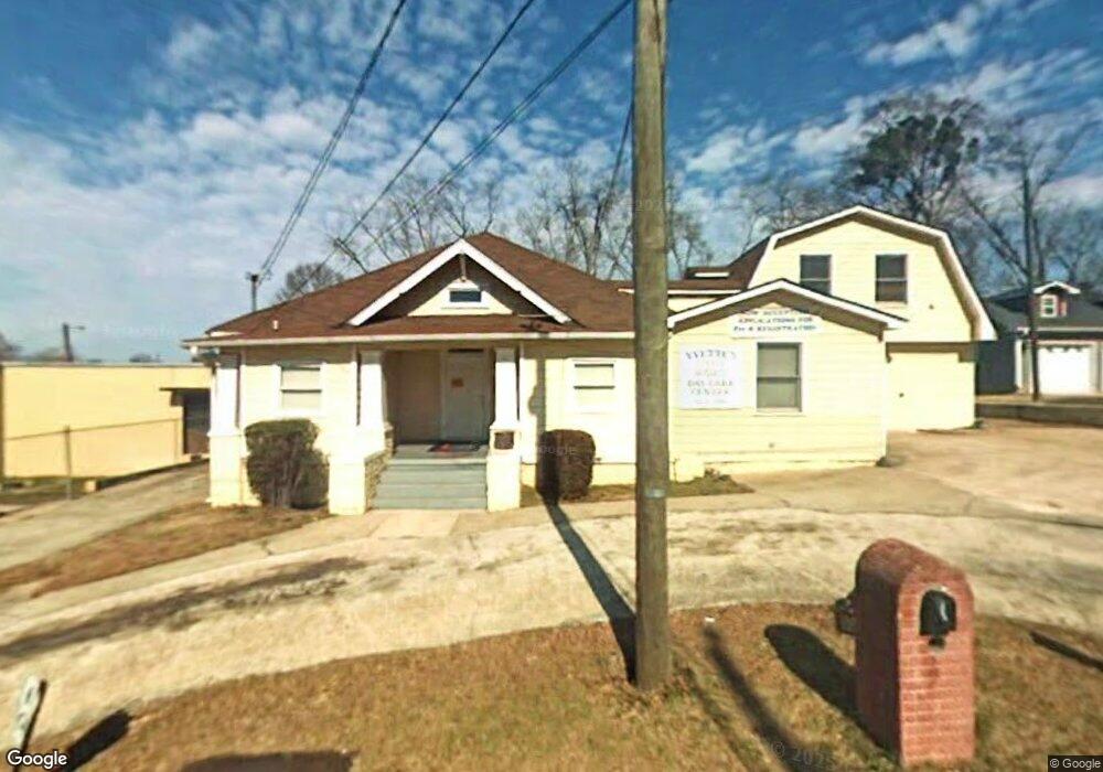
105 Fannin St Lagrange, GA 30241
Estimated Value: $350,293 - $477,000
3
Beds
3
Baths
2,466
Sq Ft
$161/Sq Ft
Est. Value
About This Home
This home is located at 105 Fannin St, Lagrange, GA 30241 and is currently estimated at $398,098, approximately $161 per square foot. 105 Fannin St is a home located in Troup County with nearby schools including Hollis Hand Elementary School, Franklin Forest Elementary School, and Ethel W. Kight Elementary School.
Ownership History
Date
Name
Owned For
Owner Type
Purchase Details
Closed on
Mar 23, 2022
Sold by
Woodard Willie J
Bought by
Woodard Yvette R
Current Estimated Value
Purchase Details
Closed on
Oct 11, 1995
Sold by
Michael E Noonan
Bought by
Woodard Willie J and Woodard Yvette R
Purchase Details
Closed on
Jun 17, 1995
Sold by
Roy D Terry
Bought by
Michael E Noonan
Purchase Details
Closed on
Jun 14, 1995
Sold by
Roy D Terry
Bought by
Roy D Terry
Purchase Details
Closed on
Apr 1, 1977
Sold by
Mina B Woods
Bought by
Roy D Terry
Purchase Details
Closed on
May 24, 1975
Sold by
Woods B T
Bought by
Mina B Woods
Purchase Details
Closed on
Nov 1, 1952
Sold by
Mccary George W and Mccary Arnel
Bought by
Woods B T
Create a Home Valuation Report for This Property
The Home Valuation Report is an in-depth analysis detailing your home's value as well as a comparison with similar homes in the area
Home Values in the Area
Average Home Value in this Area
Purchase History
| Date | Buyer | Sale Price | Title Company |
|---|---|---|---|
| Woodard Yvette R | -- | -- | |
| Woodard Willie J | -- | -- | |
| Michael E Noonan | $230,000 | -- | |
| Roy D Terry | -- | -- | |
| Roy D Terry | $25,000 | -- | |
| Mina B Woods | -- | -- | |
| Woods B T | -- | -- |
Source: Public Records
Tax History Compared to Growth
Tax History
| Year | Tax Paid | Tax Assessment Tax Assessment Total Assessment is a certain percentage of the fair market value that is determined by local assessors to be the total taxable value of land and additions on the property. | Land | Improvement |
|---|---|---|---|---|
| 2024 | $4,987 | $182,840 | $14,000 | $168,840 |
| 2023 | $4,306 | $157,880 | $14,000 | $143,880 |
| 2022 | $4,329 | $155,120 | $14,000 | $141,120 |
| 2021 | $3,488 | $115,640 | $11,480 | $104,160 |
| 2020 | $3,488 | $115,640 | $11,480 | $104,160 |
| 2019 | $3,967 | $131,520 | $11,480 | $120,040 |
| 2018 | $3,967 | $131,520 | $11,480 | $120,040 |
| 2017 | $3,967 | $131,520 | $11,480 | $120,040 |
| 2016 | $4,245 | $140,761 | $11,400 | $129,361 |
| 2015 | $4,256 | $140,871 | $11,510 | $129,361 |
| 2014 | $4,188 | $138,396 | $11,510 | $126,886 |
| 2013 | -- | $124,268 | $14,968 | $109,300 |
Source: Public Records
Map
Nearby Homes