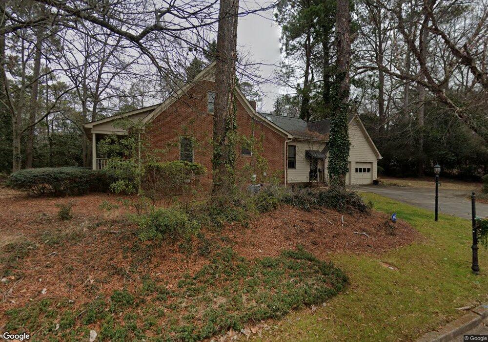
105 Fortson Cir Athens, GA 30606
Five Points NeighborhoodEstimated Value: $756,240 - $1,040,000
3
Beds
2
Baths
2,603
Sq Ft
$338/Sq Ft
Est. Value
About This Home
This home is located at 105 Fortson Cir, Athens, GA 30606 and is currently estimated at $880,310, approximately $338 per square foot. 105 Fortson Cir is a home located in Clarke County with nearby schools including Bettye Henderson Holston Elementary School, Clarke Middle School, and Clarke Central High School.
Ownership History
Date
Name
Owned For
Owner Type
Purchase Details
Closed on
Aug 26, 2014
Sold by
Lee Thomas E
Bought by
Lee Nancy C
Current Estimated Value
Purchase Details
Closed on
Oct 31, 2002
Sold by
Hannon Mary Alice and Hannon Nancy C
Bought by
Lee Thomas E and Lee Nancy C
Purchase Details
Closed on
Apr 12, 1996
Sold by
Horton Betty Bradley
Bought by
Hannon Mary Alice and Hannon Nancy C
Purchase Details
Closed on
Sep 30, 1993
Sold by
Peters Peters W and Peters Debra E
Bought by
Horton Betty Bradley
Purchase Details
Closed on
Dec 4, 1989
Sold by
Sullivan John D
Bought by
Peters Peters W and Peters Debra E
Create a Home Valuation Report for This Property
The Home Valuation Report is an in-depth analysis detailing your home's value as well as a comparison with similar homes in the area
Home Values in the Area
Average Home Value in this Area
Purchase History
| Date | Buyer | Sale Price | Title Company |
|---|---|---|---|
| Lee Nancy C | -- | -- | |
| Lee Thomas E | -- | -- | |
| Hannon Mary Alice | $194,000 | -- | |
| Horton Betty Bradley | $150,000 | -- | |
| Peters Peters W | $139,900 | -- |
Source: Public Records
Tax History Compared to Growth
Tax History
| Year | Tax Paid | Tax Assessment Tax Assessment Total Assessment is a certain percentage of the fair market value that is determined by local assessors to be the total taxable value of land and additions on the property. | Land | Improvement |
|---|---|---|---|---|
| 2025 | $8,124 | $261,636 | $60,000 | $201,636 |
| 2024 | $8,124 | $231,181 | $54,000 | $177,181 |
| 2023 | $7,224 | $215,441 | $54,000 | $161,441 |
| 2022 | $5,989 | $187,736 | $54,000 | $133,736 |
| 2021 | $5,170 | $153,410 | $54,000 | $99,410 |
| 2020 | $4,876 | $144,683 | $54,000 | $90,683 |
| 2019 | $4,506 | $132,715 | $50,000 | $82,715 |
| 2018 | $4,377 | $128,921 | $50,000 | $78,921 |
| 2017 | $4,209 | $123,988 | $50,000 | $73,988 |
| 2016 | $3,823 | $112,605 | $50,000 | $62,605 |
| 2015 | $3,334 | $98,052 | $40,000 | $58,052 |
| 2014 | $3,351 | $98,400 | $32,000 | $66,400 |
Source: Public Records
Map
Nearby Homes
- 206 Fortson Dr
- 224 Fortson Dr
- 169 Fortson Cir
- 1055 Baxter St Unit 504
- 577 W Cloverhurst Ave
- 338 Springdale St
- 490 Mcwhorter Dr
- 495 Woodlawn Ave
- 590 Highland Ave
- 265 Springdale St
- 105 Magnolia Terrace
- 175 Tillman Ln
- 997 S Milledge Ave Unit 2
- 997 S Milledge Ave Unit 3
- 997 S Milledge Ave Unit 1
- 997 S Milledge Ave Unit 4
- 1398 W Hancock Ave
- 597 Dearing St
- 1226 W Broad St
- 589 W Lake Dr
- 185 Fortson Dr
- 100 Fortson Cir
- 109 Fortson Cir
- 196 Fortson Dr
- 200 Fortson Dr
- 115 Fortson Cir
- 120 Fortson Cir
- 215 Fortson Dr
- 192 Fortson Dr
- 175 Fortson Dr
- 130 Fortson Cir
- 180 Fortson Dr
- 212 Fortson Dr
- 219 Fortson Dr
- 570 Springdale St
- 121 Fortson Cir
- 218 Fortson Dr
- 140 Fortson Cir
- 165 Fortson Dr
- 160 Fortson Dr