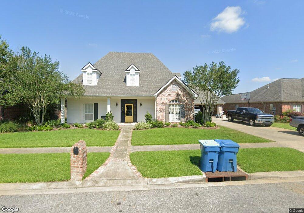
105 Gentry Cir Lafayette, LA 70508
Pilette NeighborhoodEstimated Value: $530,303 - $747,000
4
Beds
5
Baths
3,212
Sq Ft
$188/Sq Ft
Est. Value
About This Home
This home is located at 105 Gentry Cir, Lafayette, LA 70508 and is currently estimated at $605,076, approximately $188 per square foot. 105 Gentry Cir is a home located in Lafayette Parish with nearby schools including Corporal Michael Middlebrook Elementary School, Broussard Middle School, and O. Comeaux High School.
Ownership History
Date
Name
Owned For
Owner Type
Purchase Details
Closed on
Jun 19, 2012
Sold by
Paul Lejeune David and Kaye Guidry Lejeune Lanna
Bought by
Grover Properties Of Lafayette Llc
Current Estimated Value
Purchase Details
Closed on
Jun 2, 2011
Sold by
Guidry Lejeune David Paul and Guidry Lanna Kaye
Bought by
Central Properties Us Bank
Purchase Details
Closed on
Jun 11, 2010
Sold by
Drost Overton Christopher Lew and Drost Overton Staci
Bought by
Guidry Lejeune David Paul and Guidry Lejeune Lanna Kaye
Home Financials for this Owner
Home Financials are based on the most recent Mortgage that was taken out on this home.
Original Mortgage
$418,886
Interest Rate
5.02%
Mortgage Type
Purchase Money Mortgage
Create a Home Valuation Report for This Property
The Home Valuation Report is an in-depth analysis detailing your home's value as well as a comparison with similar homes in the area
Home Values in the Area
Average Home Value in this Area
Purchase History
| Date | Buyer | Sale Price | Title Company |
|---|---|---|---|
| Grover Properties Of Lafayette Llc | -- | None Available | |
| Central Properties Us Bank | -- | None Available | |
| Guidry Lejeune David Paul | $420,000 | None Available |
Source: Public Records
Mortgage History
| Date | Status | Borrower | Loan Amount |
|---|---|---|---|
| Previous Owner | Guidry Lejeune David Paul | $418,886 |
Source: Public Records
Tax History Compared to Growth
Tax History
| Year | Tax Paid | Tax Assessment Tax Assessment Total Assessment is a certain percentage of the fair market value that is determined by local assessors to be the total taxable value of land and additions on the property. | Land | Improvement |
|---|---|---|---|---|
| 2024 | $3,697 | $41,318 | $5,601 | $35,717 |
| 2023 | $3,697 | $37,536 | $5,601 | $31,935 |
| 2022 | $3,928 | $37,536 | $5,601 | $31,935 |
| 2021 | $3,941 | $37,536 | $5,601 | $31,935 |
| 2020 | $3,928 | $37,536 | $5,601 | $31,935 |
| 2019 | $2,476 | $37,536 | $5,601 | $31,935 |
| 2018 | $3,199 | $37,536 | $5,601 | $31,935 |
| 2017 | $3,195 | $37,537 | $3,921 | $33,616 |
| 2015 | $2,374 | $37,396 | $3,780 | $33,616 |
| 2013 | -- | $29,500 | $3,780 | $25,720 |
Source: Public Records
Map
Nearby Homes
- 501 Yvette Marie Dr
- 120 Greenfarm Rd
- 101 Domas Dr
- 201 S Michot Rd
- 307 Harvest Creek Ln
- 103 Failla Rd
- 313 Harvest Creek Ln
- 104 Little Hickory Ct
- 111 Orchard Park Ave
- 200 Apple Wood Crossing
- 105 Orchard Park Ave
- 219 Harvest Creek Ln
- 100 Candlewood Dr
- 208 Harvest Creek Ln
- 100 Darbonne Rd
- 305 Woodbridge Dr
- 122 Thrush Loop
- 607 Ember Grove Crossing
- 300 Amber Pond Ln
- 100 Huttingtower Ln