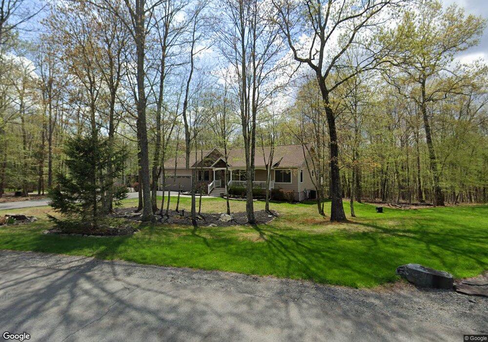
105 Glennwood Dr Hawley, PA 18428
Estimated Value: $735,882 - $908,000
4
Beds
3
Baths
2,366
Sq Ft
$347/Sq Ft
Est. Value
About This Home
This home is located at 105 Glennwood Dr, Hawley, PA 18428 and is currently estimated at $821,941, approximately $347 per square foot. 105 Glennwood Dr is a home with nearby schools including Wallenpaupack Area High School.
Ownership History
Date
Name
Owned For
Owner Type
Purchase Details
Closed on
May 5, 2019
Sold by
Bernathy Robert F and Bernathy Nadine M
Bought by
Bernathy Robert F
Current Estimated Value
Purchase Details
Closed on
Jun 8, 2015
Sold by
Tascone Salvatore J and Tascone Doreen
Bought by
Bernathy Robert F and Bernathy Nadine M
Home Financials for this Owner
Home Financials are based on the most recent Mortgage that was taken out on this home.
Original Mortgage
$294,000
Interest Rate
3.65%
Mortgage Type
New Conventional
Create a Home Valuation Report for This Property
The Home Valuation Report is an in-depth analysis detailing your home's value as well as a comparison with similar homes in the area
Home Values in the Area
Average Home Value in this Area
Purchase History
| Date | Buyer | Sale Price | Title Company |
|---|---|---|---|
| Bernathy Robert F | -- | None Available | |
| Bernathy Robert F | $367,500 | Attorney |
Source: Public Records
Mortgage History
| Date | Status | Borrower | Loan Amount |
|---|---|---|---|
| Closed | Bernathy Robert F | $294,000 |
Source: Public Records
Tax History Compared to Growth
Tax History
| Year | Tax Paid | Tax Assessment Tax Assessment Total Assessment is a certain percentage of the fair market value that is determined by local assessors to be the total taxable value of land and additions on the property. | Land | Improvement |
|---|---|---|---|---|
| 2025 | $7,926 | $66,590 | $17,500 | $49,090 |
| 2024 | $7,926 | $66,590 | $17,500 | $49,090 |
| 2023 | $7,644 | $66,590 | $17,500 | $49,090 |
| 2022 | $7,477 | $66,590 | $17,500 | $49,090 |
| 2021 | $7,344 | $66,590 | $17,500 | $49,090 |
| 2020 | $7,344 | $66,590 | $17,500 | $49,090 |
| 2019 | $7,125 | $66,590 | $17,500 | $49,090 |
| 2018 | $7,015 | $66,590 | $17,500 | $49,090 |
| 2017 | $6,810 | $66,590 | $17,500 | $49,090 |
| 2016 | $0 | $66,590 | $17,500 | $49,090 |
| 2015 | -- | $66,590 | $17,500 | $49,090 |
| 2014 | -- | $66,590 | $17,500 | $49,090 |
Source: Public Records
Map
Nearby Homes
- 106 Lilypad Ln
- 0 Waterview Dr
- 173 Water View Dr
- 46 Hawks Nest Dr
- 066 Hawks Nest Dr
- 141 Hawks Nest Dr
- 2.84 Acres Butchs Rd
- 0 Blue Eddy Rd
- 23 Ledgecrest Rd
- 0 Hidden Hollow Rd
- 797 Tink Wig Dr
- Lot 155 Tink Wig Dr
- Lot 201 Tink Wig Dr
- 843+844 Tink Wig Dr
- 0 Tinkwig Dr
- 319 Tink Wig Dr
- 314 Ridgewood Ln
- 274 Tink Wig Dr
- 432 Eastwood Cir
- Lot 557 Eastwood Cir
- 107 Glennwood Dr
- 106 Glennwood Dr
- 111 Glennwood Dr
- 101 Upland Ct
- 112 Glennwood Dr
- 114 Glennwood Dr
- 104 Upland Ct
- 117 Glennwood Dr
- 103 Vista Way
- 123 Pin Oak Cir
- 12 Pin Oak Cir
- 121 Pin Oak Cir
- 121 Glennwood Dr
- 14 Pin Oak Cir
- 107 Vista Way
- 125 Glennwood Dr
- 1650 Route 590
- 117 Pin Oak Cir
- 122 Pin Oak Cir
- 115 Pin Oak Cir