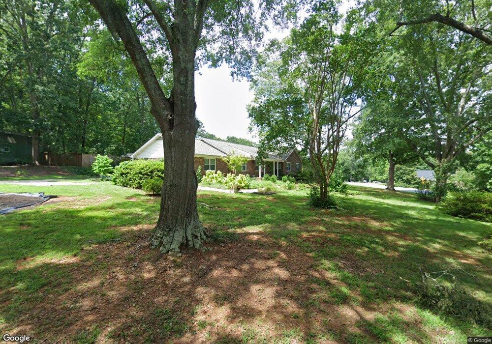
105 Jamestown Dr Greenville, SC 29615
Eastside NeighborhoodEstimated Value: $508,000 - $646,000
3
Beds
2
Baths
2,322
Sq Ft
$248/Sq Ft
Est. Value
About This Home
This home is located at 105 Jamestown Dr, Greenville, SC 29615 and is currently estimated at $575,711, approximately $247 per square foot. 105 Jamestown Dr is a home located in Greenville County with nearby schools including Mitchell Road Elementary, Greenville Middle Academy, and Eastside High School.
Ownership History
Date
Name
Owned For
Owner Type
Purchase Details
Closed on
Apr 13, 2016
Sold by
Taylor Peter A and Syracuse Caroline Taylor
Bought by
Patterson Rita J and Patterson Charles R
Current Estimated Value
Home Financials for this Owner
Home Financials are based on the most recent Mortgage that was taken out on this home.
Original Mortgage
$218,500
Outstanding Balance
$173,869
Interest Rate
3.73%
Mortgage Type
New Conventional
Estimated Equity
$401,842
Purchase Details
Closed on
Oct 1, 2015
Sold by
Taylor Peter A and Taylor Jacqueline S
Bought by
Taylor Peter A and Taylor Jacqueline S
Create a Home Valuation Report for This Property
The Home Valuation Report is an in-depth analysis detailing your home's value as well as a comparison with similar homes in the area
Home Values in the Area
Average Home Value in this Area
Purchase History
| Date | Buyer | Sale Price | Title Company |
|---|---|---|---|
| Patterson Rita J | $230,000 | None Available | |
| Taylor Peter A | -- | -- |
Source: Public Records
Mortgage History
| Date | Status | Borrower | Loan Amount |
|---|---|---|---|
| Open | Patterson Rita J | $218,500 |
Source: Public Records
Tax History Compared to Growth
Tax History
| Year | Tax Paid | Tax Assessment Tax Assessment Total Assessment is a certain percentage of the fair market value that is determined by local assessors to be the total taxable value of land and additions on the property. | Land | Improvement |
|---|---|---|---|---|
| 2024 | $1,767 | $12,100 | $2,080 | $10,020 |
| 2023 | $1,767 | $12,100 | $2,080 | $10,020 |
| 2022 | $2,056 | $12,100 | $2,080 | $10,020 |
| 2021 | $1,897 | $11,350 | $2,080 | $9,270 |
| 2020 | $1,577 | $8,870 | $2,080 | $6,790 |
| 2019 | $1,562 | $8,870 | $2,080 | $6,790 |
| 2018 | $1,644 | $8,870 | $2,080 | $6,790 |
| 2017 | $1,628 | $8,870 | $2,080 | $6,790 |
| 2016 | $915 | $176,370 | $52,000 | $124,370 |
| 2015 | $918 | $176,370 | $52,000 | $124,370 |
| 2014 | $1,019 | $193,984 | $47,385 | $146,599 |
Source: Public Records
Map
Nearby Homes
- 102 Graystone Rd
- 627 Pelham Rd
- 217 Redland Way Unit Homesite 09
- 205 Redland Way Unit Homesite 003
- Fairburn Elite Plan at Hudson Pointe
- Latimore Plan at Hudson Pointe
- Latimore with Basement Plan at Hudson Pointe
- Mossgrove with Basement Plan at Hudson Pointe
- Woodburn with Basement Plan at Hudson Pointe
- Mossgrove Plan at Hudson Pointe
- Woodburn Plan at Hudson Pointe
- 207 Redland Way
- 208 Redland Way
- 202 Redland Way
- 209 Redland Way Unit Homesite 05
- 4 Medlock Dr Unit Homesite 027
- 2 Pilgrims Point Rd
- 604 Hudson Rd
- 17 Seabury Dr
- 7 Alford Ct
- 103 Jamestown Dr
- 105 Saint Augustine Dr
- 102 Saint Augustine Dr
- 17 Saint Augustine Dr
- 101 Jamestown Dr
- 106 Saint Augustine Dr
- 1 Cape Charles Dr
- 18 Saint Augustine Dr
- 107 Saint Augustine Dr
- 29 Jamestown Dr
- 118 Saint Augustine Dr
- 13 Saint Augustine Dr
- 120 Saint Augustine Dr
- 116 Saint Augustine Dr
- 5 Cape Charles Dr
- 14 Saint Augustine Dr
- 2 Cape Charles Dr
- 310 Highbourne Dr
- 108 Graystone Rd
- 122 St Augustine Dr