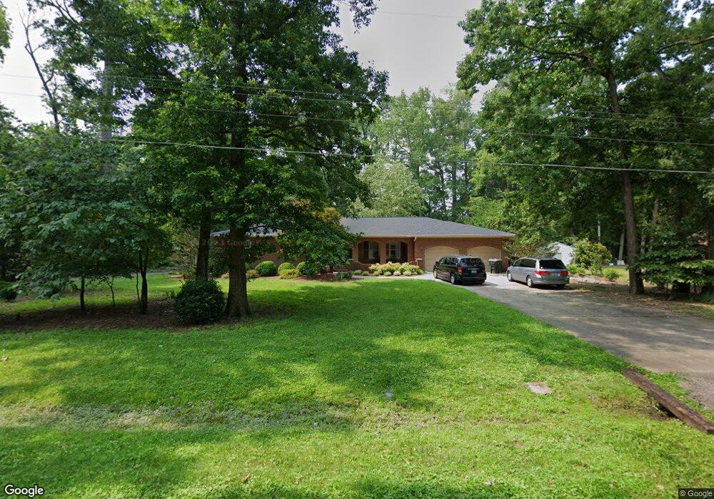
105 Laurel Path Rd Yorktown, VA 23692
Estimated Value: $500,000 - $519,000
3
Beds
2
Baths
2,122
Sq Ft
$240/Sq Ft
Est. Value
About This Home
This home is located at 105 Laurel Path Rd, Yorktown, VA 23692 and is currently estimated at $509,042, approximately $239 per square foot. 105 Laurel Path Rd is a home located in York County with nearby schools including Yorktown Elementary School, Yorktown Middle School, and York High School.
Ownership History
Date
Name
Owned For
Owner Type
Purchase Details
Closed on
Apr 20, 2010
Sold by
Humphreys Larry E
Bought by
Ancarrow John E
Current Estimated Value
Home Financials for this Owner
Home Financials are based on the most recent Mortgage that was taken out on this home.
Original Mortgage
$300,000
Outstanding Balance
$199,711
Interest Rate
4.99%
Mortgage Type
New Conventional
Estimated Equity
$309,331
Create a Home Valuation Report for This Property
The Home Valuation Report is an in-depth analysis detailing your home's value as well as a comparison with similar homes in the area
Home Values in the Area
Average Home Value in this Area
Purchase History
| Date | Buyer | Sale Price | Title Company |
|---|---|---|---|
| Ancarrow John E | $375,000 | -- |
Source: Public Records
Mortgage History
| Date | Status | Borrower | Loan Amount |
|---|---|---|---|
| Open | Ancarrow John E | $300,000 |
Source: Public Records
Tax History
| Year | Tax Paid | Tax Assessment Tax Assessment Total Assessment is a certain percentage of the fair market value that is determined by local assessors to be the total taxable value of land and additions on the property. | Land | Improvement |
|---|---|---|---|---|
| 2025 | $3,402 | $459,700 | $123,200 | $336,500 |
| 2024 | $3,402 | $459,700 | $123,200 | $336,500 |
| 2023 | $2,903 | $377,000 | $123,200 | $253,800 |
| 2022 | $2,941 | $377,000 | $123,200 | $253,800 |
| 2021 | $2,906 | $365,500 | $120,000 | $245,500 |
| 2020 | $2,906 | $365,500 | $120,000 | $245,500 |
| 2019 | $3,954 | $346,800 | $120,000 | $226,800 |
| 2018 | $3,954 | $346,800 | $120,000 | $226,800 |
| 2017 | $2,644 | $351,800 | $120,000 | $231,800 |
| 2016 | -- | $351,800 | $120,000 | $231,800 |
| 2015 | -- | $351,800 | $120,000 | $231,800 |
| 2014 | -- | $351,800 | $120,000 | $231,800 |
Source: Public Records
Map
Nearby Homes
- 504 Meadowfield Rd
- 108 Grafton District Rd
- 303 Bridge Crossing
- 107 Brokenbridge Rd
- 302 Bridge Crossing
- 115 Burnt Run
- 107 Cypress Crossing
- 107 Carrington Ln
- 103 Stadium View
- 111 Laydon Way
- 110 Peyton Randolph Dr
- 207 Falcon Rd
- 14 Bracewell Ln
- 6 Bracewell Ln
- 1 Bracewell Ln
- 11 Bracewell Ln
- 12 Bracewell Ln
- 8 Bracewell Ln
- 3 Bracewell Ln
- 111 Bracewell Ln
- 107 Laurel Path Rd
- 111 Brook Rd
- 201 Aspen Blvd
- 203 Aspen Blvd
- 104 Laurel Path Rd
- 103 Aspen Blvd
- 113 Brook Rd
- 106 Laurel Path Rd
- 101 Pioneer Ln
- 205 Aspen Blvd
- 105 Pioneer Ln
- 109 Brook Rd
- 108 Laurel Path Rd
- 107 Pioneer Ln
- 403 Meadowfield Rd
- 405 Meadowfield Rd
- 112 Brook Rd
- 207 Aspen Blvd
- 401 Meadowfield Rd
- 407 Meadowfield Rd
Your Personal Tour Guide
Ask me questions while you tour the home.