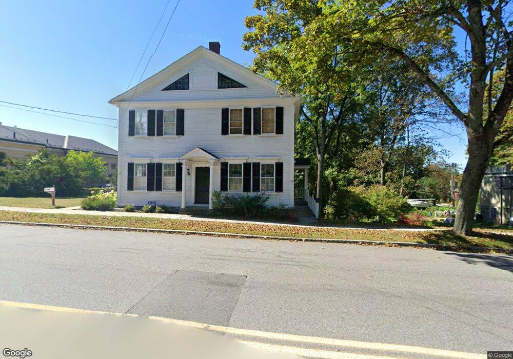
105 Main St Groton, MA 01450
Estimated Value: $640,000 - $908,000
4
Beds
2
Baths
2,351
Sq Ft
$319/Sq Ft
Est. Value
About This Home
This home is located at 105 Main St, Groton, MA 01450 and is currently estimated at $749,080, approximately $318 per square foot. 105 Main St is a home located in Middlesex County with nearby schools including Groton Dunstable Regional High School, Groton Community School, and Seven Hills At Groton.
Ownership History
Date
Name
Owned For
Owner Type
Purchase Details
Closed on
Nov 21, 2008
Sold by
Danti Michael D and Carr Robert I
Bought by
Groton Town Of
Current Estimated Value
Purchase Details
Closed on
Jul 2, 2007
Sold by
Williams Margery C
Bought by
Danti Michael D and Danti Samantha K
Home Financials for this Owner
Home Financials are based on the most recent Mortgage that was taken out on this home.
Original Mortgage
$299,250
Interest Rate
6.24%
Mortgage Type
Purchase Money Mortgage
Purchase Details
Closed on
Jan 30, 2001
Sold by
Tiro Richard A
Bought by
Williams Margery C
Home Financials for this Owner
Home Financials are based on the most recent Mortgage that was taken out on this home.
Original Mortgage
$125,000
Interest Rate
7.39%
Mortgage Type
Purchase Money Mortgage
Create a Home Valuation Report for This Property
The Home Valuation Report is an in-depth analysis detailing your home's value as well as a comparison with similar homes in the area
Home Values in the Area
Average Home Value in this Area
Purchase History
| Date | Buyer | Sale Price | Title Company |
|---|---|---|---|
| Groton Town Of | -- | -- | |
| Groton Town Of | -- | -- | |
| Danti Michael D | $315,000 | -- | |
| Danti Michael D | $315,000 | -- | |
| Williams Margery C | $180,000 | -- |
Source: Public Records
Mortgage History
| Date | Status | Borrower | Loan Amount |
|---|---|---|---|
| Open | Williams Margery C | $294,600 | |
| Previous Owner | Danti Michael D | $299,250 | |
| Previous Owner | Williams Margery C | $125,000 |
Source: Public Records
Tax History Compared to Growth
Tax History
| Year | Tax Paid | Tax Assessment Tax Assessment Total Assessment is a certain percentage of the fair market value that is determined by local assessors to be the total taxable value of land and additions on the property. | Land | Improvement |
|---|---|---|---|---|
| 2025 | $6,658 | $436,600 | $0 | $436,600 |
| 2024 | $6,588 | $436,600 | $0 | $436,600 |
| 2023 | $6,828 | $436,600 | $0 | $436,600 |
| 2022 | $6,271 | $364,800 | $0 | $364,800 |
| 2021 | $5,685 | $323,000 | $0 | $323,000 |
| 2020 | $5,614 | $323,000 | $0 | $323,000 |
| 2019 | $5,636 | $311,200 | $0 | $311,200 |
| 2018 | $5,810 | $311,200 | $0 | $311,200 |
| 2017 | $5,683 | $311,200 | $0 | $311,200 |
| 2016 | $5,803 | $309,000 | $0 | $309,000 |
| 2015 | $5,645 | $309,000 | $0 | $309,000 |
Source: Public Records
Map
Nearby Homes
- 117 Main St
- 228 Main St
- 247 Main St
- 111 Farmers Row
- 284 Martins Pond Rd
- 20 Hayes Woods Ln
- Lot 9A Hayes Woods Ln
- 100 Whitman Rd
- 65 Skyfields Dr
- 45 Legacy Ln Unit B
- 227 Boston Rd
- 52 Chestnut Hill Rd
- 436 Main St
- PL 639 Indian Hill Rd
- 71 Wintergreen Ln
- 72 Dale Ln
- 523 Martins Pond Rd
- 12 Oriole Dr
- 40 Hemlock Park Dr
- 121 Culver Rd
- 105 Main St Unit 105/right
- 103 Main St
- 103 Main St Unit 1
- 103A Main St
- 103-10 103-105 Main St
- 113 Main St
- 95 Main St
- 1 Broad Meadow Rd
- 1C Broad Meadow Rd
- 13 Broad Meadow Rd
- 2 Lowell Rd
- 17 Broad Meadow Rd
- 16 Broad Meadow Rd
- 18 Broad Meadow Rd
- 20 Broad Meadow Rd
- 125 Main St
- 22 Broad Meadow Rd Unit 24
- 11 Lowell Rd Unit 1B
- 11 Lowell Rd Unit 3
- 11 Lowell Rd Unit 2A