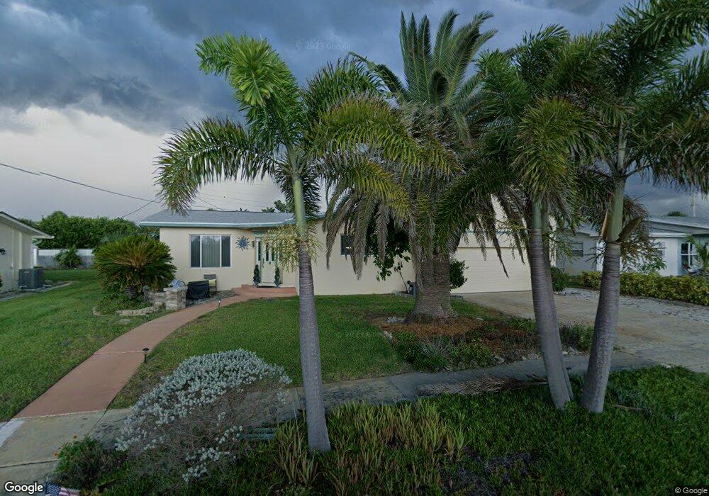
105 Maple Dr Satellite Beach, FL 32937
Estimated Value: $497,000 - $601,000
4
Beds
2
Baths
2,191
Sq Ft
$252/Sq Ft
Est. Value
About This Home
This home is located at 105 Maple Dr, Satellite Beach, FL 32937 and is currently estimated at $553,008, approximately $252 per square foot. 105 Maple Dr is a home located in Brevard County with nearby schools including Surfside Elementary School, Satellite Senior High School, and DeLaura Middle School.
Ownership History
Date
Name
Owned For
Owner Type
Purchase Details
Closed on
Nov 7, 2018
Sold by
Wente Brent R and Jackson Wente Robin R
Bought by
Wente Brent R and Jackson Wente Robin R
Current Estimated Value
Purchase Details
Closed on
Nov 22, 1996
Sold by
Whitaker Philip Francis
Bought by
Wente Brent R and Jacksonwente Robin R
Home Financials for this Owner
Home Financials are based on the most recent Mortgage that was taken out on this home.
Original Mortgage
$91,500
Interest Rate
7.87%
Create a Home Valuation Report for This Property
The Home Valuation Report is an in-depth analysis detailing your home's value as well as a comparison with similar homes in the area
Home Values in the Area
Average Home Value in this Area
Purchase History
| Date | Buyer | Sale Price | Title Company |
|---|---|---|---|
| Wente Brent R | -- | Attorney | |
| Wente Brent R | $103,000 | -- |
Source: Public Records
Mortgage History
| Date | Status | Borrower | Loan Amount |
|---|---|---|---|
| Previous Owner | Wente Brent R | $91,500 |
Source: Public Records
Tax History
| Year | Tax Paid | Tax Assessment Tax Assessment Total Assessment is a certain percentage of the fair market value that is determined by local assessors to be the total taxable value of land and additions on the property. | Land | Improvement |
|---|---|---|---|---|
| 2025 | $2,311 | $157,960 | -- | -- |
| 2024 | $2,267 | $153,510 | -- | -- |
| 2023 | $2,267 | $149,040 | $0 | $0 |
| 2022 | $2,116 | $144,700 | $0 | $0 |
| 2021 | $2,169 | $140,490 | $0 | $0 |
| 2020 | $2,159 | $138,560 | $0 | $0 |
| 2019 | $2,130 | $134,970 | $0 | $0 |
| 2018 | $2,127 | $132,460 | $0 | $0 |
| 2017 | $1,970 | $129,740 | $0 | $0 |
| 2016 | $1,971 | $127,080 | $85,000 | $42,080 |
| 2015 | $2,017 | $126,200 | $75,000 | $51,200 |
| 2014 | $2,017 | $125,200 | $70,000 | $55,200 |
Source: Public Records
Map
Nearby Homes
- 110 Maple Dr
- 118 Skyline Cir
- 155 Elm Ave
- 172 Skyline Blvd
- 105 Carissa Dr
- 180 Queens Ct
- 1568 Highway A1a
- 1455 Highway A1a Unit 507
- 204 Queens Ct
- 240 Greenway Ave
- 1455 Jimmy Buffett Memorial Hwy Unit 511
- 254 Queens Ct
- 110 Desoto Pkwy Unit 10
- 110 Desoto Pkwy Unit 9
- 229 Kings Way
- 550 Temple St
- 485 Temple St
- 1395 Jimmy Buffett Memorial Hwy Unit 203
- 0000 Cassia Blvd
- 270 Cinnamon Dr
Your Personal Tour Guide
Ask me questions while you tour the home.