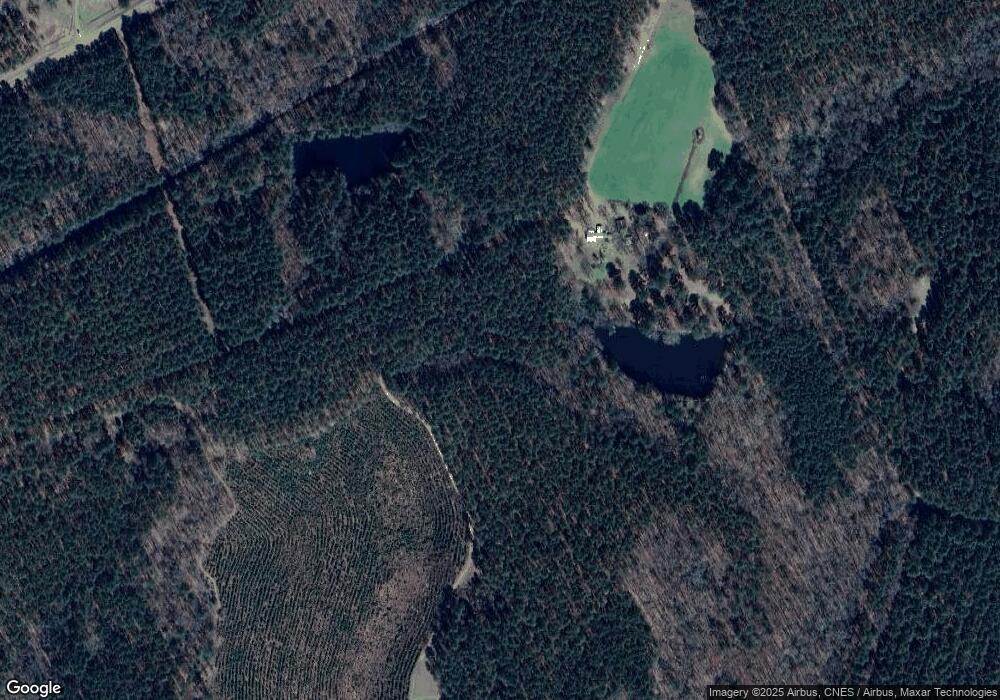
105 Mcmichael Rd Warrenton, GA 30828
Estimated Value: $126,000 - $1,448,000
Studio
--
Bath
600
Sq Ft
$1,184/Sq Ft
Est. Value
About This Home
This home is located at 105 Mcmichael Rd, Warrenton, GA 30828 and is currently estimated at $710,424, approximately $1,184 per square foot. 105 Mcmichael Rd is a home with nearby schools including Freeman Elementary School, Warren County Middle School, and Warren County High School.
Ownership History
Date
Name
Owned For
Owner Type
Purchase Details
Closed on
May 15, 2023
Sold by
Gunn Stewart James
Bought by
Stewart Farm Outdoors Llc
Current Estimated Value
Purchase Details
Closed on
Mar 28, 2014
Sold by
Mcmichael James H
Bought by
Stewart James Gunn
Home Financials for this Owner
Home Financials are based on the most recent Mortgage that was taken out on this home.
Original Mortgage
$245,000
Interest Rate
4.4%
Mortgage Type
New Conventional
Purchase Details
Closed on
Nov 26, 1988
Sold by
Mcmichael James and Alton Kit
Bought by
Mcmichael Jh
Purchase Details
Closed on
Sep 5, 1985
Sold by
Byrd Shirley
Bought by
Mcmichael Jh and Alton Kitchens
Purchase Details
Closed on
Mar 1, 1975
Sold by
Byrd Shirley
Bought by
Byrd Shirley
Create a Home Valuation Report for This Property
The Home Valuation Report is an in-depth analysis detailing your home's value as well as a comparison with similar homes in the area
Purchase History
| Date | Buyer | Sale Price | Title Company |
|---|---|---|---|
| Stewart Farm Outdoors Llc | -- | -- | |
| Stewart James Gunn | $595,500 | -- | |
| Mcmichael Jh | -- | -- | |
| Mcmichael Jh | -- | -- | |
| Byrd Shirley | -- | -- |
Source: Public Records
Mortgage History
| Date | Status | Borrower | Loan Amount |
|---|---|---|---|
| Previous Owner | Stewart James Gunn | $245,000 |
Source: Public Records
Tax History
| Year | Tax Paid | Tax Assessment Tax Assessment Total Assessment is a certain percentage of the fair market value that is determined by local assessors to be the total taxable value of land and additions on the property. | Land | Improvement |
|---|---|---|---|---|
| 2024 | $2,582 | $134,453 | $130,002 | $4,451 |
| 2023 | $2,511 | $134,189 | $130,002 | $4,187 |
| 2022 | $2,444 | $134,189 | $130,002 | $4,187 |
| 2021 | $2,379 | $134,189 | $130,002 | $4,187 |
| 2020 | $2,332 | $134,189 | $130,002 | $4,187 |
| 2019 | $2,275 | $134,189 | $130,002 | $4,187 |
| 2018 | $4,074 | $134,189 | $130,002 | $4,187 |
| 2017 | $2,087 | $134,189 | $130,002 | $4,187 |
| 2016 | $4,342 | $134,189 | $130,002 | $4,187 |
| 2015 | -- | $134,190 | $130,002 | $4,187 |
| 2014 | -- | $134,190 | $130,002 | $4,187 |
| 2013 | -- | $134,189 | $130,002 | $4,187 |
Source: Public Records
Map
Nearby Homes
- 0 Wilson Rd
- 47 Buena Vista Ave
- 157 Macon Hwy
- 205 Macon Hwy
- 25 Bray St Unit 31
- 550 Atlanta Hwy
- 41 Bray St
- 55 Brinkley St
- 178 Academy St
- LOT 8 Black Pearl Dr
- 45 Court Square
- 202 S Gibson St
- 144 N Gibson St
- 0 Pates Mill Rd
- 1 Pates Mill Rd
- 331 Oak St
- 0 Long Creek Church Rd
- 858 Atlanta Hwy
- 1786 Andrews Rd
- LOT 76 W Plainview Dr
- 62 Mcmichael Rd
- 2454 Mayfield Rd
- 2410 Mayfield Rd
- 2339 Mayfield Rd
- 0 Mayfield Rd Unit 509037
- 0 Mayfield Rd Unit 378647
- 0 Mayfield Rd Unit 3245212
- 0 Mayfield Rd Unit 8025329
- 0 Mayfield Rd Unit 8634524
- 2332 Mayfield Rd
- 2259 Mayfield Rd
- 1732 Stoney Hill Rd Unit 1754
- 232 Stoney Hill Rd
- 1634 Stoney Hill Rd
- 1684 Stoney Hill Rd
- 2119 Mayfield Rd
- 3431 Mayfield Rd
- 00 Stoney Hill Rd
- 0 Stoney Hill Rd
- 3460 Mayfield Rd
