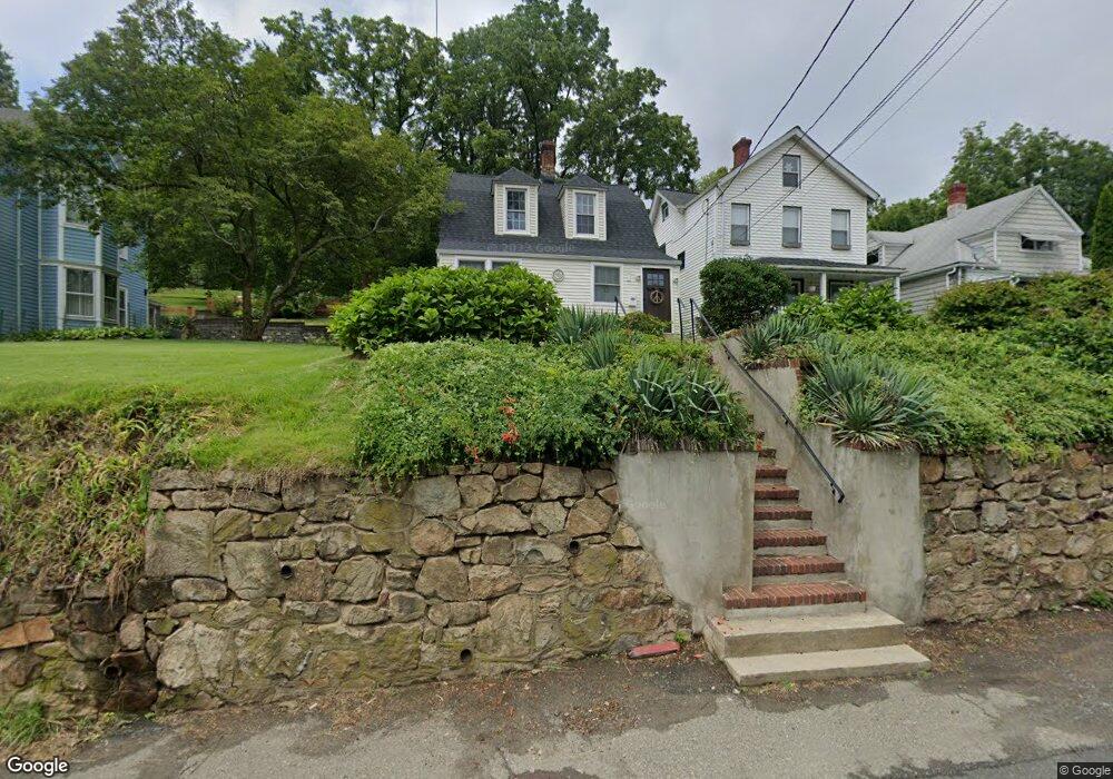
105 Mine Brook Rd Bernardsville, NJ 07924
Estimated Value: $433,000 - $502,000
--
Bed
--
Bath
1,204
Sq Ft
$394/Sq Ft
Est. Value
About This Home
This home is located at 105 Mine Brook Rd, Bernardsville, NJ 07924 and is currently estimated at $474,403, approximately $394 per square foot. 105 Mine Brook Rd is a home located in Somerset County with nearby schools including Bernardsville Middle School, Bernards High School, and The School of Saint Elizabeth.
Ownership History
Date
Name
Owned For
Owner Type
Purchase Details
Closed on
Jun 29, 2007
Sold by
Roselle Peter
Bought by
Kelshaw Todd S and Kelshaw Martha A
Current Estimated Value
Home Financials for this Owner
Home Financials are based on the most recent Mortgage that was taken out on this home.
Original Mortgage
$342,000
Outstanding Balance
$210,841
Interest Rate
6.24%
Mortgage Type
Purchase Money Mortgage
Estimated Equity
$263,562
Purchase Details
Closed on
Jul 11, 2005
Sold by
Knoll Mark D
Bought by
Roselle Peter
Purchase Details
Closed on
Jan 18, 2002
Sold by
Fritze Barbara
Bought by
Knoll Mark and Knoll Leah
Home Financials for this Owner
Home Financials are based on the most recent Mortgage that was taken out on this home.
Original Mortgage
$179,062
Interest Rate
7.15%
Create a Home Valuation Report for This Property
The Home Valuation Report is an in-depth analysis detailing your home's value as well as a comparison with similar homes in the area
Home Values in the Area
Average Home Value in this Area
Purchase History
| Date | Buyer | Sale Price | Title Company |
|---|---|---|---|
| Kelshaw Todd S | $380,000 | Old Republic National Title | |
| Roselle Peter | $375,000 | -- | |
| Knoll Mark | $184,600 | -- |
Source: Public Records
Mortgage History
| Date | Status | Borrower | Loan Amount |
|---|---|---|---|
| Open | Kelshaw Todd S | $342,000 | |
| Previous Owner | Knoll Mark | $179,062 |
Source: Public Records
Tax History Compared to Growth
Tax History
| Year | Tax Paid | Tax Assessment Tax Assessment Total Assessment is a certain percentage of the fair market value that is determined by local assessors to be the total taxable value of land and additions on the property. | Land | Improvement |
|---|---|---|---|---|
| 2025 | $7,429 | $410,600 | $178,400 | $232,200 |
| 2024 | $7,429 | $380,000 | $163,700 | $216,300 |
| 2023 | $7,222 | $359,500 | $154,400 | $205,100 |
| 2022 | $7,110 | $345,800 | $147,000 | $198,800 |
| 2021 | $7,026 | $334,900 | $144,100 | $190,800 |
| 2020 | $6,863 | $326,200 | $144,100 | $182,100 |
| 2019 | $6,732 | $330,300 | $144,100 | $186,200 |
| 2018 | $6,527 | $327,800 | $142,500 | $185,300 |
| 2017 | $6,384 | $331,300 | $138,500 | $192,800 |
| 2016 | $6,196 | $330,300 | $138,500 | $191,800 |
| 2015 | $6,079 | $330,900 | $138,500 | $192,400 |
| 2014 | $5,937 | $324,600 | $138,500 | $186,100 |
Source: Public Records
Map
Nearby Homes
- 20 Anderson Hill Rd
- 80 Claremont Rd Unit 802
- 80 Claremont Rd Unit 206
- 16 Dayton Crescent
- 26 Anderson Hill Rd
- 41 Anderson Hill Rd
- 15 Highview Ave
- 22 Orchard Hill Rd
- 58 Seney Dr
- 10 Tysley St
- 117 W Oak St
- 101 Rippling Brook Way
- 22 Dayton St
- 149 Overleigh Rd
- 71 Mount Harmony Rd
- 34 Spruce Place
- 3 Rose Hill
- 136 2 Mount Harmony Rd
- 71 Crest Dr
- 453 Mine Brook Rd
- 103 Mine Brook Rd
- 107 Mine Brook Rd
- 101 Mine Brook Rd
- 8 Woodland Rd
- 109 Mine Brook Rd
- 12 Woodland Rd
- 99 Mine Brook Rd
- 113 Mine Brook Rd
- 106 Mine Brook Rd
- 106 Mine Brook Rd
- 106 Mine Brook Rd
- 106 Mine Brook Rd Unit 1
- 14 Woodland Rd
- 42 Essex Ave
- 44 Essex Ave
- 115 Mine Brook Rd
- 26 Essex Ave
- 11 Chilton St
- 24 Essex Ave
- 76 Mine Brook Rd