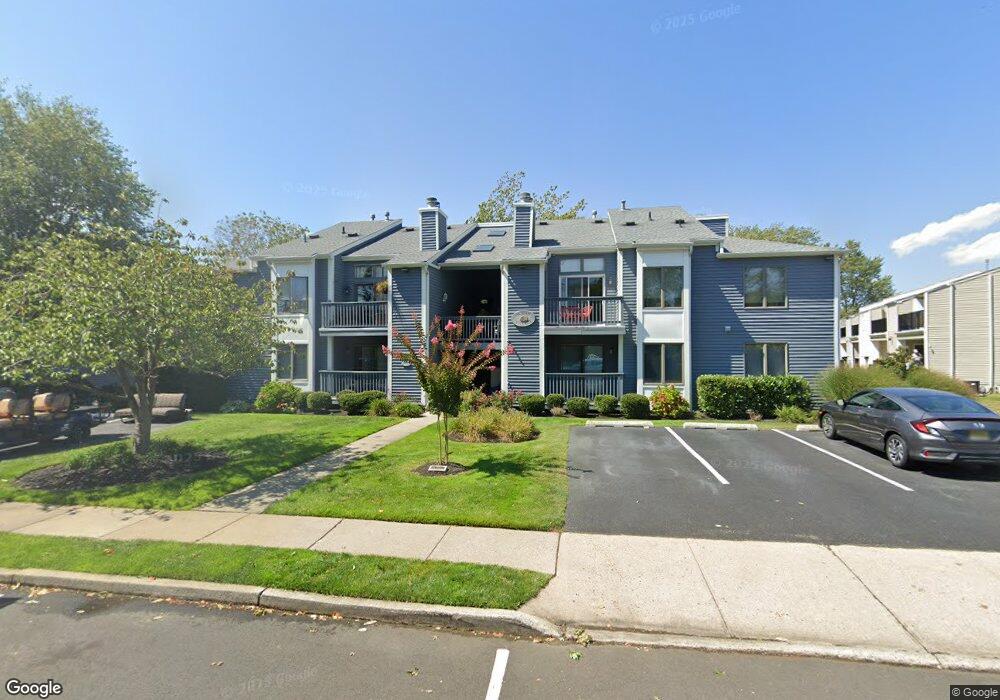
105 Mount Ln Unit 4 Manasquan, NJ 08736
Estimated Value: $500,704 - $848,000
2
Beds
1
Bath
982
Sq Ft
$618/Sq Ft
Est. Value
About This Home
This home is located at 105 Mount Ln Unit 4, Manasquan, NJ 08736 and is currently estimated at $607,176, approximately $618 per square foot. 105 Mount Ln Unit 4 is a home located in Monmouth County with nearby schools including Manasquan Elementary School, Manasquan High School, and St. Catharine School.
Ownership History
Date
Name
Owned For
Owner Type
Purchase Details
Closed on
Jul 27, 2001
Sold by
Rittweger Patricia
Bought by
Patterson Richard
Current Estimated Value
Purchase Details
Closed on
Dec 27, 1995
Sold by
Egan Matthew
Bought by
Hodgkiss Oscar
Home Financials for this Owner
Home Financials are based on the most recent Mortgage that was taken out on this home.
Original Mortgage
$35,000
Interest Rate
7.34%
Create a Home Valuation Report for This Property
The Home Valuation Report is an in-depth analysis detailing your home's value as well as a comparison with similar homes in the area
Home Values in the Area
Average Home Value in this Area
Purchase History
| Date | Buyer | Sale Price | Title Company |
|---|---|---|---|
| Patterson Richard | $169,000 | -- | |
| Patterson Richard | $169,000 | -- | |
| Hodgkiss Oscar | $120,000 | -- |
Source: Public Records
Mortgage History
| Date | Status | Borrower | Loan Amount |
|---|---|---|---|
| Previous Owner | Hodgkiss Oscar | $35,000 |
Source: Public Records
Tax History Compared to Growth
Tax History
| Year | Tax Paid | Tax Assessment Tax Assessment Total Assessment is a certain percentage of the fair market value that is determined by local assessors to be the total taxable value of land and additions on the property. | Land | Improvement |
|---|---|---|---|---|
| 2025 | $4,795 | $269,700 | $153,000 | $116,700 |
| 2024 | $4,615 | $269,700 | $153,000 | $116,700 |
| 2023 | $4,615 | $269,700 | $153,000 | $116,700 |
| 2022 | $4,442 | $269,700 | $153,000 | $116,700 |
| 2021 | $4,442 | $269,700 | $153,000 | $116,700 |
| 2020 | $4,380 | $269,700 | $153,000 | $116,700 |
| 2019 | $4,215 | $269,700 | $153,000 | $116,700 |
| 2018 | $4,121 | $269,700 | $153,000 | $116,700 |
| 2017 | $3,965 | $269,700 | $153,000 | $116,700 |
| 2016 | $3,859 | $269,700 | $153,000 | $116,700 |
| 2015 | $3,116 | $182,300 | $60,000 | $122,300 |
| 2014 | $3,469 | $203,200 | $60,000 | $143,200 |
Source: Public Records
Map
Nearby Homes
- 116 Curtis Ave
- 130 Union Ave
- 355 Cedar Ave
- 610 Agnes Ave
- 507 Magnolia Ave
- 34 Broad St Unit 306
- 323-325 Fisk Ave
- 394 E Virginia Ave
- 34 Gertrude Place
- 542 Woodland Ave
- 619 Park Ave
- 329 Fisk Ave
- 22 Woodland Ave
- 300 Union Ave
- 80 Stockton Lake Blvd
- 508 Harris Ave
- 308 South St
- 14 Lebanon Dr
- 203 Lenape Trail
- 15 Spruce Ave
- 105 Mount Ln Unit 1
- 105 Mount Ln Unit 5
- 105 Mount Ln Unit 7
- 105 Mount Ln Unit 6
- 105 Mount Ln Unit 8
- 105 Mount Ln Unit 2
- 121 Curtis Ave Unit 2
- 121 Curtis Ave Unit 3
- 121 Curtis Ave Unit 4
- 121 Curtis Ave Unit 1
- 119 Curtis Ave
- 115 Curtis Ave Unit 4
- 115 Curtis Ave Unit 2
- 115 Curtis Ave Unit 1
- 115 Curtis Ave Unit 3
- 115 Curtis Ave
- 101 Mount Ln Unit 4
- 101 Mount Ln Unit 1
- 101 Mount Ln Unit 7
- 101 Mount Ln Unit 6