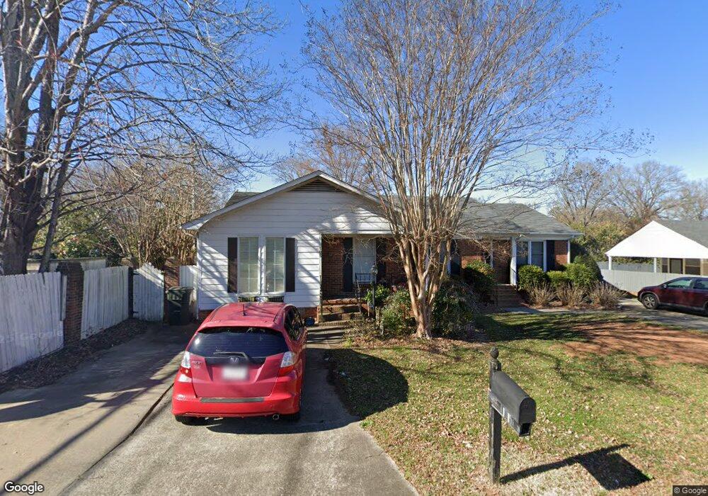
105 Neely Ct Rock Hill, SC 29732
Estimated Value: $192,298 - $245,000
--
Bed
1
Bath
1,102
Sq Ft
$197/Sq Ft
Est. Value
About This Home
This home is located at 105 Neely Ct, Rock Hill, SC 29732 and is currently estimated at $217,075, approximately $196 per square foot. 105 Neely Ct is a home located in York County with nearby schools including Ebinport Elementary School, W.C. Sullivan Middle School, and South Pointe High School.
Ownership History
Date
Name
Owned For
Owner Type
Purchase Details
Closed on
Jun 7, 2018
Sold by
Stanley Tamra W
Bought by
Wilson Tory L
Current Estimated Value
Purchase Details
Closed on
Aug 4, 2006
Sold by
Ferrell Miriam F
Bought by
Wilson Jacqueline Ann
Home Financials for this Owner
Home Financials are based on the most recent Mortgage that was taken out on this home.
Original Mortgage
$70,000
Interest Rate
6.71%
Mortgage Type
New Conventional
Purchase Details
Closed on
Jul 19, 1999
Sold by
Ferguson Daniel B
Bought by
Dawkins Harold D
Create a Home Valuation Report for This Property
The Home Valuation Report is an in-depth analysis detailing your home's value as well as a comparison with similar homes in the area
Home Values in the Area
Average Home Value in this Area
Purchase History
| Date | Buyer | Sale Price | Title Company |
|---|---|---|---|
| Wilson Tory L | -- | None Available | |
| Stanley Tamra W | -- | None Available | |
| Wilson Jacqueline Ann | $87,500 | None Available | |
| Dawkins Harold D | $85,000 | -- |
Source: Public Records
Mortgage History
| Date | Status | Borrower | Loan Amount |
|---|---|---|---|
| Previous Owner | Wilson Jacqueline Ann | $70,000 |
Source: Public Records
Tax History Compared to Growth
Tax History
| Year | Tax Paid | Tax Assessment Tax Assessment Total Assessment is a certain percentage of the fair market value that is determined by local assessors to be the total taxable value of land and additions on the property. | Land | Improvement |
|---|---|---|---|---|
| 2024 | $2,412 | $5,450 | $1,320 | $4,130 |
| 2023 | $2,415 | $5,450 | $1,320 | $4,130 |
| 2022 | $2,302 | $5,450 | $1,320 | $4,130 |
| 2021 | -- | $5,450 | $1,320 | $4,130 |
| 2020 | $2,256 | $5,450 | $0 | $0 |
| 2019 | $2,279 | $5,370 | $0 | $0 |
| 2018 | $1,994 | $5,370 | $0 | $0 |
| 2017 | $260 | $3,180 | $0 | $0 |
| 2016 | $258 | $3,180 | $0 | $0 |
| 2014 | $270 | $3,180 | $880 | $2,300 |
| 2013 | $270 | $3,300 | $880 | $2,420 |
Source: Public Records
Map
Nearby Homes
- 1830 Ebenezer Rd Unit 1
- 1806 Ebenezer Rd Unit E
- 1910 Ebenezer Rd
- 1792 Ebenezer Rd Unit G
- 1784 Ebenezer Rd
- 150 Brookwood Ln
- 130 Bailey Ave
- 2014 Steeplechase Dr
- 555 Stockton Way
- 490 Clouds Way
- 412 Osborn St
- 405 Jenny Skip Ln
- 448 Berryman Rd
- Garland Plan at Allston
- Gable Plan at Allston
- 302 Ginsberg Rd
- 306 Ginsberg Rd
- 310 Ginsberg Rd
- 310 Berkeley Rd
- 420 Bly St
- 107 Neely Ct
- 1826 Ebenezer Rd
- 113 Neely Ct
- 106 Neely Ct
- 104 Neely Ct
- 1828 Ebenezer Rd Unit 1828
- 1828 Ebenezer Rd
- 1830 Ebenezer Rd Unit 1830
- 121 Neely Ct
- 1832 Ebenezer Rd Unit 1832
- 1832 Ebenezer Rd
- 114 Neely Ct
- 150 Grady Dr
- 1834 Ebenezer Rd
- 152 Grady Dr Unit 152
- 120 Neely Ct
- 154 Grady Dr
- 123 Neely Ct
- 156 Grady Dr
- 1824 Ebenezer Rd