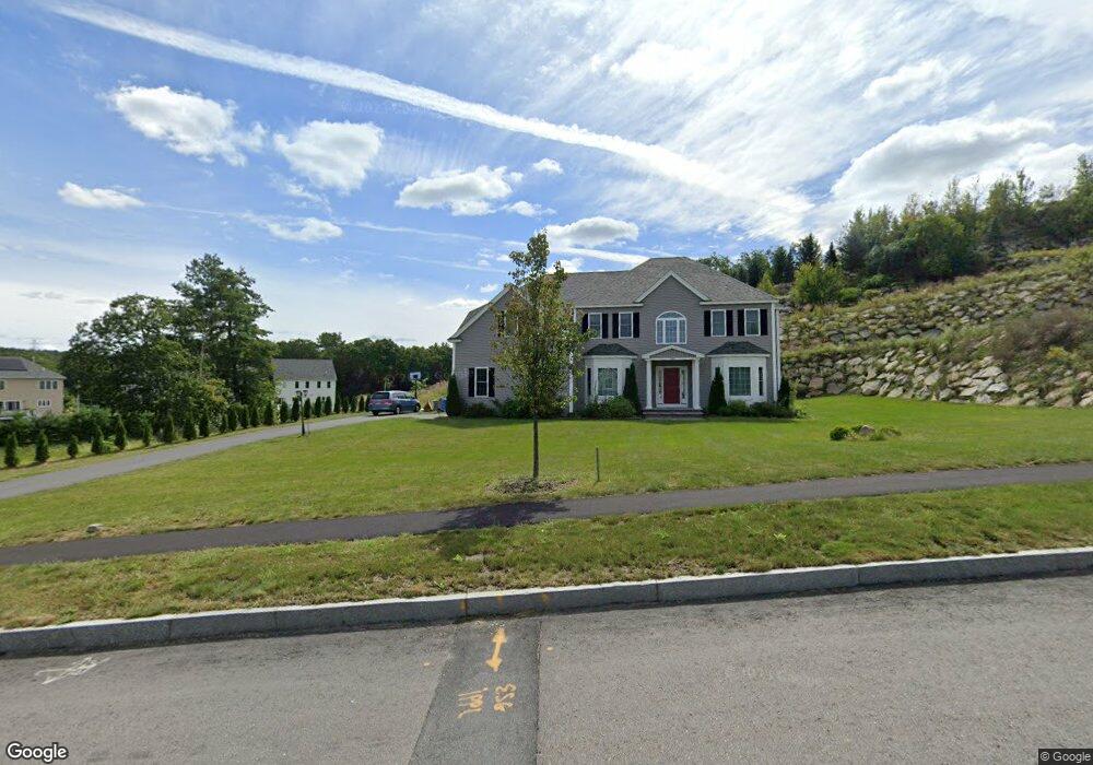
105 Old Cart Path Holliston, MA 01746
Estimated Value: $1,169,394 - $1,358,000
4
Beds
4
Baths
3,328
Sq Ft
$383/Sq Ft
Est. Value
About This Home
This home is located at 105 Old Cart Path, Holliston, MA 01746 and is currently estimated at $1,275,099, approximately $383 per square foot. 105 Old Cart Path is a home with nearby schools including Placentino Elementary School, Miller Elementary School, and Robert H. Adams Middle School.
Ownership History
Date
Name
Owned For
Owner Type
Purchase Details
Closed on
Jul 23, 2019
Sold by
Constitution Village Llc
Bought by
Vompolu Ravi
Current Estimated Value
Home Financials for this Owner
Home Financials are based on the most recent Mortgage that was taken out on this home.
Original Mortgage
$699,280
Outstanding Balance
$612,632
Interest Rate
3.82%
Mortgage Type
Purchase Money Mortgage
Estimated Equity
$662,467
Create a Home Valuation Report for This Property
The Home Valuation Report is an in-depth analysis detailing your home's value as well as a comparison with similar homes in the area
Home Values in the Area
Average Home Value in this Area
Purchase History
| Date | Buyer | Sale Price | Title Company |
|---|---|---|---|
| Vompolu Ravi | $874,100 | -- |
Source: Public Records
Mortgage History
| Date | Status | Borrower | Loan Amount |
|---|---|---|---|
| Open | Vompolu Ravi | $699,280 |
Source: Public Records
Tax History
| Year | Tax Paid | Tax Assessment Tax Assessment Total Assessment is a certain percentage of the fair market value that is determined by local assessors to be the total taxable value of land and additions on the property. | Land | Improvement |
|---|---|---|---|---|
| 2025 | $15,903 | $1,085,500 | $291,400 | $794,100 |
| 2024 | $15,699 | $1,042,400 | $291,400 | $751,000 |
| 2023 | $14,927 | $969,300 | $291,400 | $677,900 |
| 2022 | $14,059 | $808,900 | $291,400 | $517,500 |
| 2021 | $15,183 | $850,600 | $275,800 | $574,800 |
| 2020 | $14,531 | $770,900 | $260,600 | $510,300 |
| 2019 | $4,764 | $253,000 | $253,000 | $0 |
| 2018 | $1,955 | $104,700 | $104,700 | $0 |
| 2017 | $2,033 | $109,800 | $109,800 | $0 |
| 2016 | $1,939 | $103,200 | $103,200 | $0 |
| 2015 | $1,746 | $90,100 | $90,100 | $0 |
Source: Public Records
Map
Nearby Homes
- 9 Adams Ln Unit 9
- 1 Adams Ln Unit 1
- 18 Sherborne Cir
- 306 Trailside Way
- 241 Trailside Way
- 363 Eliot St
- 67 Mohawk Path
- 3 Danforth Dr
- 1 Danforth Dr
- 59 Brooksmont Dr Unit 59
- 147 Turner Rd Unit 80
- 26 Meeting House Path Unit 26
- 615 Mayflower Landing
- 62 Ashland St
- 74 Meeting House Path
- 269 Concord St
- 9 Mountain Gate Rd
- 2 Arrowhead Cir Unit 2
- 207 Eliot St
- 45 Half Crown Cir
- 101 Old Cart Path
- 186 Mohawk Path Unit Lot 77
- 186 Mohawk Path Unit 186
- 194 Mohawk Path
- 3 Pout Ln
- 97 Old Cart Path
- 195 Mohawk Path
- 195 Mohawk Path
- 195 Mohawk Path Unit 85
- 112 Old Cart Path
- 32 Hiawatha Trail
- 28 Hiawatha Trail
- 8 Pout Ln
- 92 Old Cart Path
- 180 Mohawk Path
- Lot 56 Hiawatha Trail
- 204 Mohawk Path Unit Lot 80
- 204 Mohawk Path
- 93 Old Cart Path
- 187 Mohawk Path
Your Personal Tour Guide
Ask me questions while you tour the home.