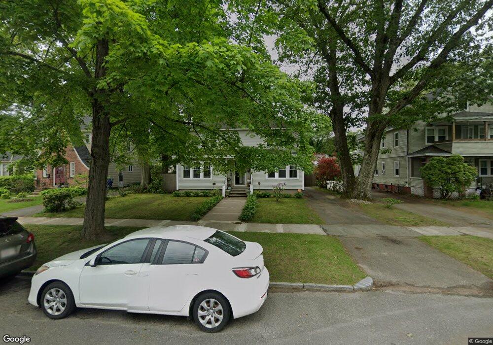
105 Olmsted Dr Springfield, MA 01108
Forest Park NeighborhoodEstimated Value: $366,000 - $446,000
6
Beds
2
Baths
2,884
Sq Ft
$140/Sq Ft
Est. Value
About This Home
This home is located at 105 Olmsted Dr, Springfield, MA 01108 and is currently estimated at $404,057, approximately $140 per square foot. 105 Olmsted Dr is a home located in Hampden County with nearby schools including Alice B. Beal Elementary School, Forest Park Middle School, and High School Of Commerce.
Ownership History
Date
Name
Owned For
Owner Type
Purchase Details
Closed on
Mar 9, 2021
Sold by
Rodriguez-Torres David O
Bought by
Rodriguez David and Torres Suzie
Current Estimated Value
Purchase Details
Closed on
Sep 30, 2020
Sold by
Hsb Investments Llc
Bought by
Rodriguez-Torres David O
Home Financials for this Owner
Home Financials are based on the most recent Mortgage that was taken out on this home.
Original Mortgage
$274,928
Interest Rate
2.9%
Mortgage Type
FHA
Purchase Details
Closed on
Dec 31, 2018
Sold by
Academy Group Llc
Bought by
Hsb Investments Llc
Purchase Details
Closed on
Dec 29, 2006
Sold by
Bernal Hugo S
Bought by
Academy Group Llc
Purchase Details
Closed on
Nov 3, 2003
Sold by
Academy Group Llc and Bernal Hugo S
Bought by
Cangialosi Gloria M and Cangialosi Salvatore F
Home Financials for this Owner
Home Financials are based on the most recent Mortgage that was taken out on this home.
Original Mortgage
$101,350
Interest Rate
6.05%
Mortgage Type
Purchase Money Mortgage
Purchase Details
Closed on
May 6, 2002
Sold by
Bercan Assocs Inc
Bought by
Cangialoso Gloria M
Home Financials for this Owner
Home Financials are based on the most recent Mortgage that was taken out on this home.
Original Mortgage
$97,500
Interest Rate
7.13%
Mortgage Type
Purchase Money Mortgage
Purchase Details
Closed on
May 2, 2002
Sold by
Petrocelli Joseph A
Bought by
Bercan Assocs Inc
Home Financials for this Owner
Home Financials are based on the most recent Mortgage that was taken out on this home.
Original Mortgage
$97,500
Interest Rate
7.13%
Mortgage Type
Purchase Money Mortgage
Purchase Details
Closed on
Feb 27, 2002
Sold by
Fleet Ntl Bk
Bought by
Petrocelli Joseph A
Purchase Details
Closed on
Mar 12, 1987
Sold by
Burke Kevin M
Bought by
Miller Ginnita
Home Financials for this Owner
Home Financials are based on the most recent Mortgage that was taken out on this home.
Original Mortgage
$100,000
Interest Rate
9.01%
Mortgage Type
Purchase Money Mortgage
Create a Home Valuation Report for This Property
The Home Valuation Report is an in-depth analysis detailing your home's value as well as a comparison with similar homes in the area
Home Values in the Area
Average Home Value in this Area
Purchase History
| Date | Buyer | Sale Price | Title Company |
|---|---|---|---|
| Rodriguez David | -- | None Available | |
| Rodriguez-Torres David O | $280,000 | None Available | |
| Hsb Investments Llc | -- | -- | |
| Academy Group Llc | -- | -- | |
| Cangialosi Gloria M | -- | -- | |
| Cangialoso Gloria M | $130,000 | -- | |
| Bercan Assocs Inc | $75,000 | -- | |
| Petrocelli Joseph A | $47,250 | -- | |
| Miller Ginnita | $134,900 | -- |
Source: Public Records
Mortgage History
| Date | Status | Borrower | Loan Amount |
|---|---|---|---|
| Previous Owner | Rodriguez-Torres David O | $274,928 | |
| Previous Owner | Cangialosi Gloria M | $101,350 | |
| Previous Owner | Miller Ginnita | $97,500 | |
| Previous Owner | Miller Ginnita | $100,000 |
Source: Public Records
Tax History
| Year | Tax Paid | Tax Assessment Tax Assessment Total Assessment is a certain percentage of the fair market value that is determined by local assessors to be the total taxable value of land and additions on the property. | Land | Improvement |
|---|---|---|---|---|
| 2025 | $5,218 | $332,800 | $38,900 | $293,900 |
| 2024 | $5,510 | $343,100 | $38,900 | $304,200 |
| 2023 | $4,951 | $290,400 | $36,600 | $253,800 |
| 2022 | $4,799 | $255,000 | $34,200 | $220,800 |
| 2021 | $3,848 | $203,600 | $31,100 | $172,500 |
| 2020 | $3,570 | $182,800 | $31,100 | $151,700 |
| 2019 | $3,332 | $169,300 | $32,100 | $137,200 |
| 2018 | $3,292 | $167,300 | $32,100 | $135,200 |
| 2017 | $3,203 | $162,900 | $32,100 | $130,800 |
| 2016 | $3,122 | $158,800 | $32,100 | $126,700 |
| 2015 | $3,057 | $155,400 | $32,100 | $123,300 |
Source: Public Records
Map
Nearby Homes
- 58 Appleton St
- 104 Appleton St
- 12 Carroll St
- 42 Carroll St
- 115 Tiffany St
- 35 Carlton St
- 134-136 Woodlawn St
- 132 Carroll St
- 27 Ormond St
- 144 Washington St
- 179 Carver St
- 137 Carroll St
- 52 Orlando St
- 302 -306 Sumner Ave
- 332-334 Forest Park Ave
- 114 Sylvan St Unit 116
- 264 Sumner Ave
- 96 Firglade Ave
- 88-90 Beaumont St
- 153 Porter Lake Dr Unit 153
- 109 Olmsted Dr
- 109-111 Olmsted Dr
- 97 Olmsted Dr
- 117 Olmsted Dr Unit 119
- 91 Olmsted Dr
- 117-119 Olmsted Dr Unit 119
- 100 Bronson Terrace
- 106 Bronson Terrace
- 96 Bronson Terrace
- 85 Olmsted Dr
- 112 Bronson Terrace
- 90 Bronson Terrace
- Dr Unit 127 Olmsted Dr
- 127 Olmsted Dr Unit 129
- 127-129 Olmsted Dr Unit 1
- 127 Olmsted Dr Unit 1
- 127 Olmsted Dr Unit 2
- 108 Olmsted Dr Unit 110
- 100 Olmsted Dr
- 82 Bronson Terrace
Your Personal Tour Guide
Ask me questions while you tour the home.