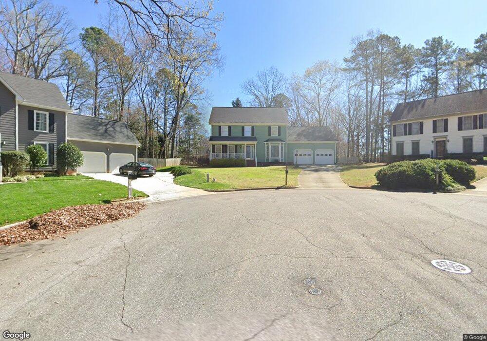
105 Parsons Ln Cary, NC 27511
South Cary NeighborhoodEstimated Value: $576,000 - $670,000
4
Beds
3
Baths
2,411
Sq Ft
$259/Sq Ft
Est. Value
About This Home
This home is located at 105 Parsons Ln, Cary, NC 27511 and is currently estimated at $625,410, approximately $259 per square foot. 105 Parsons Ln is a home located in Wake County with nearby schools including Briarcliff Elementary School, East Cary Middle School, and Cary High School.
Ownership History
Date
Name
Owned For
Owner Type
Purchase Details
Closed on
Jul 7, 2022
Sold by
Michau Charlotte M
Bought by
Charlotte M Michau Revocable Trust
Current Estimated Value
Purchase Details
Closed on
Sep 21, 2001
Sold by
White Benjamin C and White Toby S
Bought by
Michau Kenneth J and Michau Charlotte M
Home Financials for this Owner
Home Financials are based on the most recent Mortgage that was taken out on this home.
Original Mortgage
$150,000
Interest Rate
5.87%
Create a Home Valuation Report for This Property
The Home Valuation Report is an in-depth analysis detailing your home's value as well as a comparison with similar homes in the area
Home Values in the Area
Average Home Value in this Area
Purchase History
| Date | Buyer | Sale Price | Title Company |
|---|---|---|---|
| Charlotte M Michau Revocable Trust | -- | Johnson Senter Stephenson | |
| Charlotte M Michau Revocable Trust | -- | Johnson Senter Stephenson | |
| Michau Kenneth J | $194,000 | -- |
Source: Public Records
Mortgage History
| Date | Status | Borrower | Loan Amount |
|---|---|---|---|
| Previous Owner | Michau Kenneth J | $150,000 |
Source: Public Records
Tax History Compared to Growth
Tax History
| Year | Tax Paid | Tax Assessment Tax Assessment Total Assessment is a certain percentage of the fair market value that is determined by local assessors to be the total taxable value of land and additions on the property. | Land | Improvement |
|---|---|---|---|---|
| 2025 | $4,533 | $526,487 | $170,000 | $356,487 |
| 2024 | $4,435 | $526,487 | $170,000 | $356,487 |
| 2023 | $3,717 | $368,941 | $125,000 | $243,941 |
| 2022 | $3,578 | $368,941 | $125,000 | $243,941 |
| 2021 | $3,507 | $368,941 | $125,000 | $243,941 |
| 2020 | $3,525 | $368,941 | $125,000 | $243,941 |
| 2019 | $3,312 | $307,478 | $95,000 | $212,478 |
| 2018 | $3,108 | $307,478 | $95,000 | $212,478 |
| 2017 | $2,987 | $307,478 | $95,000 | $212,478 |
| 2016 | $2,943 | $307,478 | $95,000 | $212,478 |
| 2015 | $2,791 | $281,412 | $86,700 | $194,712 |
| 2014 | $2,632 | $281,412 | $86,700 | $194,712 |
Source: Public Records
Map
Nearby Homes
- 108 Ridgepath Way
- 311 Dunhagan Place
- 301 Dunhagan Place
- 102 Shriver Ct
- 101 Kramer Ct
- 103 Shriver Ct
- 102 Coventry Ln
- 1404 Rock Creek Ln
- 119 Hanover Place
- 1640 Glengarry Dr
- 4311 Wellington Ridge Loop
- 100 Moray Ct
- 408 Brookcliff Ln
- 512 Spring Flower Ct
- 1510 Kildaire Farm Rd
- 305 Springhurst Ln
- 1641 Kildonan Place
- 112 Queensferry Rd
- 130 Castlewood Dr
- 512 New Kent Place Unit 512
- 104 Parsons Ln
- 103 Parsons Ln
- 102 Parsons Ln
- 300 Coorsdale Dr
- 313 Heidinger Dr
- 104 Ridgepath Way
- 311 Heidinger Dr
- 302 Coorsdale Dr
- 102 Ridgepath Way
- 315 Heidinger Dr
- 110 Ridgepath Way
- 210 Coorsdale Dr
- 304 Coorsdale Dr
- 309 Heidinger Dr
- 208 Coorsdale Dr
- 314 Heidinger Dr
- 301 Coorsdale Dr
- 109 Ridgepath Way
- 303 Coorsdale Dr
- 107 Ridgepath Way