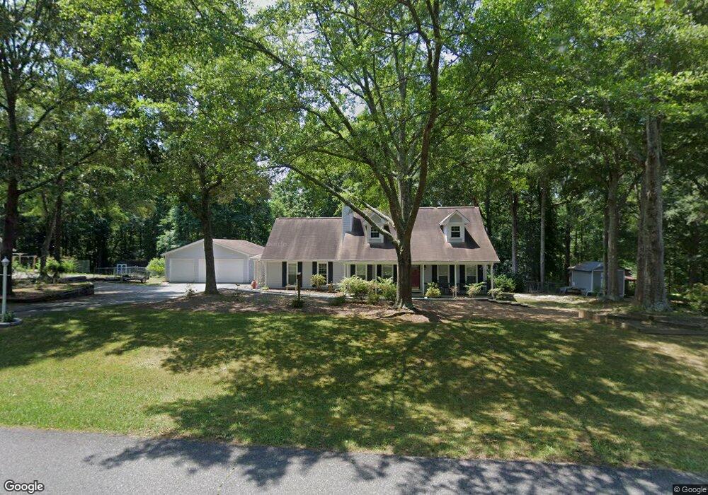
105 Port Victoria Way Unit 1 Woodstock, GA 30189
Sutallee NeighborhoodEstimated Value: $407,000 - $426,000
3
Beds
2
Baths
1,960
Sq Ft
$214/Sq Ft
Est. Value
About This Home
This home is located at 105 Port Victoria Way Unit 1, Woodstock, GA 30189 and is currently estimated at $419,453, approximately $214 per square foot. 105 Port Victoria Way Unit 1 is a home located in Cherokee County with nearby schools including Boston Elementary School, E. T. Booth Middle School, and Etowah High School.
Ownership History
Date
Name
Owned For
Owner Type
Purchase Details
Closed on
Jun 25, 2012
Sold by
Haynes Rebecca A
Bought by
Warren Rebecca A and Warren Joseph N
Current Estimated Value
Home Financials for this Owner
Home Financials are based on the most recent Mortgage that was taken out on this home.
Original Mortgage
$115,450
Outstanding Balance
$77,317
Interest Rate
3.05%
Mortgage Type
New Conventional
Estimated Equity
$342,136
Purchase Details
Closed on
Nov 30, 2004
Sold by
Raftopoulos Gerald
Bought by
Haynes Rebecca A
Home Financials for this Owner
Home Financials are based on the most recent Mortgage that was taken out on this home.
Original Mortgage
$138,160
Interest Rate
5.62%
Mortgage Type
New Conventional
Create a Home Valuation Report for This Property
The Home Valuation Report is an in-depth analysis detailing your home's value as well as a comparison with similar homes in the area
Home Values in the Area
Average Home Value in this Area
Purchase History
| Date | Buyer | Sale Price | Title Company |
|---|---|---|---|
| Warren Rebecca A | $172,700 | -- | |
| Haynes Rebecca A | $172,700 | -- |
Source: Public Records
Mortgage History
| Date | Status | Borrower | Loan Amount |
|---|---|---|---|
| Open | Warren Rebecca A | $115,450 | |
| Previous Owner | Haynes Rebecca A | $138,160 |
Source: Public Records
Tax History Compared to Growth
Tax History
| Year | Tax Paid | Tax Assessment Tax Assessment Total Assessment is a certain percentage of the fair market value that is determined by local assessors to be the total taxable value of land and additions on the property. | Land | Improvement |
|---|---|---|---|---|
| 2024 | $733 | $146,040 | $29,200 | $116,840 |
| 2023 | $604 | $149,240 | $29,200 | $120,040 |
| 2022 | $663 | $113,384 | $26,000 | $87,384 |
| 2021 | $636 | $90,824 | $19,480 | $71,344 |
| 2020 | $607 | $82,464 | $17,400 | $65,064 |
| 2019 | $568 | $72,200 | $15,000 | $57,200 |
| 2018 | $565 | $68,640 | $13,600 | $55,040 |
| 2017 | $1,887 | $172,800 | $13,600 | $55,520 |
| 2016 | $1,824 | $164,200 | $11,760 | $53,920 |
| 2015 | $1,673 | $148,000 | $11,760 | $47,440 |
| 2014 | $1,450 | $128,800 | $11,760 | $39,760 |
Source: Public Records
Map
Nearby Homes
- 146 Sunset Ln
- 313 Maltibe Dr
- 7119 Big Woods Dr
- 507 Huntgate Rd
- 617 Driftwood Dr
- 477 Victoria Rd
- 1028 Deer Hollow Dr
- 7307 Carriage Creek Rd
- 627 Apache Trail
- 1001 Deer Hollow Dr
- 1031 Camden Ln
- 104 Rose Cottage Ln Unit 65
- 306 N Briar Ridge
- 2006 Hawthorne Way
- 1508 Towne Harbor Ln
- 0 Black Oak Trail Unit 10267626
- 0 Black Oak Trail Unit 7303191
- 418 Allatoona Trail
- 1001 Braelin Ct
- 1511 Harbor Watch Ct
- 103 Port Victoria Way
- 202 Shelter Cove
- 301 Mariner Cir
- 106 Port Victoria Way Unit 1
- 104 Port Victoria Way
- 101 Port Victoria Way
- 201 Shelter Cove
- 303-A Mariner Cir
- 102 Port Victoria Way Unit 1
- 0 Port Victoria Way
- 112 Port Victoria Way
- 204 Shelter Cove
- 111 Port Victoria Way Unit I
- 304 Mariner Cir
- 114 Port Victoria Way Unit 1
- 305 Mariner Cir
- 303 Mariner Cir
- 305-A Mariner Cir
- 203 Shelter Cove Unit 1
- 305 Mariner Cir