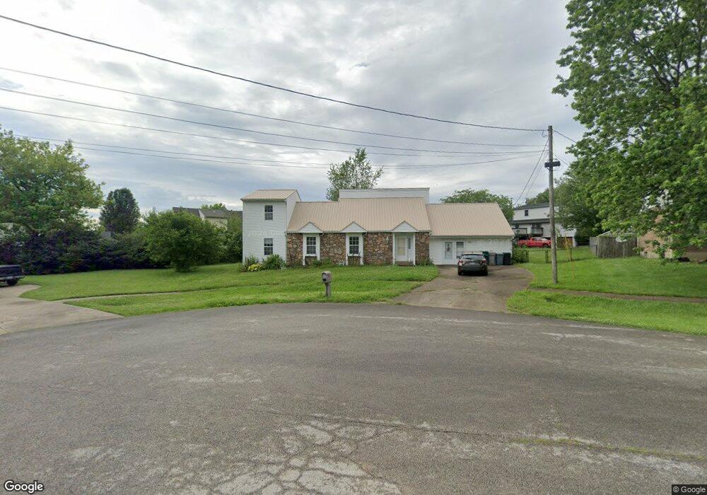
105 Quietside Ct Vine Grove, KY 40175
Estimated Value: $258,000 - $304,989
5
Beds
2
Baths
2,715
Sq Ft
$106/Sq Ft
Est. Value
About This Home
This home is located at 105 Quietside Ct, Vine Grove, KY 40175 and is currently estimated at $286,997, approximately $105 per square foot. 105 Quietside Ct is a home located in Hardin County with nearby schools including Meadow View Elementary School, North Middle School, and North Hardin High School.
Ownership History
Date
Name
Owned For
Owner Type
Purchase Details
Closed on
Oct 24, 2011
Sold by
Bonnett Michael Lee and Bonnett Kap Song
Bought by
Bonnett Charles
Current Estimated Value
Home Financials for this Owner
Home Financials are based on the most recent Mortgage that was taken out on this home.
Original Mortgage
$118,400
Outstanding Balance
$80,395
Interest Rate
4.16%
Mortgage Type
New Conventional
Estimated Equity
$206,602
Create a Home Valuation Report for This Property
The Home Valuation Report is an in-depth analysis detailing your home's value as well as a comparison with similar homes in the area
Home Values in the Area
Average Home Value in this Area
Purchase History
| Date | Buyer | Sale Price | Title Company |
|---|---|---|---|
| Bonnett Charles | $148,000 | None Available |
Source: Public Records
Mortgage History
| Date | Status | Borrower | Loan Amount |
|---|---|---|---|
| Open | Bonnett Charles | $118,400 |
Source: Public Records
Tax History Compared to Growth
Tax History
| Year | Tax Paid | Tax Assessment Tax Assessment Total Assessment is a certain percentage of the fair market value that is determined by local assessors to be the total taxable value of land and additions on the property. | Land | Improvement |
|---|---|---|---|---|
| 2025 | $192,900 | $192,900 | $24,100 | $168,800 |
| 2024 | $1,813 | $192,900 | $24,100 | $168,800 |
| 2023 | $235 | $162,900 | $24,100 | $138,800 |
| 2022 | $1,553 | $162,900 | $24,100 | $138,800 |
| 2021 | $1,763 | $162,900 | $24,100 | $138,800 |
| 2020 | $1,780 | $162,900 | $24,100 | $138,800 |
| 2019 | $245 | $157,300 | $0 | $0 |
| 2018 | $1,683 | $157,300 | $0 | $0 |
| 2017 | $1,676 | $157,300 | $0 | $0 |
| 2016 | $245 | $157,300 | $0 | $0 |
| 2015 | $1,342 | $157,300 | $0 | $0 |
| 2012 | -- | $153,600 | $0 | $0 |
Source: Public Records
Map
Nearby Homes
- 149 Red Hawk Dr
- 143 Red Hawk Dr
- 139 Red Hawk Dr
- Ashton Plan at Falcon Heights
- 132 Red Hawk Dr
- 130 Red Hawk Dr
- 126 Red Hawk Dr
- 128 Red Hawk Dr
- 114 S Osprey Ct
- 119 Red Hawk Dr
- 1435 Hawkins Dr
- 1362 Darlene Cir
- 1165 N Logsdon Pkwy
- 2424 Hill St
- 806 Yates Dr
- 1433 Crestview Dr
- 1465 Crestview Dr
- 1393 Kingswood Way
- 1058 Scenic Dr
- 1329 Bramblett Blvd
- 103 Quietside Ct
- 117 Baywood Ave
- 115 Baywood Ave
- 112 Whisbrook Ave
- 114 Whisbrook Ave
- 113 Baywood Ave
- 108 Whisbrook Ave
- 107 Quietside Ct
- 106 Quietside Ct
- 111 Baywood Ave
- 104 Quietside Ct
- 116 Baywood Ave
- 114 Baywood Ave
- 108 Quietside Ct
- 118 Baywood Ave
- 102 Whisbrook Ave
- 112 Baywood Ave
- 109 Baywood Ave
- 111 Whisbrook Ave
- 115 Whisbrook Ave