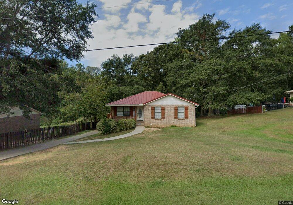
105 Randall Cir Clanton, AL 35045
Estimated Value: $152,002 - $196,000
Studio
--
Bath
1,010
Sq Ft
$172/Sq Ft
Est. Value
About This Home
This home is located at 105 Randall Cir, Clanton, AL 35045 and is currently estimated at $173,501, approximately $171 per square foot. 105 Randall Cir is a home with nearby schools including Clanton Elementary School, Thorsby High School, and Isabella High School.
Ownership History
Date
Name
Owned For
Owner Type
Purchase Details
Closed on
May 14, 2024
Sold by
Fincher Gregory Shawn
Bought by
Fincher Gregory Shawn and Fincher Johnna Rachel
Current Estimated Value
Purchase Details
Closed on
Mar 30, 2007
Sold by
Bradley Jonathan E and Bradley Jessica S
Bought by
Fincher Gregory Shawn
Home Financials for this Owner
Home Financials are based on the most recent Mortgage that was taken out on this home.
Original Mortgage
$88,715
Interest Rate
6.27%
Mortgage Type
Future Advance Clause Open End Mortgage
Create a Home Valuation Report for This Property
The Home Valuation Report is an in-depth analysis detailing your home's value as well as a comparison with similar homes in the area
Purchase History
| Date | Buyer | Sale Price | Title Company |
|---|---|---|---|
| Fincher Gregory Shawn | $1,000 | None Listed On Document | |
| Fincher Gregory Shawn | $88,750 | None Available |
Source: Public Records
Mortgage History
| Date | Status | Borrower | Loan Amount |
|---|---|---|---|
| Previous Owner | Fincher Gregory Shawn | $88,715 |
Source: Public Records
Tax History
| Year | Tax Paid | Tax Assessment Tax Assessment Total Assessment is a certain percentage of the fair market value that is determined by local assessors to be the total taxable value of land and additions on the property. | Land | Improvement |
|---|---|---|---|---|
| 2024 | $380 | $23,540 | $4,200 | $19,340 |
| 2023 | $437 | $22,760 | $4,000 | $18,760 |
| 2022 | $374 | $10,270 | $2,420 | $7,850 |
| 2021 | $299 | $8,490 | $2,000 | $6,490 |
| 2020 | $299 | $8,490 | $2,000 | $6,490 |
| 2019 | $299 | $8,290 | $2,000 | $6,290 |
| 2018 | $316 | $10,200 | $0 | $0 |
| 2017 | $316 | $0 | $0 | $0 |
| 2016 | $316 | $0 | $0 | $0 |
| 2015 | $310 | $0 | $0 | $0 |
| 2013 | $310 | $8,760 | $0 | $0 |
Source: Public Records
Map
Nearby Homes
- 103 Randall Cir
- 103 Windover Dr
- 800 Airport Rd
- 0 County Road 32 Unit 21440953
- 110 Round Forest Dr Unit 4
- 104 Adriane St
- 1302 Lay Dam Rd
- 1306 Lay Dam Rd
- 106 Bethany Ln
- 168 County Road 454
- 1912 Lay Dam Rd
- 75 County Road 920
- 1003 Lay Dam Rd
- 311 Thrash Rd
- 6101 Alabama 145
- 504 Adams St
- 01 Alabama 145
- 421 County Road 764
- 803 3rd St N
- 442 Thrash Rd
- B Randall Cir Unit 1
- B Randall Cir
- 107 Randall Cir
- A Randall Cir
- 109 Randall Cir
- 201 Elson Ave
- 102 Randall Cir
- 110 Randall Cir
- 204 Elson Ave
- 103 Laverne Ave
- 203 Elson Ave
- 100 Randall Cir
- 111 Randall Cir
- 114 Randall Cir
- 215 Randall Cir
- 113 Randall Cir
- 269 Wyatt Rd Unit 13
- 269 Wyatt Rd
- 102 Laverne Ave
- 205 Elson Ave
Your Personal Tour Guide
Ask me questions while you tour the home.