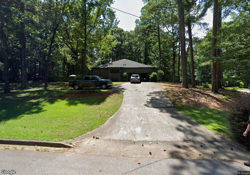
105 Red Oak Dr Unit 2 Fayetteville, GA 30214
Estimated Value: $346,429 - $389,000
--
Bed
2
Baths
2,100
Sq Ft
$175/Sq Ft
Est. Value
About This Home
This home is located at 105 Red Oak Dr Unit 2, Fayetteville, GA 30214 and is currently estimated at $367,107, approximately $174 per square foot. 105 Red Oak Dr Unit 2 is a home located in Fayette County with nearby schools including Bennett's Mill Middle School, Fayette County High School, and Rising Star Montessori School.
Ownership History
Date
Name
Owned For
Owner Type
Purchase Details
Closed on
Mar 28, 2018
Sold by
Rice William P
Bought by
Gzesiakowski Caryn
Current Estimated Value
Purchase Details
Closed on
Nov 20, 2003
Sold by
Perry Frank B and Perry Mary G
Bought by
Grzesiakowski Caryn A
Home Financials for this Owner
Home Financials are based on the most recent Mortgage that was taken out on this home.
Original Mortgage
$179,400
Interest Rate
6.5%
Mortgage Type
New Conventional
Create a Home Valuation Report for This Property
The Home Valuation Report is an in-depth analysis detailing your home's value as well as a comparison with similar homes in the area
Home Values in the Area
Average Home Value in this Area
Purchase History
| Date | Buyer | Sale Price | Title Company |
|---|---|---|---|
| Gzesiakowski Caryn | -- | -- | |
| Grzesiakowski Caryn A | $188,900 | -- |
Source: Public Records
Mortgage History
| Date | Status | Borrower | Loan Amount |
|---|---|---|---|
| Previous Owner | Grzesiakowski Caryn A | $179,400 |
Source: Public Records
Tax History Compared to Growth
Tax History
| Year | Tax Paid | Tax Assessment Tax Assessment Total Assessment is a certain percentage of the fair market value that is determined by local assessors to be the total taxable value of land and additions on the property. | Land | Improvement |
|---|---|---|---|---|
| 2024 | $2,571 | $135,724 | $22,000 | $113,724 |
| 2023 | $2,176 | $130,520 | $22,000 | $108,520 |
| 2022 | $2,464 | $120,680 | $22,000 | $98,680 |
| 2021 | $2,202 | $91,760 | $22,000 | $69,760 |
| 2020 | $2,476 | $90,120 | $12,800 | $77,320 |
| 2019 | $2,406 | $86,760 | $12,800 | $73,960 |
| 2018 | $2,279 | $81,400 | $12,800 | $68,600 |
| 2017 | $2,011 | $71,880 | $12,800 | $59,080 |
| 2016 | $1,688 | $59,520 | $12,800 | $46,720 |
| 2015 | $1,585 | $55,080 | $12,800 | $42,280 |
| 2014 | $1,490 | $51,040 | $12,800 | $38,240 |
| 2013 | -- | $51,040 | $0 | $0 |
Source: Public Records
Map
Nearby Homes
- 225 S Shore Terrace
- 215 Creekside Trail
- 585 Huddleston Rd
- Columbia Plan at Arborvale
- Oak Park Plan at Arborvale
- Esquire Place Plan at Arborvale
- Cumberland Plan at Arborvale
- Lehigh Plan at Arborvale
- 230 White Rd
- 140 Biltmore Dr
- 160 Winona Dr
- 560 Hawthorne Dr
- 205 Sycamore Bend
- 180 Habersham Place
- 110 Birch Ct
- 120 Birch Ct
- E OF 118 Stanley Rd
- 145 Heritage Way
- 115 Westside Way
- 590 Hood Ave
- 115 Red Oak Dr
- 205 Ashland Way
- 230 Ashland Way
- 125 Red Oak Dr
- 220 Ashland Way
- 110 Red Oak Dr
- 120 Red Oak Dr
- 250 Ashland Way
- 210 Ashland Way
- 210 Ashland Way Unit 2
- 225 Ashland Way
- 100 Timberlane Dr
- 100 Timberlane Dr Unit 1C
- 135 Red Oak Dr Unit 6c
- 135 Red Oak Dr
- 130 Red Oak Dr
- 110 Timberlane Dr
- 130 South Shore Terrace
- 260 Ashland Way
- 200 Ashland Way