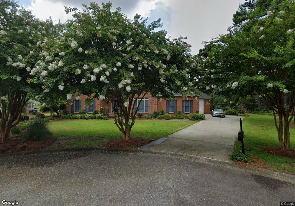
105 Scotts Ct West Columbia, SC 29172
Pine Ridge NeighborhoodEstimated Value: $406,000 - $486,958
3
Beds
3
Baths
2,778
Sq Ft
$157/Sq Ft
Est. Value
About This Home
This home is located at 105 Scotts Ct, West Columbia, SC 29172 and is currently estimated at $435,240, approximately $156 per square foot. 105 Scotts Ct is a home located in Lexington County with nearby schools including Herbert A. Wood Elementary School, Pine Ridge Middle School, and Airport High School.
Ownership History
Date
Name
Owned For
Owner Type
Purchase Details
Closed on
Mar 20, 2023
Sold by
Henry M Jefferson Iii Revocable Living T
Bought by
Lytes Edwina Walker and Lytes Ernest Sylester
Current Estimated Value
Home Financials for this Owner
Home Financials are based on the most recent Mortgage that was taken out on this home.
Original Mortgage
$140,000
Outstanding Balance
$135,597
Interest Rate
6.12%
Mortgage Type
New Conventional
Estimated Equity
$299,643
Purchase Details
Closed on
Nov 13, 2013
Sold by
Scott E Danny and Scott Jenny F
Bought by
Jefferson Henry M
Create a Home Valuation Report for This Property
The Home Valuation Report is an in-depth analysis detailing your home's value as well as a comparison with similar homes in the area
Home Values in the Area
Average Home Value in this Area
Purchase History
| Date | Buyer | Sale Price | Title Company |
|---|---|---|---|
| Lytes Edwina Walker | $459,000 | -- | |
| Jefferson Henry M | $260,000 | -- |
Source: Public Records
Mortgage History
| Date | Status | Borrower | Loan Amount |
|---|---|---|---|
| Open | Lytes Edwina Walker | $140,000 |
Source: Public Records
Tax History Compared to Growth
Tax History
| Year | Tax Paid | Tax Assessment Tax Assessment Total Assessment is a certain percentage of the fair market value that is determined by local assessors to be the total taxable value of land and additions on the property. | Land | Improvement |
|---|---|---|---|---|
| 2024 | $1,255 | $10,707 | $1,680 | $9,027 |
| 2023 | $1,517 | $10,707 | $1,680 | $9,027 |
| 2020 | $1,127 | $10,707 | $1,680 | $9,027 |
| 2019 | $1,003 | $9,727 | $1,680 | $8,047 |
| 2018 | $1,023 | $9,727 | $1,680 | $8,047 |
| 2017 | $974 | $9,727 | $1,680 | $8,047 |
| 2016 | $965 | $9,405 | $1,680 | $7,725 |
| 2014 | $3,711 | $14,190 | $2,160 | $12,030 |
| 2013 | -- | $9,460 | $1,440 | $8,020 |
Source: Public Records
Map
Nearby Homes
- 4156 Bachman Rd
- 151 Long Iron Ct
- 112 Preakness Ct
- 500 Calcutta Dr
- 0 Hyland Cir
- 119 Hartford Place
- 225 Corine Dr
- 141 Shumpert Rd
- 1124 Myrtle Rd
- 114 Henston Dr
- 107 Bunker Dr
- 632 Spruce Ln
- 266 Shumpert Rd
- 130 Mary Dr
- 100 Marilyn Ln
- 256 Calcutta Dr
- 945 Brookfield Dr
- 1306 Congaree Dr
- 273 Sandy Valley Ct
- 2105 Sandy Run Dr
- 148 Clubhouse Dr
- 104 Scotts Ct
- 140 Clubhouse Dr
- 143 Clubhouse Dr
- 148 Sawgrass Ct
- 147 Sawgrass Ct
- 139 Clubhouse Dr
- 134 Clubhouse Dr
- 144 Sawgrass Ct
- 151 Clubhouse Dr
- 143 Sawgrass Ct
- 4204 Bachman Rd
- 135 Clubhouse Dr
- 140 Sawgrass Ct
- 139 Sawgrass Ct
- 155 Clubhouse Dr
- 128 Clubhouse Dr
- 131 Clubhouse Dr
- 136 Sawgrass Ct
- 135 Sawgrass Ct