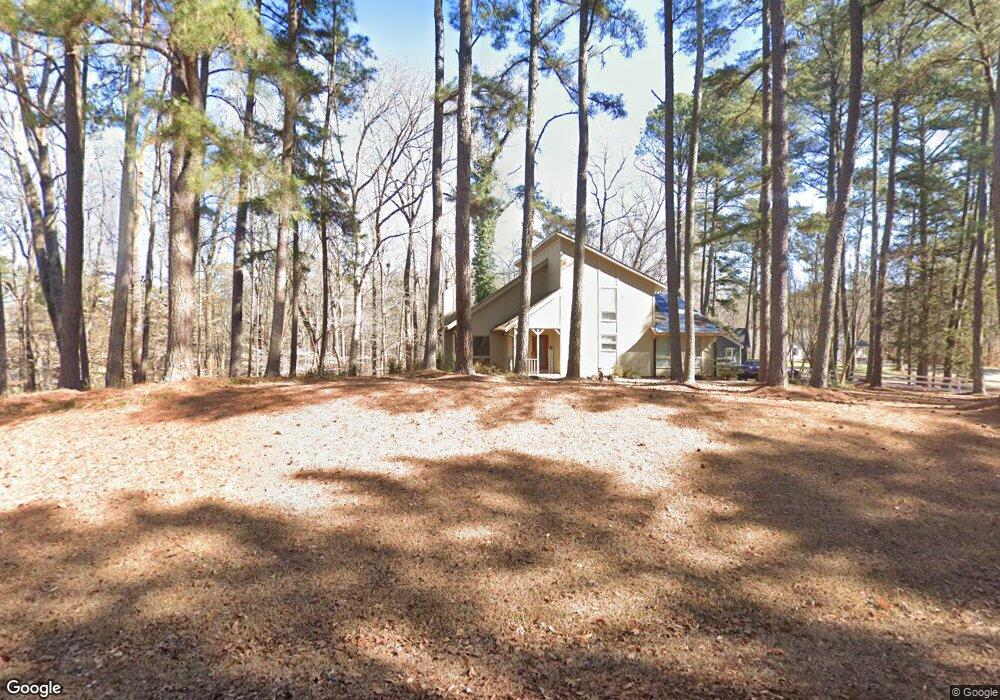
105 Shadowbrook Dr Henderson, NC 27537
Estimated Value: $287,035 - $362,000
3
Beds
2
Baths
1,951
Sq Ft
$167/Sq Ft
Est. Value
About This Home
This home is located at 105 Shadowbrook Dr, Henderson, NC 27537 and is currently estimated at $326,509, approximately $167 per square foot. 105 Shadowbrook Dr is a home located in Vance County with nearby schools including Dabney Elementary School, Vance County High School, and Kerr-Vance Academy.
Ownership History
Date
Name
Owned For
Owner Type
Purchase Details
Closed on
Jun 29, 2021
Sold by
Lawrence Dale M and Lawrence Benjamin J
Bought by
Jennings Brittni Lynn
Current Estimated Value
Home Financials for this Owner
Home Financials are based on the most recent Mortgage that was taken out on this home.
Original Mortgage
$234,848
Outstanding Balance
$211,231
Interest Rate
2.9%
Mortgage Type
New Conventional
Estimated Equity
$115,278
Purchase Details
Closed on
Dec 13, 2005
Sold by
Taylor Glen
Bought by
Mead Dale Rae
Home Financials for this Owner
Home Financials are based on the most recent Mortgage that was taken out on this home.
Original Mortgage
$139,650
Interest Rate
6.29%
Mortgage Type
New Conventional
Create a Home Valuation Report for This Property
The Home Valuation Report is an in-depth analysis detailing your home's value as well as a comparison with similar homes in the area
Purchase History
| Date | Buyer | Sale Price | Title Company |
|---|---|---|---|
| Jennings Brittni Lynn | $232,500 | Magnolia Title Company | |
| Mead Dale Rae | $147,000 | -- |
Source: Public Records
Mortgage History
| Date | Status | Borrower | Loan Amount |
|---|---|---|---|
| Open | Jennings Brittni Lynn | $234,848 | |
| Previous Owner | Mead Dale Rae | $139,650 |
Source: Public Records
Tax History
| Year | Tax Paid | Tax Assessment Tax Assessment Total Assessment is a certain percentage of the fair market value that is determined by local assessors to be the total taxable value of land and additions on the property. | Land | Improvement |
|---|---|---|---|---|
| 2025 | $2,054 | $237,690 | $22,876 | $214,814 |
| 2024 | $1,986 | $237,690 | $22,876 | $214,814 |
| 2023 | $1,473 | $138,212 | $18,000 | $120,212 |
| 2022 | $1,473 | $138,212 | $18,000 | $120,212 |
| 2021 | $1,353 | $138,212 | $18,000 | $120,212 |
| 2020 | $1,470 | $138,212 | $18,000 | $120,212 |
| 2019 | $1,465 | $138,212 | $18,000 | $120,212 |
| 2018 | $1,291 | $138,212 | $18,000 | $120,212 |
| 2017 | $1,396 | $138,212 | $18,000 | $120,212 |
| 2016 | $1,396 | $138,212 | $18,000 | $120,212 |
| 2015 | $1,282 | $154,180 | $23,000 | $131,180 |
| 2014 | $1,388 | $154,178 | $23,000 | $131,178 |
Source: Public Records
Map
Nearby Homes
- 160 Shadowbrook Dr
- 1.21 Turner Ln
- 0 Us Hwy 158 Hwy Unit CAR4105253
- 84 Weybossett Rd
- 507 E Waycliff Rd
- 399 W Waycliff Rd
- 42 Tall Pines Dr
- 1822 Ruin Creek Rd
- 2535 Fairway Dr Unit 3
- 204 Par Dr
- 206 Beechwood Trail
- 2111 Coleman Place
- 731 Lakeview Dr
- Lot 5 Sidney Hill
- 1842 Lynne Ave
- 4688 Dorsey Rd
- 4710 Dorsey Rd
- 106 Orchard Rd
- 1707 Peace St
- 00 Oxford Rd Southern Ave Rd
- 105 Shadow Brook Dr
- 161 Shadowbrook Dr
- 102 Shadowbrook Dr
- 124 Shadowbrook Dr
- 70 Shadow Brook Dr
- 70 Shadowbrook Dr
- 228 Hunters Ridge
- 228 Hunters Ridge Rd
- 102 Shadow Brook Dr
- 168 Shadowbrook Dr
- 196 Hunters Ridge
- 196 Hunters Ridge Rd
- 196 Hunters Ridge
- 255 Hunters Ridge Rd
- 255 Hunters Ridge
- 170 Hunters Ridge
- 308 Wood Trail Way
- 290 Wood Trail Way
- 285 Hunters Ridge
- 303 Hunters Ridge
Your Personal Tour Guide
Ask me questions while you tour the home.