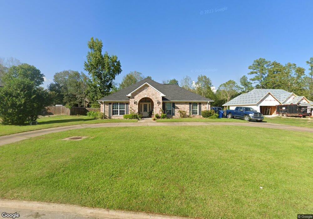
105 Southbend Dr Lufkin, TX 75901
Estimated Value: $356,000 - $491,493
--
Bed
10
Baths
2,453
Sq Ft
$170/Sq Ft
Est. Value
About This Home
This home is located at 105 Southbend Dr, Lufkin, TX 75901 and is currently estimated at $416,498, approximately $169 per square foot. 105 Southbend Dr is a home located in Angelina County with nearby schools including Kurth Primary School, Anderson Elementary School, and Lufkin Middle School.
Ownership History
Date
Name
Owned For
Owner Type
Purchase Details
Closed on
Dec 23, 2004
Sold by
Spence Ronald L
Bought by
Briggs Robin
Current Estimated Value
Home Financials for this Owner
Home Financials are based on the most recent Mortgage that was taken out on this home.
Original Mortgage
$189,440
Outstanding Balance
$94,935
Interest Rate
5.74%
Mortgage Type
New Conventional
Estimated Equity
$321,563
Create a Home Valuation Report for This Property
The Home Valuation Report is an in-depth analysis detailing your home's value as well as a comparison with similar homes in the area
Home Values in the Area
Average Home Value in this Area
Purchase History
| Date | Buyer | Sale Price | Title Company |
|---|---|---|---|
| Briggs Robin | $189,440 | None Available |
Source: Public Records
Mortgage History
| Date | Status | Borrower | Loan Amount |
|---|---|---|---|
| Open | Briggs Robin | $189,440 |
Source: Public Records
Tax History Compared to Growth
Tax History
| Year | Tax Paid | Tax Assessment Tax Assessment Total Assessment is a certain percentage of the fair market value that is determined by local assessors to be the total taxable value of land and additions on the property. | Land | Improvement |
|---|---|---|---|---|
| 2025 | $7,273 | $348,020 | $39,670 | $308,350 |
| 2024 | $7,193 | $344,220 | $39,670 | $304,550 |
| 2023 | $6,739 | $339,130 | $39,670 | $299,460 |
| 2022 | $7,173 | $314,910 | $39,670 | $275,240 |
| 2021 | $6,998 | $291,360 | $39,670 | $251,690 |
| 2020 | $6,353 | $258,520 | $39,670 | $218,850 |
| 2019 | $6,790 | $261,230 | $39,670 | $221,560 |
| 2018 | $5,495 | $257,860 | $39,670 | $218,190 |
| 2017 | $5,495 | $243,230 | $33,980 | $209,250 |
| 2016 | $5,722 | $240,040 | $33,980 | $206,060 |
| 2015 | $4,909 | $240,040 | $33,980 | $206,060 |
| 2014 | $4,909 | $238,580 | $33,980 | $204,600 |
Source: Public Records
Map
Nearby Homes
- 110 Copperwood Loop
- R33234 Platt Rd
- 5100 Farm To Market 58
- 101 Southern Trace Dr
- 410 Brentwood Dr
- 310 Oak Crest Dr
- 301 Southern Trace Dr
- 1302 Parkman St
- 322 Oak Crest Dr
- 502 Brentwood Dr
- 406 Forest Creek Dr
- 107 Eastwood Place
- 3306 S Chestnut St
- 5552 S Chestnut St
- 508 Forest Creek Dr
- 247 John James Rd
- 1502 Brentwood Dr
- 2210 Peachtree St
- 3106 S Chestnut St
- 105 Southbend Dr
- 103 S Bend Dr
- 103 Southbend Dr
- 126 S Bend Dr
- 102 S Bend Dr
- 104 S Bend Dr
- 107 S Bend Dr
- 101 S Bend Dr
- 106 S Bend Dr
- 4109 S Chestnut St
- 106 Southbend Dr
- 109 Southbend Dr
- 108 Southbend Dr
- 108 S Bend Dr
- 111 Southbend Dr
- 110 S Bend Dr
- 110 Southbend Dr
- 111 S Bend Dr
- 4207 S Chestnut St
- 201 Southbend Dr