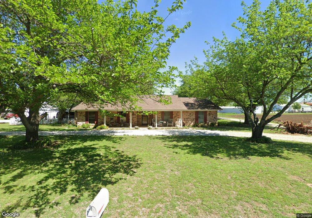
105 W Holt St Sanger, TX 76266
Estimated Value: $521,106 - $553,000
3
Beds
2
Baths
2,476
Sq Ft
$217/Sq Ft
Est. Value
About This Home
This home is located at 105 W Holt St, Sanger, TX 76266 and is currently estimated at $537,027, approximately $216 per square foot. 105 W Holt St is a home located in Denton County with nearby schools including Chisholm Trail Elementary School, Clear Creek Intermediate School, and Sanger Middle School.
Ownership History
Date
Name
Owned For
Owner Type
Purchase Details
Closed on
Feb 29, 2000
Sold by
Henzler Henry J and Henzler Nadine E
Bought by
Roberts Dale R
Current Estimated Value
Home Financials for this Owner
Home Financials are based on the most recent Mortgage that was taken out on this home.
Original Mortgage
$133,000
Outstanding Balance
$43,751
Interest Rate
8.31%
Estimated Equity
$493,276
Create a Home Valuation Report for This Property
The Home Valuation Report is an in-depth analysis detailing your home's value as well as a comparison with similar homes in the area
Home Values in the Area
Average Home Value in this Area
Purchase History
| Date | Buyer | Sale Price | Title Company |
|---|---|---|---|
| Roberts Dale R | -- | -- | |
| Roberts Dale R | -- | -- |
Source: Public Records
Mortgage History
| Date | Status | Borrower | Loan Amount |
|---|---|---|---|
| Open | Roberts Dale R | $133,000 | |
| Closed | Roberts Dale R | $133,000 |
Source: Public Records
Tax History Compared to Growth
Tax History
| Year | Tax Paid | Tax Assessment Tax Assessment Total Assessment is a certain percentage of the fair market value that is determined by local assessors to be the total taxable value of land and additions on the property. | Land | Improvement |
|---|---|---|---|---|
| 2025 | $7,155 | $452,221 | $163,686 | $432,022 |
| 2024 | $8,309 | $411,110 | $0 | $0 |
| 2023 | $6,417 | $373,736 | $127,311 | $385,553 |
| 2022 | $7,535 | $339,760 | $122,722 | $255,034 |
| 2021 | $6,492 | $308,873 | $55,783 | $253,090 |
| 2020 | $6,919 | $312,671 | $55,783 | $256,888 |
| 2019 | $6,968 | $306,040 | $55,783 | $262,766 |
| 2018 | $6,368 | $278,218 | $55,783 | $222,435 |
| 2017 | $5,861 | $254,821 | $55,783 | $199,038 |
| 2016 | $5,490 | $237,384 | $55,783 | $188,415 |
| 2015 | $4,353 | $215,804 | $55,783 | $162,745 |
| 2013 | -- | $178,350 | $44,626 | $133,724 |
Source: Public Records
Map
Nearby Homes
- 106 W Holt St
- 411 Hughes St
- 1009 Porter Place
- 1209 Bolivar St
- 1149 Serendipity Cir
- 1010 Bolivar St
- 2037 Duck Creek Rd
- TBD Interstate 35
- 820 N Tejas Dr
- 818 N Tejas Dr
- 4063 Farm To Market 455 W
- 710 W Willow St
- 902 Plum St
- 702 Peach St Unit 2
- 2504 Santa fe Trail
- 113 Diane Dr
- 4551 Farm To Market Road 455
- 2501 Caddo Trail
- 109 S 5th St
- 509 Marshall St
- 107 W Holt St
- 102 W Holt St
- 104 W Holt St
- 109 W Holt St
- 111 W Holt St
- 749 Keaton Rd N Unit N
- 787 Keaton Rd N Unit N
- 789 Keaton Rd N Unit N
- 791 Keaton Rd N Unit N
- 793 Keaton Rd N Unit N
- LOT 1 I-35 Service Rd S
- 101 Berry St
- 101 N Berry St
- 201 N Stemmons St
- 1701 Duck Creek Rd
- 2001 Brooke Dr
- LOT 2 I-35 Service Rd S
- 2003 Brooke Dr
- 2000 Brooke Dr
- 105 Acker St