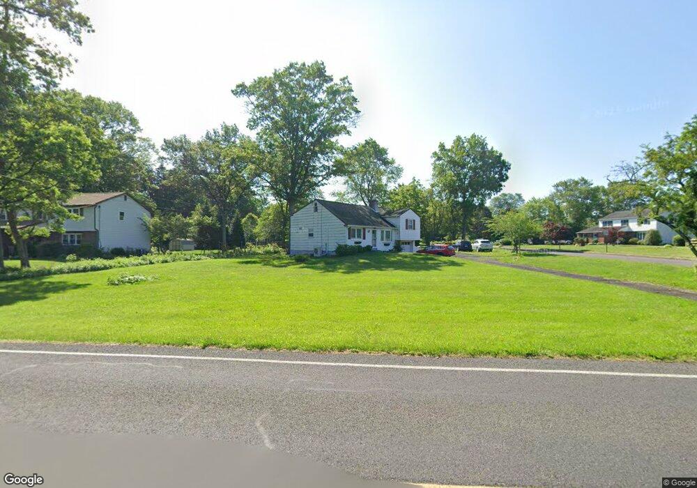
105 W Sandy Ridge Rd Doylestown, PA 18901
Estimated Value: $446,000 - $507,336
4
Beds
2
Baths
1,162
Sq Ft
$413/Sq Ft
Est. Value
About This Home
This home is located at 105 W Sandy Ridge Rd, Doylestown, PA 18901 and is currently estimated at $480,084, approximately $413 per square foot. 105 W Sandy Ridge Rd is a home located in Bucks County with nearby schools including Doyle El School, Lenape Middle School, and Central Bucks High School-West.
Ownership History
Date
Name
Owned For
Owner Type
Purchase Details
Closed on
Oct 16, 2007
Sold by
Wells Fargo Bank Na
Bought by
Gerrity Michael
Current Estimated Value
Home Financials for this Owner
Home Financials are based on the most recent Mortgage that was taken out on this home.
Original Mortgage
$237,405
Interest Rate
6.3%
Mortgage Type
Purchase Money Mortgage
Purchase Details
Closed on
Jul 30, 2007
Sold by
Perrine Richard L and Perrine Nancy A
Bought by
Wells Fargo Bank Na
Purchase Details
Closed on
Jul 1, 1987
Sold by
Lutz Franklin C
Bought by
Perrine Richard L and Perrine Nancy A
Home Financials for this Owner
Home Financials are based on the most recent Mortgage that was taken out on this home.
Original Mortgage
$121,000
Interest Rate
8.51%
Create a Home Valuation Report for This Property
The Home Valuation Report is an in-depth analysis detailing your home's value as well as a comparison with similar homes in the area
Home Values in the Area
Average Home Value in this Area
Purchase History
| Date | Buyer | Sale Price | Title Company |
|---|---|---|---|
| Gerrity Michael | $249,900 | None Available | |
| Wells Fargo Bank Na | $1,413 | None Available | |
| Perrine Richard L | $122,000 | -- |
Source: Public Records
Mortgage History
| Date | Status | Borrower | Loan Amount |
|---|---|---|---|
| Previous Owner | Gerrity Michael | $237,405 | |
| Previous Owner | Perrine Richard L | $121,000 |
Source: Public Records
Tax History Compared to Growth
Tax History
| Year | Tax Paid | Tax Assessment Tax Assessment Total Assessment is a certain percentage of the fair market value that is determined by local assessors to be the total taxable value of land and additions on the property. | Land | Improvement |
|---|---|---|---|---|
| 2025 | $5,235 | $26,000 | $8,400 | $17,600 |
| 2024 | $5,235 | $26,000 | $8,400 | $17,600 |
| 2023 | $4,871 | $26,000 | $8,400 | $17,600 |
| 2022 | $4,765 | $26,000 | $8,400 | $17,600 |
| 2021 | $4,678 | $26,000 | $8,400 | $17,600 |
| 2020 | $4,678 | $26,000 | $8,400 | $17,600 |
| 2019 | $4,574 | $26,000 | $8,400 | $17,600 |
| 2018 | $4,574 | $26,000 | $8,400 | $17,600 |
| 2017 | $4,542 | $26,000 | $8,400 | $17,600 |
| 2016 | $4,542 | $26,000 | $8,400 | $17,600 |
| 2015 | -- | $26,000 | $8,400 | $17,600 |
| 2014 | -- | $26,000 | $8,400 | $17,600 |
Source: Public Records
Map
Nearby Homes
- 60 Cedar Dr
- 179 Almshouse Rd
- 2 W Butler Ave
- 200 N Shady Retreat Rd
- 84 Iron Hill Rd
- 218 Keeley Ave
- 250 Wooded Dr
- 158 W Butler Ave
- 218 Vaux Dr
- 121 Conestoga Dr
- 197 Spring Ln
- 432 Ford Hook Rd
- 422 Fordhook Rd
- 450 Ford Hook Rd
- 157 Pine Run Rd
- 4 Old Colonial Dr Unit 254
- 13 Cedar Crest Ct
- 114 Progress Dr
- 1 Gatehouse Ln
- 8 Elizabeth Ln
- 117 W Sandy Ridge Rd
- 37 Maple Ln
- 100 Ridgeview Ln
- 129 W Sandy Ridge Rd
- 26 Maple Ln
- 25 Maple Ct
- 35 Maple Ct
- 102 Ridgeview Ln
- 73 W Sandy Ridge Rd
- 47 Maple Ln
- 139 W Sandy Ridge Rd
- 139 W Sandy Ridge Rd
- 101 Ridgeview Ln
- 14 Maple Ct
- 33 Maple Ct
- 34 Maple Ln
- 57 Maple Ln
- 27 Maple Ct
- 149 W Sandy Ridge Rd
- 67 Maple Ln