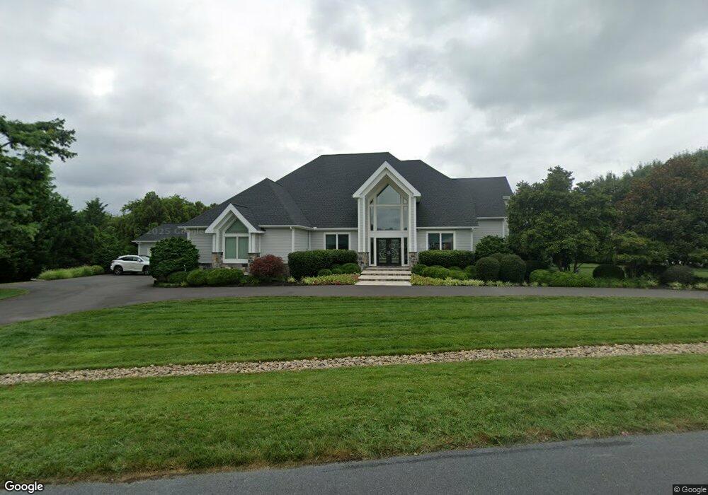
105 Windward Ct Stevensville, MD 21666
Estimated Value: $2,570,691 - $2,922,000
--
Bed
5
Baths
6,112
Sq Ft
$440/Sq Ft
Est. Value
About This Home
This home is located at 105 Windward Ct, Stevensville, MD 21666 and is currently estimated at $2,688,564, approximately $439 per square foot. 105 Windward Ct is a home located in Queen Anne's County with nearby schools including Matapeake Elementary School, Matapeake Middle School, and Kent Island High School.
Ownership History
Date
Name
Owned For
Owner Type
Purchase Details
Closed on
Feb 25, 2008
Sold by
Callahan Daniel J
Bought by
Shields Daniel R and Shields Joy O
Current Estimated Value
Purchase Details
Closed on
Feb 21, 2008
Sold by
Callahan Daniel J
Bought by
Shields Daniel R and Shields Joy O
Purchase Details
Closed on
Jul 10, 1995
Sold by
Rafferty Kevin
Bought by
Nelson David B
Purchase Details
Closed on
Oct 28, 1994
Sold by
Callahan Daniel J
Bought by
Callahan Daniel J
Purchase Details
Closed on
Dec 15, 1983
Sold by
Kettler Brothers, Inc
Bought by
Callahan Daniel J and Callahan Colleen M
Create a Home Valuation Report for This Property
The Home Valuation Report is an in-depth analysis detailing your home's value as well as a comparison with similar homes in the area
Home Values in the Area
Average Home Value in this Area
Purchase History
| Date | Buyer | Sale Price | Title Company |
|---|---|---|---|
| Shields Daniel R | $362,000 | -- | |
| Shields Daniel R | $362,000 | -- | |
| Nelson David B | $82,800 | -- | |
| Callahan Daniel J | -- | -- | |
| Callahan Daniel J | $35,000 | -- |
Source: Public Records
Tax History Compared to Growth
Tax History
| Year | Tax Paid | Tax Assessment Tax Assessment Total Assessment is a certain percentage of the fair market value that is determined by local assessors to be the total taxable value of land and additions on the property. | Land | Improvement |
|---|---|---|---|---|
| 2025 | $13,468 | $1,554,733 | $0 | $0 |
| 2024 | $12,754 | $1,415,467 | $0 | $0 |
| 2023 | $12,022 | $1,276,200 | $450,000 | $826,200 |
| 2022 | $12,082 | $1,276,200 | $450,000 | $826,200 |
| 2021 | $11,732 | $1,276,200 | $450,000 | $826,200 |
| 2020 | $11,732 | $1,284,700 | $480,000 | $804,700 |
| 2019 | $11,154 | $1,204,300 | $0 | $0 |
| 2018 | $10,600 | $1,123,900 | $0 | $0 |
| 2017 | $10,068 | $1,043,500 | $0 | $0 |
| 2016 | -- | $1,031,300 | $0 | $0 |
| 2015 | $5,148 | $1,019,100 | $0 | $0 |
| 2014 | $5,148 | $1,006,900 | $0 | $0 |
Source: Public Records
Map
Nearby Homes
- 102 Golf Ct
- 224 Long Point Rd
- 0 Ackerman Dr
- 214 Pennick Dr
- 213 Pennick Dr
- 210 Pennick Dr
- Lot 8 Ackerman Dr
- 208 Long Point Rd
- 203 Olive Branch Rd
- 200 Mallard Cove Ln
- 123 Long Point Rd
- 312 S Lake Dr
- 9401 Romancoke Rd
- Lot 1 - E/Kent Point Romancoke
- 114 N Lake Dr
- 145 N Lake Dr
- 208 Tower Dr
- 8905 Romancoke Rd
- 118 N Lake Dr
- 201 Beachside Dr
- 107 Windward Ct
- 104 Teal Ct
- 103 Windward Ct
- 104 Windward Ct
- 102 Windward Ct
- 105 Teal Ct
- 102 Teal Ct
- 106 Windward Ct
- 103 Teal Ct
- 101 Windward Ct
- 100 Windward Ct
- 100 Cove Creek Rd
- 714 Penny Dr
- 101 Teal Ct
- 712 Penny Dr
- 202 Cove Creek Rd
- 100 Gray Fox Ct
- 102 Cove Creek Ct
- 101 Some Other Place
- 201 Cove Creek Rd