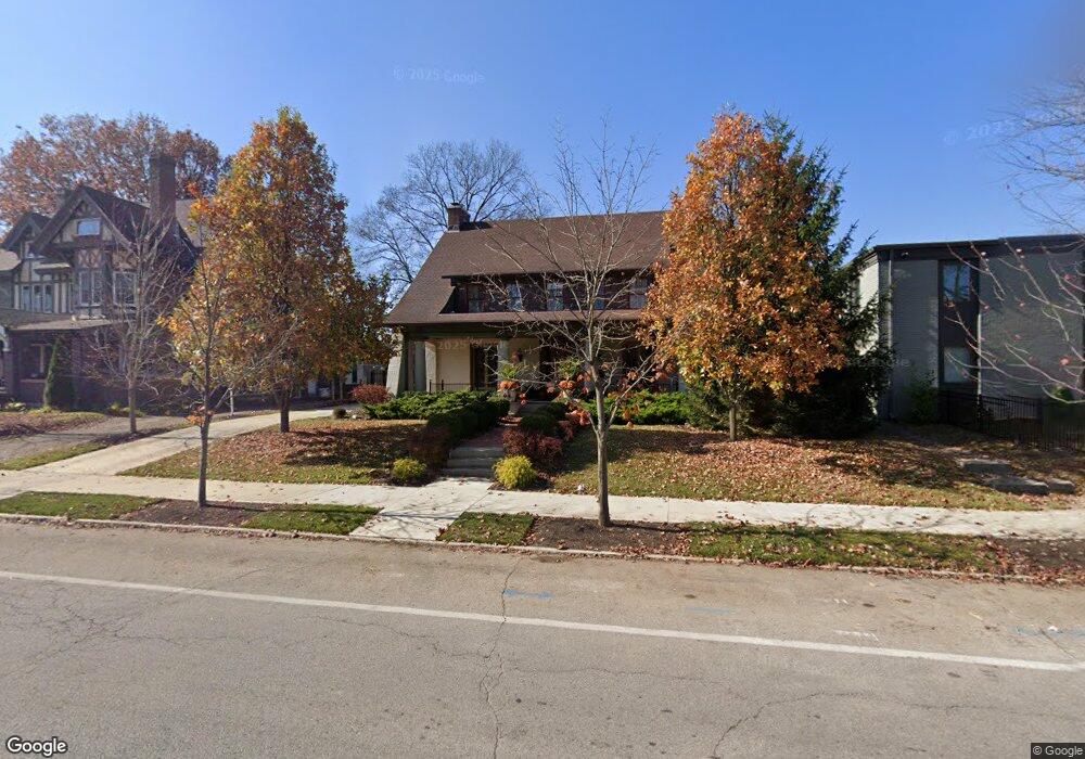
105 Woodland Ave Columbus, OH 43203
Woodland Park NeighborhoodEstimated Value: $410,000 - $629,000
4
Beds
3
Baths
2,962
Sq Ft
$188/Sq Ft
Est. Value
About This Home
This home is located at 105 Woodland Ave, Columbus, OH 43203 and is currently estimated at $555,568, approximately $187 per square foot. 105 Woodland Ave is a home located in Franklin County with nearby schools including Eastgate Elementary School, Champion Middle School, and East High School.
Ownership History
Date
Name
Owned For
Owner Type
Purchase Details
Closed on
Dec 19, 2019
Sold by
Maly Michael S and Maly Gregory E
Bought by
Maly Michael S and Maly Gregory E
Current Estimated Value
Purchase Details
Closed on
Nov 30, 2012
Sold by
Espinoza Gregory
Bought by
Maly Michael S
Home Financials for this Owner
Home Financials are based on the most recent Mortgage that was taken out on this home.
Original Mortgage
$173,805
Interest Rate
3.31%
Mortgage Type
New Conventional
Purchase Details
Closed on
Nov 8, 2007
Sold by
Maly Michael S
Bought by
Maly Michael S and Espinoza Gregory
Purchase Details
Closed on
Jun 21, 2004
Sold by
Link Michael D and Link Joyce B
Bought by
Maly Michael S
Purchase Details
Closed on
Aug 29, 1991
Bought by
Link Michael D and Link Joyce B
Purchase Details
Closed on
Dec 1, 1984
Create a Home Valuation Report for This Property
The Home Valuation Report is an in-depth analysis detailing your home's value as well as a comparison with similar homes in the area
Home Values in the Area
Average Home Value in this Area
Purchase History
| Date | Buyer | Sale Price | Title Company |
|---|---|---|---|
| Maly Michael S | -- | None Available | |
| Maly Michael S | $103,600 | None Available | |
| Maly Michael S | $133,800 | Amerititle | |
| Maly Michael S | $262,500 | Amerititle | |
| Link Michael D | $90,000 | -- | |
| -- | $60,400 | -- |
Source: Public Records
Mortgage History
| Date | Status | Borrower | Loan Amount |
|---|---|---|---|
| Previous Owner | Maly Michael S | $173,805 |
Source: Public Records
Tax History Compared to Growth
Tax History
| Year | Tax Paid | Tax Assessment Tax Assessment Total Assessment is a certain percentage of the fair market value that is determined by local assessors to be the total taxable value of land and additions on the property. | Land | Improvement |
|---|---|---|---|---|
| 2024 | $7,818 | $174,200 | $35,490 | $138,710 |
| 2023 | $7,718 | $174,195 | $35,490 | $138,705 |
| 2022 | $4,266 | $82,260 | $3,960 | $78,300 |
| 2021 | $4,274 | $82,260 | $3,960 | $78,300 |
| 2020 | $4,280 | $82,260 | $3,960 | $78,300 |
| 2019 | $4,003 | $65,980 | $3,150 | $62,830 |
| 2018 | $4,287 | $65,980 | $3,150 | $62,830 |
| 2017 | $4,523 | $65,980 | $3,150 | $62,830 |
| 2016 | $5,046 | $76,160 | $6,440 | $69,720 |
| 2015 | $4,581 | $76,160 | $6,440 | $69,720 |
| 2014 | $4,592 | $76,160 | $6,440 | $69,720 |
| 2013 | $2,157 | $72,520 | $6,125 | $66,395 |
Source: Public Records
Map
Nearby Homes
- 54 Woodland Ave
- 34 Woodland Ave
- 1593 Clifton Ave
- 1622 Clifton Ave
- 1620 E Broad St Unit 1108
- 220 Parkwood Ave Unit 222
- 1517 Hawthorne Ave
- 1562 Richmond Ave
- 1575 Granville St
- 280 Taylor Ave
- 90-92 Burt St Unit 90
- 39 Auburn Ave
- 1634-1636 Greenway Ave
- 334 Woodland Ave
- 330 Taylor Ave
- 1418 Phale D Hale Dr
- 1483 Mount Vernon Ave
- 290 Graham St
- 1880 Greenway Ave S
- 1872 Greenway Ave S
- 115 Woodland Ave
- 93 Woodland Ave
- 1617 Hawthorne Park
- 81 Woodland Ave
- 591 Woodland Ave
- O Woodland Ave
- 1601 Hawthorne Park
- 71 Woodland Ave
- 1600 E Long St
- 1616 Hawthorne Park
- 1591 Hawthorne Park
- 55 Woodland Ave
- 1610 Hawthorne Park
- 1582 E Long St
- 1581 Hawthorne Park
- 20 Woodland Ave
- 1578 E Long St
- 1607 E Long St
- 45 Woodland Ave
- 1592 Hawthorne Park