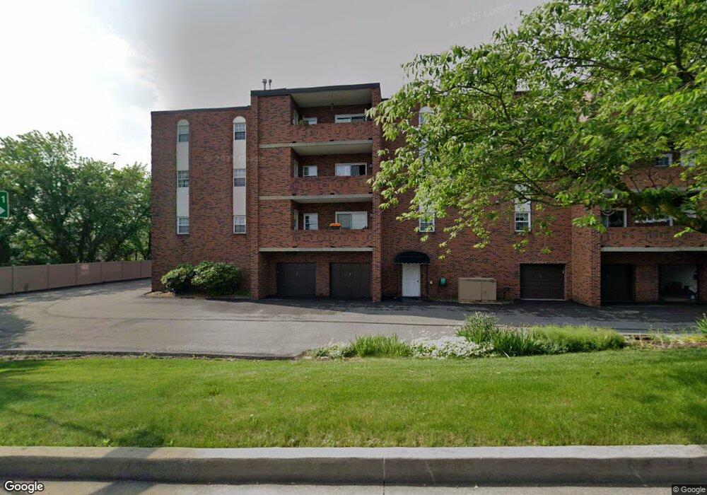
105 Woodstone Ln Unit 72 New Kensington, PA 15068
Estimated Value: $131,000 - $244,468
--
Bed
--
Bath
--
Sq Ft
1,699
Sq Ft Lot
About This Home
This home is located at 105 Woodstone Ln Unit 72, New Kensington, PA 15068 and is currently estimated at $166,867. 105 Woodstone Ln Unit 72 is a home located in Westmoreland County with nearby schools including Mary Queen of Apostles School.
Ownership History
Date
Name
Owned For
Owner Type
Purchase Details
Closed on
Oct 29, 2013
Sold by
Carnahan Robert Earl
Bought by
Mcvay Darcy L
Current Estimated Value
Home Financials for this Owner
Home Financials are based on the most recent Mortgage that was taken out on this home.
Original Mortgage
$50,000
Outstanding Balance
$13,344
Interest Rate
4.24%
Mortgage Type
New Conventional
Estimated Equity
$153,523
Purchase Details
Closed on
Dec 29, 2011
Sold by
Carnahan Robert Earl
Bought by
Carnahan Robert Earl
Create a Home Valuation Report for This Property
The Home Valuation Report is an in-depth analysis detailing your home's value as well as a comparison with similar homes in the area
Home Values in the Area
Average Home Value in this Area
Purchase History
| Date | Buyer | Sale Price | Title Company |
|---|---|---|---|
| Mcvay Darcy L | $125,000 | None Available | |
| Carnahan Robert Earl | -- | None Available |
Source: Public Records
Mortgage History
| Date | Status | Borrower | Loan Amount |
|---|---|---|---|
| Open | Mcvay Darcy L | $50,000 |
Source: Public Records
Tax History Compared to Growth
Tax History
| Year | Tax Paid | Tax Assessment Tax Assessment Total Assessment is a certain percentage of the fair market value that is determined by local assessors to be the total taxable value of land and additions on the property. | Land | Improvement |
|---|---|---|---|---|
| 2025 | $3,273 | $20,500 | $940 | $19,560 |
| 2024 | $3,242 | $20,500 | $940 | $19,560 |
| 2023 | $3,068 | $20,500 | $940 | $19,560 |
| 2022 | $2,974 | $20,500 | $940 | $19,560 |
| 2021 | $2,907 | $20,500 | $940 | $19,560 |
| 2020 | $2,845 | $20,500 | $940 | $19,560 |
| 2019 | $2,773 | $20,500 | $940 | $19,560 |
| 2018 | $2,732 | $20,500 | $940 | $19,560 |
| 2017 | $2,691 | $20,500 | $940 | $19,560 |
| 2016 | $2,691 | $20,500 | $940 | $19,560 |
| 2015 | $2,691 | $20,500 | $940 | $19,560 |
| 2014 | $2,586 | $20,500 | $940 | $19,560 |
Source: Public Records
Map
Nearby Homes
- 103 Woodstone Ln Unit 34
- 715 Carl Ave
- 408 Craigdell Rd
- 2108 Hollingsworth St
- 148 Liberty Ave
- 2538 Richdale Dr
- 337 Fernledge Dr
- 1407 Drey St Unit 29
- 2516 Kentucky Ct
- 438 Esther Ave
- 436 Esther Ave
- 181 Edward St
- 1802 Kimball Ave
- 344 Iroquois Dr
- 1741 Freeport Rd Unit U
- 1809 Kimball Ave
- 220 Falcon Ridge Dr
- 233 Reed St
- 1719 Freeport Rd
- 1735 Kimball Ave
- 105 Woodstone Ln Unit 85
- 105 Woodstone Ln Unit 74
- 105 Woodstone Ln
- 105 Woodstone Ln Unit 64
- 105 Woodstone Ln Unit 83
- 105 Woodstone Ln Unit 82
- 105 Woodstone Ln Unit 81
- 105 Woodstone Ln Unit 84
- 105 Woodstone Ln Unit 73
- 105 Woodstone Ln Unit 71
- 105 Woodstone Ln Unit 65
- 105 Woodstone Ln Unit 64
- 105 Woodstone Ln Unit 63
- 105 Woodstone Ln Unit 62
- 162 Woodstone Ln
- 164 Woodstone Ln
- 166 Woodstone Ln Unit 166
- 148 Woodstone Ln
- 168 Woodstone Ln
- 103 Woodstone Ln Unit 57