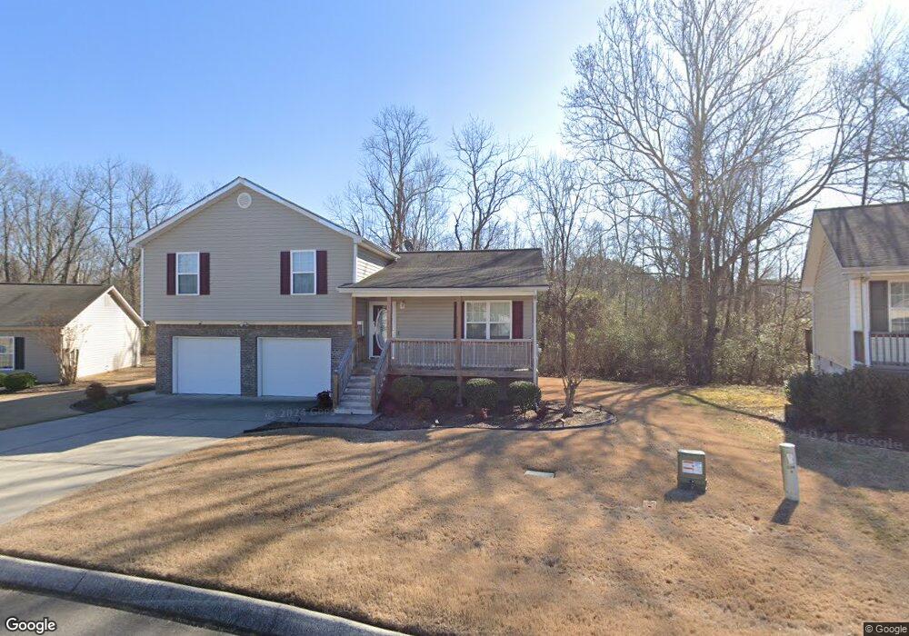
1050 Brookstone Cir Dalton, GA 30721
Estimated Value: $231,046 - $268,000
3
Beds
2
Baths
1,279
Sq Ft
$198/Sq Ft
Est. Value
About This Home
This home is located at 1050 Brookstone Cir, Dalton, GA 30721 and is currently estimated at $252,762, approximately $197 per square foot. 1050 Brookstone Cir is a home located in Whitfield County with nearby schools including Valley Point Elementary School, Valley Point Middle School, and Southeast Whitfield County High School.
Ownership History
Date
Name
Owned For
Owner Type
Purchase Details
Closed on
Nov 14, 2007
Sold by
Not Provided
Bought by
Waters Damond L
Current Estimated Value
Home Financials for this Owner
Home Financials are based on the most recent Mortgage that was taken out on this home.
Original Mortgage
$132,000
Outstanding Balance
$81,899
Interest Rate
6.36%
Mortgage Type
New Conventional
Estimated Equity
$170,863
Purchase Details
Closed on
Apr 10, 2007
Sold by
Not Provided
Bought by
Waters Damond L
Create a Home Valuation Report for This Property
The Home Valuation Report is an in-depth analysis detailing your home's value as well as a comparison with similar homes in the area
Purchase History
| Date | Buyer | Sale Price | Title Company |
|---|---|---|---|
| Waters Damond L | $132,000 | -- | |
| Waters Damond L | $30,000 | -- |
Source: Public Records
Mortgage History
| Date | Status | Borrower | Loan Amount |
|---|---|---|---|
| Open | Waters Damond L | $132,000 |
Source: Public Records
Tax History
| Year | Tax Paid | Tax Assessment Tax Assessment Total Assessment is a certain percentage of the fair market value that is determined by local assessors to be the total taxable value of land and additions on the property. | Land | Improvement |
|---|---|---|---|---|
| 2025 | $1,696 | $81,753 | $11,600 | $70,153 |
| 2024 | $1,696 | $81,753 | $11,600 | $70,153 |
| 2023 | $1,637 | $61,642 | $11,000 | $50,642 |
| 2022 | $1,287 | $52,177 | $11,000 | $41,177 |
| 2021 | $1,287 | $52,177 | $11,000 | $41,177 |
| 2020 | $1,319 | $52,177 | $11,000 | $41,177 |
| 2019 | $1,335 | $52,177 | $11,000 | $41,177 |
| 2018 | $1,203 | $47,477 | $6,800 | $40,677 |
| 2017 | $1,204 | $47,477 | $6,800 | $40,677 |
| 2016 | $1,059 | $43,796 | $6,800 | $36,996 |
| 2014 | $980 | $43,796 | $6,800 | $36,996 |
| 2013 | -- | $43,796 | $6,800 | $36,996 |
Source: Public Records
Map
Nearby Homes
- 586 Collington Cir
- 321 Collington Cir
- 282 Collington Cir
- 162 Valley Point Dr SE
- 147 Toria Trace
- 3737 S Dixie Hwy
- 3950 S Dixie Rd
- 3950 S Dixie Hwy
- 0 Waterfront Way
- 139 Waterfront Way
- 169 Waterfront Way
- 112 Robin Hood Dr
- 116 Robin Hood Dr
- 122 Robin Hood Dr Unit A,B
- 122 Robin Hood Dr
- 124 Robin Hood Dr
- 0 Old Dixie Hwy
- 000 S Dixie Hwy
- 171 Maurine Dr
- 243 Gaz Rd SE
- 1060 Brookstone Cir
- 1040 Brookstone Cir
- 1070 Brookstone Cir
- 1045 Brookstone Cir
- 1065 Brookstone Cir
- 1075 Brookstone Cir
- 1295 Brookstone Cir
- 1020 Brookstone Cir
- 1285 Brookstone Cir
- 676 Collington Cir
- 634 Collington Cir
- 1090 Brookstone Cir
- 1085 Brookstone Cir
- 616 Collington Cir
- 1275 Brookstone Cir
- 602 Collington Cir
- 688 Collington Cir
- 1265 Brookstone Cir
- 1100 Brookstone Cir
- 1095 Brookstone Cir
Your Personal Tour Guide
Ask me questions while you tour the home.