Estimated Value: $50,000 - $133,000
--
Bed
1
Bath
870
Sq Ft
$86/Sq Ft
Est. Value
About This Home
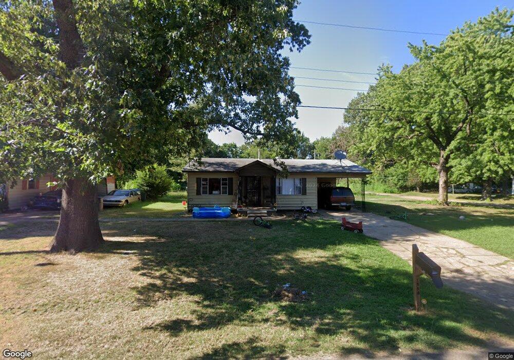
This home is located at 1050 Forrest Ave W, Wynne, AR 72396 and is currently estimated at $74,638, approximately $85 per square foot. 1050 Forrest Ave W is a home located in Cross County with nearby schools including Wynne Primary School, Wynne Intermediate School, and Wynne Junior High School.
Ownership History
Date
Name
Owned For
Owner Type
Purchase Details
Closed on
Sep 7, 2023
Sold by
Clayton Chris and Stegall Hartensia
Bought by
Clayton44 Enterprise Llc
Current Estimated Value
Purchase Details
Closed on
Mar 6, 2023
Sold by
Commissioner Of State Lands
Bought by
Martisha Inc
Purchase Details
Closed on
Mar 3, 2023
Sold by
Martisha Inc
Bought by
Stegall Hartensia
Purchase Details
Closed on
Nov 14, 2011
Sold by
Davis Karen and Davis Jimmy
Bought by
Martisha Inc
Home Financials for this Owner
Home Financials are based on the most recent Mortgage that was taken out on this home.
Original Mortgage
$7,500
Interest Rate
4.08%
Purchase Details
Closed on
Feb 23, 1991
Bought by
Johnson Larry L
Purchase Details
Closed on
Jun 20, 1990
Bought by
Gates Robert A
Create a Home Valuation Report for This Property
The Home Valuation Report is an in-depth analysis detailing your home's value as well as a comparison with similar homes in the area
Home Values in the Area
Average Home Value in this Area
Purchase History
| Date | Buyer | Sale Price | Title Company |
|---|---|---|---|
| Clayton44 Enterprise Llc | -- | None Listed On Document | |
| Martisha Inc | $1,013 | -- | |
| Stegall Hartensia | $23,500 | None Listed On Document | |
| Martisha Inc | $15,000 | None Available | |
| Johnson Larry L | $16,000 | -- | |
| Gates Robert A | -- | -- |
Source: Public Records
Mortgage History
| Date | Status | Borrower | Loan Amount |
|---|---|---|---|
| Previous Owner | Martisha Inc | $7,500 |
Source: Public Records
Tax History Compared to Growth
Tax History
| Year | Tax Paid | Tax Assessment Tax Assessment Total Assessment is a certain percentage of the fair market value that is determined by local assessors to be the total taxable value of land and additions on the property. | Land | Improvement |
|---|---|---|---|---|
| 2024 | $275 | $5,570 | $1,140 | $4,430 |
| 2023 | $276 | $5,570 | $1,140 | $4,430 |
| 2022 | $276 | $5,570 | $1,140 | $4,430 |
| 2021 | $276 | $5,570 | $1,140 | $4,430 |
| 2020 | $261 | $5,570 | $1,140 | $4,430 |
| 2019 | $237 | $4,790 | $1,090 | $3,700 |
| 2018 | $237 | $4,790 | $1,090 | $3,700 |
| 2017 | $237 | $4,790 | $1,090 | $3,700 |
| 2016 | $237 | $4,790 | $1,090 | $3,700 |
| 2015 | $237 | $4,790 | $1,090 | $3,700 |
| 2014 | $237 | $5,590 | $990 | $4,600 |
Source: Public Records
Map
Nearby Homes
- 813 Childress Dr
- 0 Cr 760
- 0 Brittney Cir Unit 43670
- 0 Brittney Cir Unit 25030957
- 1002 Brittney Cir
- 624 C St
- 136 Matthew Addition Cove
- 714 Church St N
- 513 Forrest Ave E
- 514 Poplar Ave E
- 1910 Union Ave W
- 704 Front St S
- 607 Bruce St N
- 411 N Bruce St
- 810 Forrest Ave E
- 1783 Hart
- 908 Block St S
- 106 Eldridge Ct
- 903 Levesque Ave E
- 919 Hamilton Ave E
- 1017 Forrest Ave W
- 1052 Forrest Ave W
- 1053 Forrest Ave W
- 1054 Forrest Ave W
- 1015 Forrest Ave W
- 1014 Forrest Ave W
- 1056 Forrest Ave W
- 641 N St
- 1055 Forrest Ave W
- 1013 Forrest Ave W
- 1010 Forrest Ave W
- 1057 Forrest Ave W
- 101 M St
- 631 N St
- 1058 Poplar Ave W
- 1011 Forrest Ave W
- 1062 Forrest Ave W
- 1062 Forrest Ave W
- 1064 Forrest Ave W
- 1020 Poplar Ave W