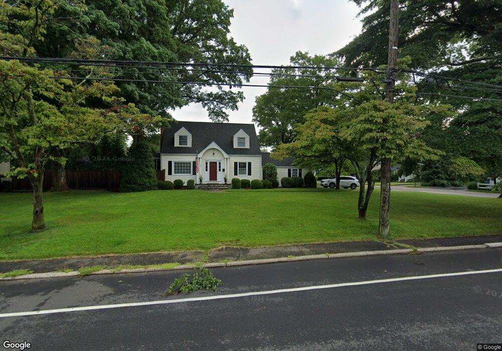
1050 High St Fairfield, CT 06824
University NeighborhoodEstimated Value: $715,000 - $818,000
3
Beds
2
Baths
1,488
Sq Ft
$519/Sq Ft
Est. Value
About This Home
This home is located at 1050 High St, Fairfield, CT 06824 and is currently estimated at $772,675, approximately $519 per square foot. 1050 High St is a home located in Fairfield County with nearby schools including Holland Hill Elementary, Fairfield Woods Middle School, and Fairfield Ludlowe High School.
Ownership History
Date
Name
Owned For
Owner Type
Purchase Details
Closed on
Jan 20, 2017
Sold by
Bambach Christopher P
Bought by
Bambach Christopher P and Bambach Jennifer
Current Estimated Value
Purchase Details
Closed on
Jul 14, 2008
Sold by
Forget Erin C and Cutney Ellen M
Bought by
Bambach Christopher P
Purchase Details
Closed on
Feb 18, 2000
Sold by
Est Dardini Elizabeth and Gasper Marjorie
Bought by
Forget Michael M and Forget Erin C
Create a Home Valuation Report for This Property
The Home Valuation Report is an in-depth analysis detailing your home's value as well as a comparison with similar homes in the area
Home Values in the Area
Average Home Value in this Area
Purchase History
| Date | Buyer | Sale Price | Title Company |
|---|---|---|---|
| Bambach Christopher P | -- | -- | |
| Bambach Christopher P | -- | -- | |
| Bambach Christopher P | $540,000 | -- | |
| Bambach Christopher P | $540,000 | -- | |
| Forget Michael M | $305,000 | -- | |
| Forget Michael M | $305,000 | -- |
Source: Public Records
Mortgage History
| Date | Status | Borrower | Loan Amount |
|---|---|---|---|
| Previous Owner | Forget Michael M | $395,000 | |
| Previous Owner | Forget Michael M | $407,000 |
Source: Public Records
Tax History
| Year | Tax Paid | Tax Assessment Tax Assessment Total Assessment is a certain percentage of the fair market value that is determined by local assessors to be the total taxable value of land and additions on the property. | Land | Improvement |
|---|---|---|---|---|
| 2025 | $9,704 | $341,810 | $234,850 | $106,960 |
| 2024 | $9,536 | $341,810 | $234,850 | $106,960 |
| 2023 | $9,403 | $341,810 | $234,850 | $106,960 |
| 2022 | $9,311 | $341,810 | $234,850 | $106,960 |
| 2021 | $9,222 | $341,810 | $234,850 | $106,960 |
| 2020 | $7,955 | $296,940 | $192,920 | $104,020 |
| 2019 | $7,955 | $296,940 | $192,920 | $104,020 |
| 2018 | $7,827 | $296,940 | $192,920 | $104,020 |
| 2017 | $7,667 | $296,940 | $192,920 | $104,020 |
| 2016 | $7,557 | $296,940 | $192,920 | $104,020 |
| 2015 | $7,384 | $297,850 | $213,780 | $84,070 |
| 2014 | $7,268 | $297,850 | $213,780 | $84,070 |
Source: Public Records
Map
Nearby Homes
- 41 Pepperbush Ln
- 28 Country Rd
- 12 Sugar Plum Ln
- 21 Boroskey Rd
- 245 Reid St
- 109 Katona Dr Unit 18
- 108 Roseville St
- 288 Melody Ln
- 214 York Rd
- 115 Mayfair Rd
- 359 Reid St
- 196 Robin Ln
- 42 Robin Cir
- 706 Judd St
- 12 Reynolds Dr
- 68 Figlar Ave
- 378 High St
- 240 Sunnyridge Ave Unit 63
- 164 Farist Rd
- 183 Vesper St
- 12B Oakwood Dr
- 12A Oakwood Dr
- 12 Oakwood Dr
- 26 Oakwood Dr
- 1070 High St
- 40 Oakwood Dr
- 1055 High St
- 1027 High St
- 60 Oakwood Dr Unit 2
- 60 Oakwood Dr Unit 60
- 1018 High St
- 58 Oakwood Dr Unit 1
- 58 Oakwood Dr Unit 2
- 5 Woodcrest Rd
- 33 Oakwood Dr
- 31 Woodcrest Rd
- 1073 High St
- 41 Oakwood Dr
- 1004 High St
- 64 Oakwood Dr
Your Personal Tour Guide
Ask me questions while you tour the home.