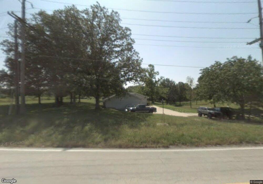
1050 Highway D Foristell, MO 63348
Estimated Value: $396,000 - $496,000
3
Beds
2
Baths
1,713
Sq Ft
$258/Sq Ft
Est. Value
About This Home
This home is located at 1050 Highway D, Foristell, MO 63348 and is currently estimated at $442,754, approximately $258 per square foot. 1050 Highway D is a home located in St. Charles County with nearby schools including Daniel Boone Elementary School, Francis Howell Middle School, and Francis Howell Union High School.
Ownership History
Date
Name
Owned For
Owner Type
Purchase Details
Closed on
Apr 15, 2008
Sold by
Pawelek Robert A and Pawelek Heather M
Bought by
Pawelek Robert A and Pawelek Heather M
Current Estimated Value
Home Financials for this Owner
Home Financials are based on the most recent Mortgage that was taken out on this home.
Original Mortgage
$212,000
Interest Rate
5.86%
Mortgage Type
New Conventional
Purchase Details
Closed on
Jan 25, 2006
Sold by
Pawelek Robert A
Bought by
Pawelek Robert A
Home Financials for this Owner
Home Financials are based on the most recent Mortgage that was taken out on this home.
Original Mortgage
$30,000
Interest Rate
6.21%
Mortgage Type
New Conventional
Purchase Details
Closed on
Jul 10, 2001
Sold by
Pawelek Stephanie J and Buchholz Stephanie J
Bought by
Pawelek Robert A
Create a Home Valuation Report for This Property
The Home Valuation Report is an in-depth analysis detailing your home's value as well as a comparison with similar homes in the area
Home Values in the Area
Average Home Value in this Area
Purchase History
| Date | Buyer | Sale Price | Title Company |
|---|---|---|---|
| Pawelek Robert A | -- | Titleamerica Inc | |
| Pawelek Robert A | -- | None Available | |
| Pawelek Robert A | -- | -- |
Source: Public Records
Mortgage History
| Date | Status | Borrower | Loan Amount |
|---|---|---|---|
| Closed | Pawelek Robert A | $212,000 | |
| Closed | Pawelek Robert A | $30,000 |
Source: Public Records
Tax History Compared to Growth
Tax History
| Year | Tax Paid | Tax Assessment Tax Assessment Total Assessment is a certain percentage of the fair market value that is determined by local assessors to be the total taxable value of land and additions on the property. | Land | Improvement |
|---|---|---|---|---|
| 2025 | $3,661 | $61,210 | -- | -- |
| 2023 | $3,493 | $59,358 | $0 | $0 |
| 2022 | $2,966 | $46,861 | $0 | $0 |
| 2021 | $2,969 | $46,861 | $0 | $0 |
| 2020 | $2,809 | $43,537 | $0 | $0 |
| 2019 | $2,796 | $43,537 | $0 | $0 |
| 2018 | $2,171 | $41,425 | $0 | $0 |
| 2017 | $2,722 | $41,425 | $0 | $0 |
| 2016 | $2,740 | $40,216 | $0 | $0 |
| 2015 | $2,739 | $40,216 | $0 | $0 |
| 2014 | $2,699 | $38,330 | $0 | $0 |
Source: Public Records
Map
Nearby Homes
- 0 Lot 1 Holt Farms Unit MAR25007408
- Lot 25 Holt Summit Ct
- Lot 39 Holt Farm Ct
- Lot 27 Holt Farm Ct
- Lot 38 Holt Farm Ct
- Lot 36 Holt Acres Ct
- Lot 35 Holt Acres Ct
- 1639 Sneak Rd Unit Lot 8A
- 271 Westwood Trail
- 3821 Holt Rd (6 6 Acres)
- Lot 26 Holt Summit Ct
- 554 Callaway Estates Dr
- 521 Callaway Estates Dr
- 525 Callaway Estates Dr
- 404 Stones Throw Ct
- 404 & 408 Stones Throw Ct
- 1 Meadow
- 408 Stones Throw Ct
- 140 Norfork Ct
- 1 Caroline Plan @ Auden Meadow
- 0 Sneak Rd
- 10ACRES Sneak Rd
- 0 Highway D
- 1110 Sneak Rd
- 1109 Sneak Rd
- 19AC Sneak Rd
- 2727 Elm Ridge Rd
- 957 Highway D
- 1066 Highway D
- 945 W Highway D
- 1123 Sneak Rd
- 2712 Elm Ridge Rd
- 1101 Highway D
- 1120 Highway D
- 2715 Elm Ridge Rd
- 1124 Highway D
- 932 Highway D
- 931 W Highway D
- 2679 Cricket Hollow Dr
- 1128 Old Highway D