Estimated Value: $334,586 - $713,000
Studio
--
Bath
--
Sq Ft
5,750
Sq Ft Lot
About This Home
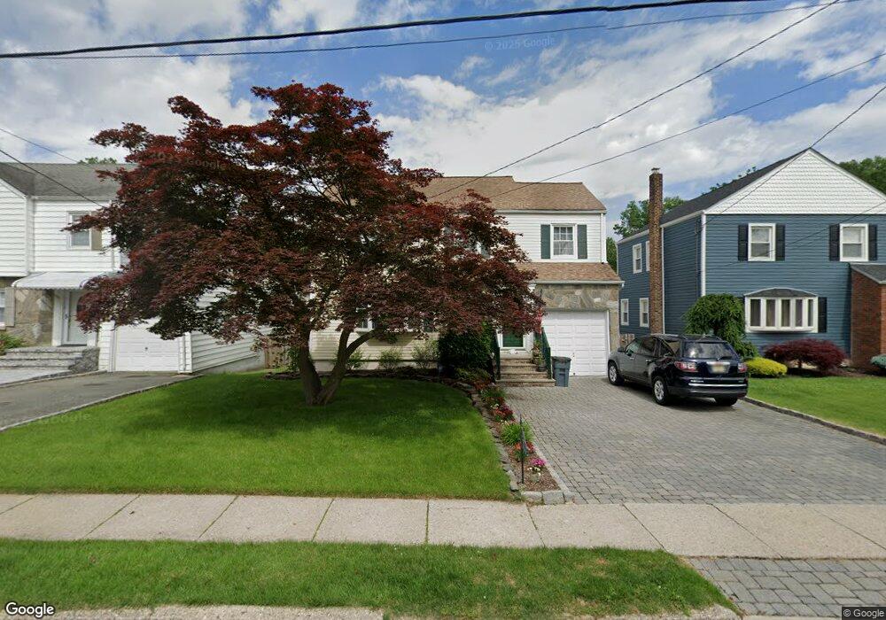
This home is located at 1050 Mayfair Rd, Union, NJ 07083 and is currently estimated at $577,147. 1050 Mayfair Rd is a home located in Union County with nearby schools including Battle Hill Elementary School, Burnet Middle School, and Union High School.
Ownership History
Date
Name
Owned For
Owner Type
Purchase Details
Closed on
Apr 6, 1998
Sold by
Robertello Roy and Robertello Rose
Bought by
Allers Edgar and Allers Milagros
Current Estimated Value
Home Financials for this Owner
Home Financials are based on the most recent Mortgage that was taken out on this home.
Original Mortgage
$148,000
Outstanding Balance
$28,119
Interest Rate
7.11%
Estimated Equity
$549,028
Create a Home Valuation Report for This Property
The Home Valuation Report is an in-depth analysis detailing your home's value as well as a comparison with similar homes in the area
Home Values in the Area
Average Home Value in this Area
Purchase History
| Date | Buyer | Sale Price | Title Company |
|---|---|---|---|
| Allers Edgar | $185,000 | -- |
Source: Public Records
Mortgage History
| Date | Status | Borrower | Loan Amount |
|---|---|---|---|
| Open | Allers Edgar | $148,000 |
Source: Public Records
Tax History
| Year | Tax Paid | Tax Assessment Tax Assessment Total Assessment is a certain percentage of the fair market value that is determined by local assessors to be the total taxable value of land and additions on the property. | Land | Improvement |
|---|---|---|---|---|
| 2025 | $11,757 | $52,600 | $21,200 | $31,400 |
| 2024 | $11,398 | $52,600 | $21,200 | $31,400 |
Source: Public Records
Map
Nearby Homes
- 1042 Battle Hill Terrace
- 2785 Larchmont Rd
- 1 Perry Place
- 960 Moessner Ave
- 67 Battle Hill Ave
- 2853 Allen Ave
- 17 Alvin Terrace
- 2766 Alice Terrace
- 2659 Hawthorne Ave
- 2620 Eleanor Terrace
- 105 Battle Hill Ave
- 2636 Frederick Terrace
- 20 Maple Ave
- 5 Bashford Ave Unit 5
- 14 Bashford Ave Unit 14
- 787 Liberty Ave
- 6 Bashford Ave Unit 6
- 750 Andover Rd
- 2705 Andrea Rd
- 933 Douglas Terrace
- 1046 Mayfair Rd
- 1054 Mayfair Rd
- 1042 Mayfair Rd
- 1060 Mayfair Rd
- 1057 Mount Vernon Rd
- 1049 Mount Vernon Rd
- 2799 Larchmont Rd
- 1061 Mount Vernon Rd
- 1062 Mayfair Rd
- 1055 Mayfair Rd
- 2797 Larchmont Rd
- 1059 Mayfair Rd
- 1065 Mount Vernon Rd
- 1061 Mayfair Rd
- 2795 Larchmont Rd
- 1069 Mount Vernon Rd
- 1065 Mayfair Rd
- 1070 Mayfair Rd
- 2802 Larchmont Rd
- 1052 Mount Vernon Rd
Your Personal Tour Guide
Ask me questions while you tour the home.