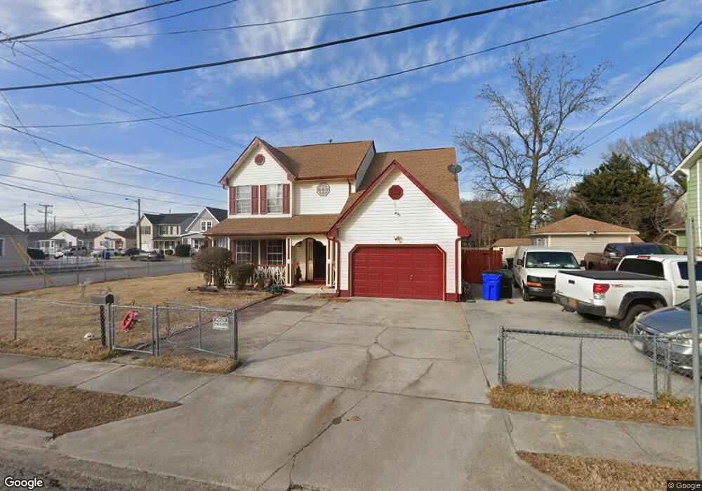
1050 Meads Rd Norfolk, VA 23505
Titustown NeighborhoodEstimated Value: $345,000 - $408,439
4
Beds
3
Baths
2,132
Sq Ft
$179/Sq Ft
Est. Value
About This Home
This home is located at 1050 Meads Rd, Norfolk, VA 23505 and is currently estimated at $381,110, approximately $178 per square foot. 1050 Meads Rd is a home located in Norfolk City with nearby schools including Camp Allen Elementary School, Blair Middle School, and Granby High School.
Ownership History
Date
Name
Owned For
Owner Type
Purchase Details
Closed on
Sep 28, 2016
Sold by
Aikens Devin Lee
Bought by
Fonseca Reina M
Current Estimated Value
Home Financials for this Owner
Home Financials are based on the most recent Mortgage that was taken out on this home.
Original Mortgage
$181,649
Interest Rate
3.25%
Mortgage Type
FHA
Purchase Details
Closed on
May 23, 2014
Sold by
Smythe Bervin K and Smythe Carolyn L
Bought by
Aikens Devin Lee
Create a Home Valuation Report for This Property
The Home Valuation Report is an in-depth analysis detailing your home's value as well as a comparison with similar homes in the area
Home Values in the Area
Average Home Value in this Area
Purchase History
| Date | Buyer | Sale Price | Title Company |
|---|---|---|---|
| Fonseca Reina M | $185,000 | Fidelity National Title Co | |
| Aikens Devin Lee | $222,500 | Landmark Title Llc |
Source: Public Records
Mortgage History
| Date | Status | Borrower | Loan Amount |
|---|---|---|---|
| Previous Owner | Fonseca Reina M | $181,649 |
Source: Public Records
Tax History Compared to Growth
Tax History
| Year | Tax Paid | Tax Assessment Tax Assessment Total Assessment is a certain percentage of the fair market value that is determined by local assessors to be the total taxable value of land and additions on the property. | Land | Improvement |
|---|---|---|---|---|
| 2025 | $5,094 | $407,500 | $120,900 | $286,600 |
| 2024 | $4,643 | $377,500 | $120,900 | $256,600 |
| 2023 | $4,314 | $345,100 | $120,900 | $224,200 |
| 2022 | $3,728 | $298,200 | $83,500 | $214,700 |
| 2021 | $3,286 | $262,900 | $69,600 | $193,300 |
| 2020 | $3,206 | $256,500 | $63,200 | $193,300 |
| 2019 | $3,021 | $241,700 | $57,200 | $184,500 |
| 2018 | $2,876 | $230,100 | $57,200 | $172,900 |
| 2017 | $2,634 | $229,000 | $53,900 | $175,100 |
| 2016 | $2,581 | $226,500 | $49,300 | $177,200 |
| 2015 | $2,585 | $226,500 | $49,300 | $177,200 |
| 2014 | $2,585 | $226,500 | $49,300 | $177,200 |
Source: Public Records
Map
Nearby Homes
- 7720 Dunfield Place Unit 3
- 7467 Dakota Ave
- 7711 Nesbitt Dr
- 7811 Nesbitt Dr
- 7738 Castleton Place
- 7803 Ruthven Rd
- 7454 Diven St
- 1048 Wilmington St
- 1505 Meads Rd Unit A-2
- 525 Birmingham Ave
- 537 Timothy Ave
- 535 Timothy Ave
- 7318 Major Ave
- 7320 Glenroie Ave Unit 2L
- 7320 Glenroie Ave Unit 2G
- 7320 Glenroie Ave Unit 4G
- 7320 Glenroie Ave Unit 7J
- 7320 Glenroie Ave Unit 9G
- 7320 Glenroie Ave Unit 4L
- 7320 Glenroie Ave Unit 10E
- 1046 Meads Rd
- 7786 Diven St
- BLK 13 Meads Rd
- 1101 Matthew Henson St
- 1047 Meads Rd
- 1020 Meads Rd
- 7790 Diven St
- 1103 Matthew Henson St
- 1051 Meads Rd
- 1053 Meads Rd
- 1100 Matthew Henson St
- 1041 Meads Rd
- 1016 Meads Rd
- 1105 Matthew Henson St
- 1102 Matthew Henson St
- 1101 Meads Rd
- 1033 Meads Rd
- 1104 Matthew Henson St
- 1107 Matthew Henson St
- 1012 Meads Rd