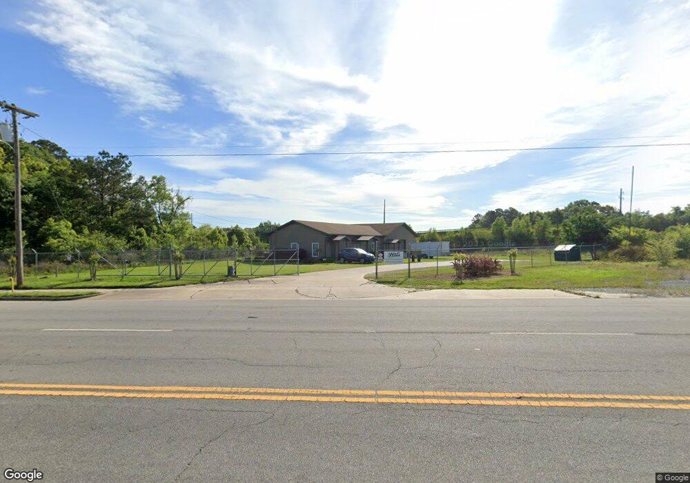
1050 N Main St Moultrie, GA 31768
Estimated Value: $308,357
--
Bed
--
Bath
1,380
Sq Ft
$223/Sq Ft
Est. Value
About This Home
This home is located at 1050 N Main St, Moultrie, GA 31768 and is currently estimated at $308,357, approximately $223 per square foot. 1050 N Main St is a home located in Colquitt County with nearby schools including Stringfellow Elementary School, C.A. Gray Junior High School, and Willie J. Williams Middle School.
Ownership History
Date
Name
Owned For
Owner Type
Purchase Details
Closed on
Mar 1, 2024
Sold by
M & W Investment Holdings Llc
Bought by
Adams Exterminators Holdings Llc
Current Estimated Value
Purchase Details
Closed on
Dec 31, 2019
Sold by
Witchs Tit Llc
Bought by
M & W Investment Holdings Llc
Purchase Details
Closed on
Jul 2, 2007
Sold by
Royster Clark Inc
Bought by
Crop Production Services Inc
Purchase Details
Closed on
May 22, 1999
Bought by
Royster Clark Agribusine
Purchase Details
Closed on
Sep 8, 1995
Bought by
Vigoro Industries Inc
Create a Home Valuation Report for This Property
The Home Valuation Report is an in-depth analysis detailing your home's value as well as a comparison with similar homes in the area
Home Values in the Area
Average Home Value in this Area
Purchase History
| Date | Buyer | Sale Price | Title Company |
|---|---|---|---|
| Adams Exterminators Holdings Llc | $300,000 | -- | |
| M & W Investment Holdings Llc | -- | -- | |
| Witchs Tit Llc | $130,500 | -- | |
| Crop Production Services Inc | -- | -- | |
| Royster Clark Agribusine | $434,300 | -- | |
| Vigoro Industries Inc | $125,000 | -- |
Source: Public Records
Tax History Compared to Growth
Tax History
| Year | Tax Paid | Tax Assessment Tax Assessment Total Assessment is a certain percentage of the fair market value that is determined by local assessors to be the total taxable value of land and additions on the property. | Land | Improvement |
|---|---|---|---|---|
| 2024 | $2,240 | $74,178 | $32,780 | $41,398 |
| 2023 | $2,239 | $74,178 | $32,780 | $41,398 |
| 2022 | $2,483 | $74,178 | $32,780 | $41,398 |
| 2021 | $2,515 | $74,178 | $32,780 | $41,398 |
| 2020 | $2,558 | $74,178 | $32,780 | $41,398 |
| 2019 | $2,668 | $68,725 | $20,976 | $47,749 |
| 2018 | $2,745 | $68,725 | $20,976 | $47,749 |
| 2017 | $2,249 | $58,558 | $20,976 | $37,582 |
| 2016 | $2,339 | $58,558 | $20,976 | $37,582 |
| 2015 | $2,360 | $58,942 | $20,976 | $37,966 |
| 2014 | $2,418 | $58,942 | $20,976 | $37,966 |
| 2013 | -- | $58,942 | $20,976 | $37,966 |
Source: Public Records
Map
Nearby Homes
- 615 1st St NW
- 1208 Maple St
- 503 2nd St NW
- 316 5th Ave NW
- 521 5th Ave NW
- 0 S U Highway 319 N
- 722 Martin Luther King jr Dr
- 408 9th St NW
- 417 9th St NW
- 614 2nd Ave NW
- 610 1st Ave NW
- 310 1st Ave SW
- 407 1st Ave SE
- 619 E Central Ave
- 00 1st Ave SW
- 118 5th St SW
- 618 2nd Ave SW
- 221 6th St SW
- 410 W Bypass Pass NW
- 610 4th Ave SW
- 15.61 AC Old Doe Run Rd Unit 217
- 105 9th Ave NE
- 111 Old Doerun Rd
- 109 9th Ave NE
- 113 9th Ave NE
- 909 1st St NW
- 115 Old Doerun Rd
- 1200 1st St NE
- 117 9th Ave NE
- 119 Old Doerun Rd
- 100 9th Ave NW
- 832 1st St NW
- 114 9th Ave NW
- 826 N Main St
- 827 1st St NE
- 114 9th Ave NE
- 123 Old Doerun Rd
- 118 9th Ave NW
- 112 9th Ave NE
- 828 1st St NW