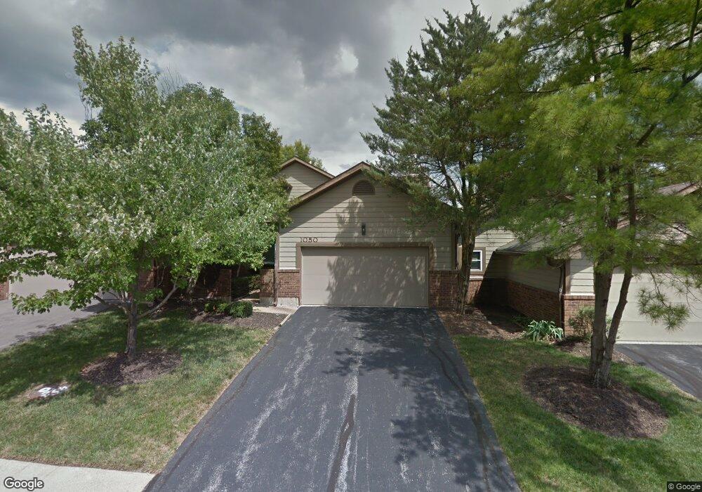
1050 N Spoede Rd Saint Louis, MO 63146
Estimated Value: $378,246 - $438,000
3
Beds
3
Baths
2,270
Sq Ft
$182/Sq Ft
Est. Value
About This Home
This home is located at 1050 N Spoede Rd, Saint Louis, MO 63146 and is currently estimated at $413,812, approximately $182 per square foot. 1050 N Spoede Rd is a home located in St. Louis County with nearby schools including Spoede Elementary School, Ladue 5th Grade Center, and Ladue Middle.
Ownership History
Date
Name
Owned For
Owner Type
Purchase Details
Closed on
Aug 20, 2019
Sold by
Chenggang Li and Chenggang Zhaohui Du
Bought by
He Jiandong and Wang Ying
Current Estimated Value
Home Financials for this Owner
Home Financials are based on the most recent Mortgage that was taken out on this home.
Original Mortgage
$240,000
Outstanding Balance
$210,196
Interest Rate
3.7%
Mortgage Type
New Conventional
Estimated Equity
$203,616
Purchase Details
Closed on
Aug 13, 2013
Sold by
Declaration Of Trust Of Bernean E Gold
Bought by
Chenggang Li and Zhaohui Du
Create a Home Valuation Report for This Property
The Home Valuation Report is an in-depth analysis detailing your home's value as well as a comparison with similar homes in the area
Home Values in the Area
Average Home Value in this Area
Purchase History
| Date | Buyer | Sale Price | Title Company |
|---|---|---|---|
| He Jiandong | $300,000 | Security Title Ins Agcy | |
| Chenggang Li | $270,000 | Investors Title Co Clayton |
Source: Public Records
Mortgage History
| Date | Status | Borrower | Loan Amount |
|---|---|---|---|
| Open | He Jiandong | $240,000 |
Source: Public Records
Tax History Compared to Growth
Tax History
| Year | Tax Paid | Tax Assessment Tax Assessment Total Assessment is a certain percentage of the fair market value that is determined by local assessors to be the total taxable value of land and additions on the property. | Land | Improvement |
|---|---|---|---|---|
| 2025 | $4,841 | $82,520 | $20,710 | $61,810 |
| 2024 | $4,841 | $69,830 | $12,940 | $56,890 |
| 2023 | $4,835 | $69,830 | $12,940 | $56,890 |
| 2022 | $4,028 | $55,940 | $12,940 | $43,000 |
| 2021 | $3,997 | $55,940 | $12,940 | $43,000 |
| 2020 | $4,085 | $56,470 | $14,230 | $42,240 |
| 2019 | $4,053 | $56,470 | $14,230 | $42,240 |
| 2018 | $4,271 | $54,970 | $6,040 | $48,930 |
| 2017 | $4,264 | $54,970 | $6,040 | $48,930 |
| 2016 | $4,121 | $51,790 | $9,480 | $42,310 |
| 2015 | $3,855 | $51,790 | $9,480 | $42,310 |
| 2014 | $3,602 | $46,950 | $10,810 | $36,140 |
Source: Public Records
Map
Nearby Homes
- 1060 Port Diane Dr
- 1033 Wilton Royal Dr Unit 210
- 1033 Wilton Royal Dr Unit 107
- 1033 Wilton Royal Dr Unit 204
- 18 Sona Ln
- 866 Deaver Ln
- 11017 Sandistan Dr
- 1054 Willow Brook Dr
- 832 Larkin Ave
- 50 Willow Brook Dr
- 817 Larkin Ave
- 10469 Briarbend Dr Unit 3
- 814 Mary Meadows Ln
- 11045 Graeser Ln
- 10401 Briarbend Dr Unit 2
- 2 Wedgewood Ln
- 942 Guelbreth Ln Unit 200
- 10352 Forest Brook Ln Unit H
- 10387 Forest Brook Ln
- 10 Spoede Woods Dr
- 1054 N Spoede Rd
- 1058 N Spoede Rd
- 1062 N Spoede Rd Unit 1062
- 1046 N Spoede Rd Unit 1046
- 10865 Picadily Square Dr
- 1065 N Spoede Rd Unit 1065
- 1028 N Spoede Rd Unit 1028
- 10903 Vauxhall Dr Unit 10903
- 10863 Picadily Square Dr
- 1032 N Spoede Rd Unit 1032
- 1035 N Spoede Rd Unit 1035
- 10905 Vauxhall Dr Unit 10905
- 1037 N Spoede Rd Unit 1037
- 1070 N Spoede Rd Unit 1070
- 1066 N Spoede Rd
- 1071 N Spoede Rd Unit 1071
- 1069 N Spoede Rd Unit 1069
- 1068 N Spoede Rd Unit 1068
- 1033 N Spoede Rd Unit 1033
- 1024 N Spoede Rd