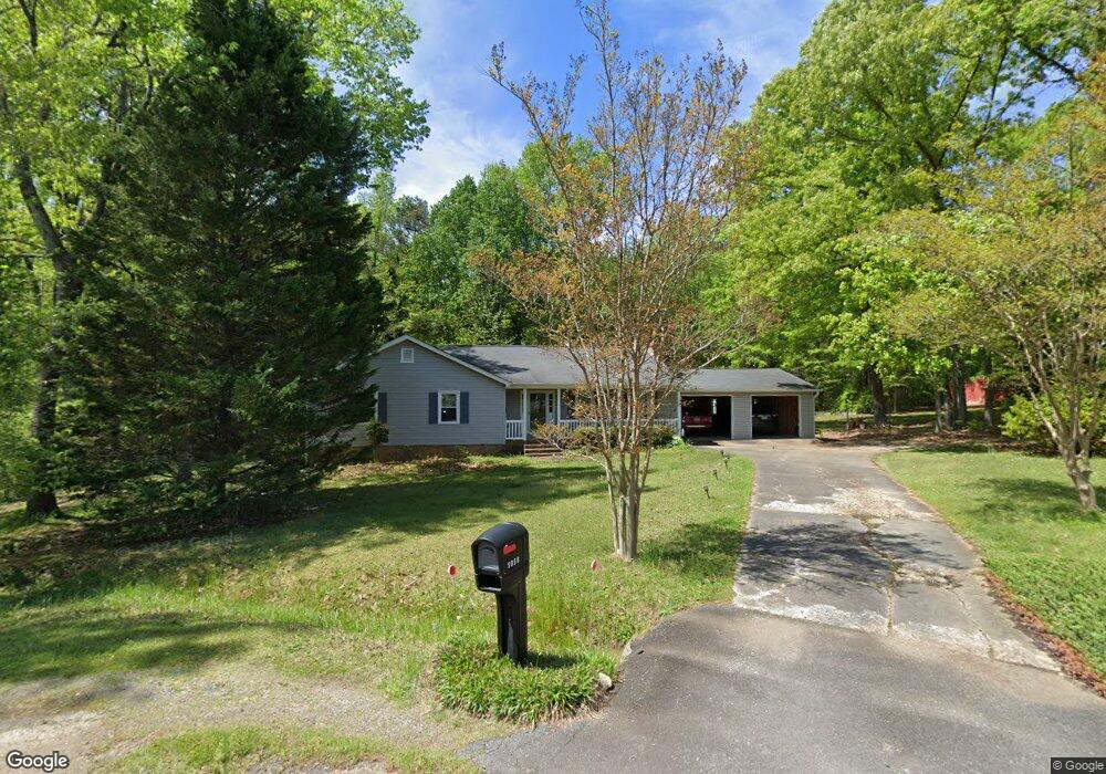
1050 Robin Ln Rock Hill, SC 29730
Estimated Value: $266,091 - $403,000
--
Bed
--
Bath
1,767
Sq Ft
$184/Sq Ft
Est. Value
About This Home
This home is located at 1050 Robin Ln, Rock Hill, SC 29730 and is currently estimated at $325,273, approximately $184 per square foot. 1050 Robin Ln is a home located in York County with nearby schools including Lesslie Elementary School, Castle Heights Middle School, and Rock Hill High School.
Ownership History
Date
Name
Owned For
Owner Type
Purchase Details
Closed on
Feb 23, 2009
Sold by
Reyes Joshua and Reyes Amy
Bought by
Carter Carlton and Carter Debra
Current Estimated Value
Purchase Details
Closed on
Apr 11, 2007
Sold by
Bank Of New York
Bought by
Reyes Joshua and Reyes Amy
Home Financials for this Owner
Home Financials are based on the most recent Mortgage that was taken out on this home.
Original Mortgage
$103,785
Interest Rate
6.1%
Mortgage Type
New Conventional
Purchase Details
Closed on
Jan 19, 2007
Sold by
Faucette Robert S and Faucette Charlie B
Bought by
Bank Of New York and Certificateholders Of Cwabs Series 2004-
Purchase Details
Closed on
Jul 10, 2001
Sold by
Cleckley Ronald H and Cleckley Patricia H
Bought by
Faucette Robert S and Faucette Charlie B
Create a Home Valuation Report for This Property
The Home Valuation Report is an in-depth analysis detailing your home's value as well as a comparison with similar homes in the area
Home Values in the Area
Average Home Value in this Area
Purchase History
| Date | Buyer | Sale Price | Title Company |
|---|---|---|---|
| Carter Carlton | $130,000 | -- | |
| Reyes Joshua | $118,650 | None Available | |
| Bank Of New York | $129,105 | None Available | |
| Faucette Robert S | $99,500 | -- |
Source: Public Records
Mortgage History
| Date | Status | Borrower | Loan Amount |
|---|---|---|---|
| Previous Owner | Reyes Joshua | $103,785 |
Source: Public Records
Tax History Compared to Growth
Tax History
| Year | Tax Paid | Tax Assessment Tax Assessment Total Assessment is a certain percentage of the fair market value that is determined by local assessors to be the total taxable value of land and additions on the property. | Land | Improvement |
|---|---|---|---|---|
| 2024 | $462 | $5,290 | $833 | $4,457 |
| 2023 | $474 | $5,290 | $833 | $4,457 |
| 2022 | $475 | $5,290 | $833 | $4,457 |
| 2021 | -- | $5,290 | $833 | $4,457 |
| 2020 | $474 | $5,290 | $0 | $0 |
| 2019 | $393 | $4,600 | $0 | $0 |
| 2018 | $389 | $4,600 | $0 | $0 |
| 2017 | $367 | $4,600 | $0 | $0 |
| 2016 | $356 | $4,600 | $0 | $0 |
| 2014 | $632 | $4,600 | $1,280 | $3,320 |
| 2013 | $632 | $5,040 | $1,280 | $3,760 |
Source: Public Records
Map
Nearby Homes
- 1104 Neely Store Rd
- 1034 Neely Store Rd
- 1540 Neely Store Rd
- 2999 Starnes Dr
- 2715 Shandon Rd
- 709 Pierce Ct
- 00 Southwinds Ct Unit 24
- 1715 Hopewell Rd
- 3943 Walker Rd Unit LOT ONLY
- 3943 Walker Rd
- 3943 Walker Road (Land Only)
- 2122 Hope Dr
- 1463 Glasscock Rd
- 1177 Ellis Pond Dr
- 953 Church Rd
- 2217 Smoltz Dr
- 2021 Eddie Massey Ln
- 1580 Anderson Rd S
- 1780 Stuart Carter Ave
- 508 Bridgestone Ln
- 1040 Robin Ln
- 1051 Robin Ln Unit 21
- 1051 Robin Ln
- 1140 Neely Store Rd
- 1030 Robin Ln
- 1031 Robin Ln
- 2840 Starnes Dr
- 1130 Neely Store Rd
- 1126 Neely Store Rd
- 1020 Robin Ln
- 2828 Starnes Dr
- 1160 Neely Store Rd
- 1150 Crows Nest Rd
- 1021 Robin Ln
- 1130 Crows Nest Rd
- 2848 Starnes Dr
- 1010 Robin Ln
- 1011 Robin Ln
- 1120 Crows Nest Rd
- 1151 Neely Store Rd