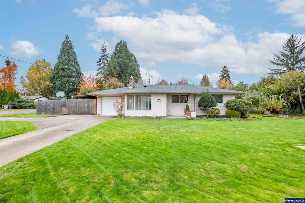
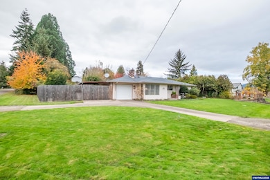
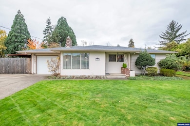
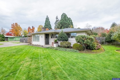
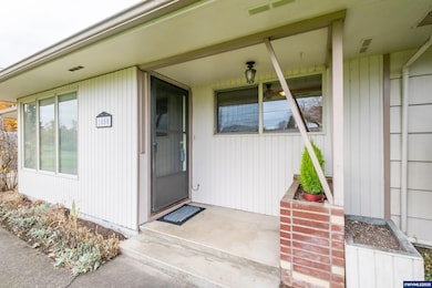
1050 SW Timian St Corvallis, OR 97333
Southwest Corvallis NeighborhoodEstimated payment $2,652/month
Highlights
- RV Access or Parking
- Deck
- Territorial View
- Linus Pauling Middle School Rated A-
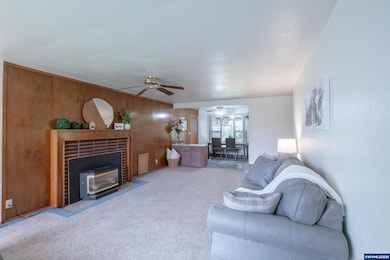
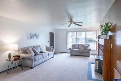
- Living Room with Fireplace
- Wood Flooring
About This Home
First time ever on the market! This charming 3-bed, 1-bath home, built in 1955, is full of original character & sits on a beautifully landscaped, nearly quarter-acre corner lot. With complete fresh interior paint, this home offers timeless appeal & exceptional outdoor space w/ mature landscaping & room to grow. Located just over a mile from OSU, this property blends convenience, charm, & opportunity - perfect for homeowners, investors, or anyone seeking a well-located home in a quiet established neighborhood. Don't miss this opportunity!
Home Details
Home Type
- Single Family
Est. Annual Taxes
- $3,702
Year Built
- Built in 1955
Lot Details
- 10,454 Sq Ft Lot
- Fenced Yard
- Landscaped
- Irregular Lot
- Sprinkler System
- Property is zoned RS-6
Home Design
- Shake Roof
- Composition Roof
- Wood Siding
- Lap Siding
- Shake Siding
Interior Spaces
- 1,018 Sq Ft Home
- 1-Story Property
- Gas Fireplace
- Living Room with Fireplace
- Territorial Views
Kitchen
- Built-In Range
- Dishwasher
Flooring
- Wood
- Carpet
- Laminate
Bedrooms and Bathrooms
- 3 Bedrooms
- 1 Full Bathroom
Parking
- 1 Car Attached Garage
- RV Access or Parking
Outdoor Features
- Deck
- Covered Patio or Porch
- Shed
Schools
- Adams Elementary School
- Linus Pauling Middle School
- Corvallis High School
Utilities
- Forced Air Heating and Cooling System
- Heating System Uses Gas
- Electric Water Heater
- High Speed Internet
Community Details
- Pleasant Acres Subdivision
Listing and Financial Details
- Legal Lot and Block 7 / 1
Map
Home Values in the Area
Average Home Value in this Area
Tax History
| Year | Tax Paid | Tax Assessment Tax Assessment Total Assessment is a certain percentage of the fair market value that is determined by local assessors to be the total taxable value of land and additions on the property. | Land | Improvement |
|---|---|---|---|---|
| 2025 | $3,703 | $198,544 | -- | -- |
| 2024 | $3,703 | $192,761 | -- | -- |
| 2023 | $3,487 | $187,147 | $0 | $0 |
| 2022 | $3,385 | $181,696 | $0 | $0 |
| 2021 | $3,273 | $176,404 | $0 | $0 |
| 2020 | $3,255 | $171,266 | $0 | $0 |
| 2019 | $3,000 | $166,278 | $0 | $0 |
| 2018 | $3,016 | $161,435 | $0 | $0 |
| 2017 | $2,790 | $156,733 | $0 | $0 |
| 2016 | $2,778 | $152,168 | $0 | $0 |
| 2015 | $2,719 | $147,736 | $0 | $0 |
| 2014 | $2,649 | $143,433 | $0 | $0 |
| 2012 | -- | $135,199 | $0 | $0 |
Property History
| Date | Event | Price | List to Sale | Price per Sq Ft |
|---|---|---|---|---|
| 11/06/2025 11/06/25 | Price Changed | $445,000 | -3.2% | $437 / Sq Ft |
| 08/21/2025 08/21/25 | For Sale | $459,500 | -- | $451 / Sq Ft |
Purchase History
| Date | Type | Sale Price | Title Company |
|---|---|---|---|
| Warranty Deed | $135,000 | Ticor Title Insurance Compan |
Mortgage History
| Date | Status | Loan Amount | Loan Type |
|---|---|---|---|
| Open | $135,000 | Seller Take Back |
Source: Willamette Valley MLS
MLS Number: 832524
APN: 142137
Disclaimer: Certain information contained herein is derived from information provided by parties other than Homes.com. All information provided is deemed reliable, but is not guaranteed to be accurate and should be independently verified.
![]() Based on information from Willamette Valley Multiple Listing Service, which neither guarantees nor is in any way responsible for its accuracy. All data is provided ‘AS IS’ and with all faults. Data maintained by Willamette Valley Multiple Listing Service may not reflect all real estate activity in the market. WVMLS Member Broker: Arlene Richardson
Based on information from Willamette Valley Multiple Listing Service, which neither guarantees nor is in any way responsible for its accuracy. All data is provided ‘AS IS’ and with all faults. Data maintained by Willamette Valley Multiple Listing Service may not reflect all real estate activity in the market. WVMLS Member Broker: Arlene Richardson
- 1124 SW Sylvia St
- 1140 SW Sylvia St
- 1123 SW Sylvia St
- Parcel #142681 SW Gerold St
- 0 SW Gerold St
- 5318 SW Touchstone Place
- 4149 SW Research Way
- 615 SW 56th St
- 6034 SW Grand Oaks Dr
- 4651 SW 47th Place
- 1080 SW 35th St
- 5636 SW Avena Place
- 2020 SW 53rd St
- 5935 SW Philomath Bl
- 4900 SW Hollyhock Cir
- 6237 SW Grand Oaks Dr
- 4942 SW Hollyhock Cir
- 200 NW 53rd St
- 5300 SW Whitby Ave
- 6298 SW Grand Oaks Dr Unit E-203 Dr
- 1613 SW 49th St
- 1745 SW 53rd St
- 6300 SW Grand Oaks Dr
- 1445 SW A St
- 2323 NW Monroe Ave
- 1363 SW Western Blvd
- 1205 NW Kline Place
- 3930 NW Witham Hill Dr
- 760 NW 21st St
- 1035 NW 27th St Unit B
- 810 NW 23rd St Unit 10
- 1250 NW 29th St
- 825 NW 23rd Ave
- 4275 NW Clubhouse Place
- 719 SW 4th St
- 124 NW 7th St
- 100-190 SE Viewmont Ave Unit 180-B
- 1335 NW Kings Blvd
- 1010-1062-1062 Nw Fillmore Ave Unit 14
- 1010-1062-1062 Nw Fillmore Ave Unit 27
