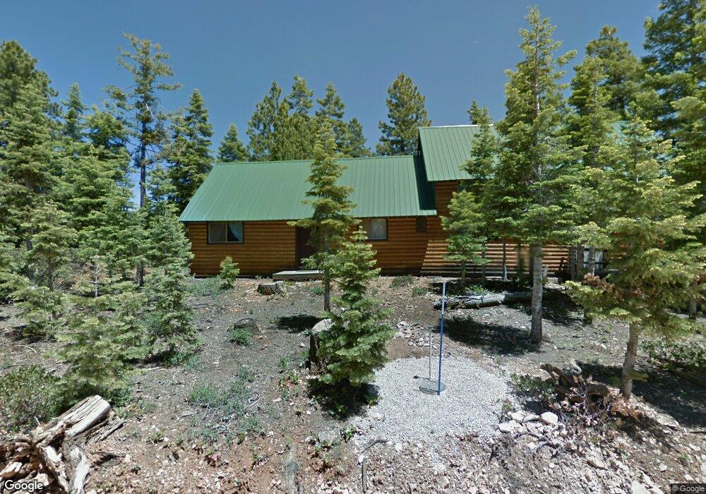
1050 W Cascade Dr Kanab, UT 84741
Duck Creek Village NeighborhoodEstimated Value: $340,000 - $728,000
--
Bed
--
Bath
2,060
Sq Ft
$233/Sq Ft
Est. Value
About This Home
This home is located at 1050 W Cascade Dr, Kanab, UT 84741 and is currently estimated at $480,914, approximately $233 per square foot. 1050 W Cascade Dr is a home with nearby schools including Valley Elementary School and Valley High School.
Ownership History
Date
Name
Owned For
Owner Type
Purchase Details
Closed on
Nov 11, 2016
Sold by
Thyrel Barnum and Thyrel Nora
Bought by
Gubler Dawna
Current Estimated Value
Purchase Details
Closed on
May 23, 2012
Sold by
Gubler Mark and Gubler Dawna
Bought by
Barnum Thyrel and Barnum Nora
Purchase Details
Closed on
Dec 7, 2011
Sold by
Gubler Mark and Gubler Dawna
Bought by
Gubler Mark F and Gubler Dawna B
Purchase Details
Closed on
Apr 19, 2011
Sold by
Bearden Roxie Ann and Bearden Roxie Ann
Bought by
Gubler Mark and Gubler Dawna
Create a Home Valuation Report for This Property
The Home Valuation Report is an in-depth analysis detailing your home's value as well as a comparison with similar homes in the area
Home Values in the Area
Average Home Value in this Area
Purchase History
| Date | Buyer | Sale Price | Title Company |
|---|---|---|---|
| Gubler Dawna | -- | -- | |
| Barnum Thyrel | -- | -- | |
| Gubler Mark F | -- | -- | |
| Gubler Mark | -- | -- |
Source: Public Records
Tax History Compared to Growth
Tax History
| Year | Tax Paid | Tax Assessment Tax Assessment Total Assessment is a certain percentage of the fair market value that is determined by local assessors to be the total taxable value of land and additions on the property. | Land | Improvement |
|---|---|---|---|---|
| 2025 | $1,646 | $237,735 | $68,998 | $168,737 |
| 2024 | $1,646 | $130,483 | $34,499 | $95,984 |
| 2023 | $1,466 | $123,373 | $34,499 | $88,874 |
| 2022 | $1,849 | $137,737 | $36,002 | $101,735 |
| 2021 | $1,485 | $166,093 | $46,756 | $119,337 |
| 2020 | $1,452 | $156,755 | $46,756 | $109,999 |
| 2019 | $1,453 | $152,509 | $42,510 | $109,999 |
| 2018 | $1,466 | $152,509 | $42,510 | $109,999 |
| 2017 | $1,430 | $142,428 | $26,100 | $116,328 |
| 2016 | $1,469 | $142,428 | $26,100 | $116,328 |
| 2015 | $1,328 | $142,428 | $26,100 | $116,328 |
| 2014 | $1,328 | $128,411 | $26,100 | $102,311 |
| 2013 | -- | $128,411 | $0 | $0 |
Source: Public Records
Map
Nearby Homes
- 1075 Cascade Dr
- 55 S Quakie Place
- 45 S Quakie Place
- 870 W Bear Track
- 250 Silver Spruce Dr
- 55 Silver Spruce Dr
- 820 W Cascade Dr
- 250 S Silver Spruce Dr
- 75 S Quakie Place
- 1395 W Canyon Breeze Dr Unit 47
- 1395 W Canyon Breeze Dr
- 1285 W Twisted Trail
- 1270 W Strawberry Point Rd
- 880 W Shale Cir
- 410 S Scenic Dr
- 845 W Tamarisk Cir
- 1225 W Twisted Trail
- 930 W Big Horn Cir
- 1110 Cascade Dr
- 1065 W Cascade Dr
- 1030 W Cascade Dr Unit D
- 275 S Lupin Ln
- 1070 W Cascade Dr
- 1095 W Cascade Dr
- Lot 52 Zion View Mountain Estates
- 235 S Lupin Ln
- 1080 W Raspberry Ln
- 250 S Buckhorn Trail
- 1110 W Raspberry Ln
- 230 S Lupin Ln
- 270 S Buckhorn Trail
- 230 S Buckhorn Trail
- 215 S Lupin Ln
- 1025 Cascade Dr
- 1120 W Raspberry Ln
- 1135 W Cascade Dr
- 210 Buckhorn Trail
- 205 S Lupin Ln