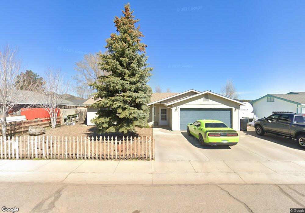
1050 W Rogers Ave Williams, AZ 86046
Estimated Value: $380,982 - $428,000
3
Beds
2
Baths
1,260
Sq Ft
$320/Sq Ft
Est. Value
About This Home
This home is located at 1050 W Rogers Ave, Williams, AZ 86046 and is currently estimated at $403,746, approximately $320 per square foot. 1050 W Rogers Ave is a home located in Coconino County with nearby schools including Williams Elementary/Middle School, Williams High School, and Heritage Elementary - Williams.
Ownership History
Date
Name
Owned For
Owner Type
Purchase Details
Closed on
Dec 4, 2002
Sold by
Sullivan John W and Sullivan Roberta E
Bought by
Mayer Frank Robert and Mayer Dina Garibay
Current Estimated Value
Home Financials for this Owner
Home Financials are based on the most recent Mortgage that was taken out on this home.
Original Mortgage
$119,130
Interest Rate
5.97%
Mortgage Type
FHA
Purchase Details
Closed on
Sep 14, 1999
Sold by
Pfr Developers Llc
Bought by
Sullivan John W and Sullivan Roberta E
Home Financials for this Owner
Home Financials are based on the most recent Mortgage that was taken out on this home.
Original Mortgage
$84,160
Interest Rate
10.37%
Mortgage Type
Seller Take Back
Create a Home Valuation Report for This Property
The Home Valuation Report is an in-depth analysis detailing your home's value as well as a comparison with similar homes in the area
Home Values in the Area
Average Home Value in this Area
Purchase History
| Date | Buyer | Sale Price | Title Company |
|---|---|---|---|
| Mayer Frank Robert | $124,000 | Transnation Title Insurance | |
| Sullivan John W | $105,200 | Chicago Title |
Source: Public Records
Mortgage History
| Date | Status | Borrower | Loan Amount |
|---|---|---|---|
| Previous Owner | Mayer Frank Robert | $119,130 | |
| Previous Owner | Sullivan John W | $84,160 | |
| Closed | Sullivan John W | $21,040 |
Source: Public Records
Tax History Compared to Growth
Tax History
| Year | Tax Paid | Tax Assessment Tax Assessment Total Assessment is a certain percentage of the fair market value that is determined by local assessors to be the total taxable value of land and additions on the property. | Land | Improvement |
|---|---|---|---|---|
| 2025 | $1,172 | $28,748 | -- | -- |
| 2024 | $1,172 | $28,745 | -- | -- |
| 2023 | $1,069 | $21,938 | $0 | $0 |
| 2022 | $1,069 | $17,825 | $0 | $0 |
| 2021 | $1,041 | $17,430 | $0 | $0 |
| 2020 | $1,017 | $16,696 | $0 | $0 |
| 2019 | $987 | $15,924 | $0 | $0 |
| 2018 | $947 | $14,453 | $0 | $0 |
| 2017 | $936 | $13,390 | $0 | $0 |
| 2016 | $880 | $11,401 | $0 | $0 |
| 2015 | $861 | $10,936 | $0 | $0 |
Source: Public Records
Map
Nearby Homes
- 1028 W Rogers Ave
- 316 N Morse Ave
- 162 Pinecrest Trail
- 165 Pinecrest Trail
- 00 W Fulton Ave
- 725 N Humbolt St
- 701 N Airport Rd
- 241 W Grant Ave
- 500 Grand Canyon Ave
- 304 S 4th St
- 410 N Locust St Unit 18
- 106 W Sherman Ave
- 344 E Route 66
- 407 S 7th St
- 411 S 6th St
- 201 S Slagel St
- 215 W Hancock Ave
- 1011 W Sheridan Ave
- 1021 W Sheridan Ave
- 1111 W Sheridan Ave
- 1064 W Rogers Ave
- 1036 W Rogers Ave
- 1077 W Morse Ave
- 1089 W Morse Ave
- 1061 W Morse Ave
- 1078 W Rogers Ave
- 1037 W Rogers Ave
- 1055 W Rogers Ave
- 1105 W Morse Ave
- 1045 W Morse Ave
- 759 N 7th St
- 1073 W Rogers Ave
- 799 N 7th St
- 1123 W Morse Ave
- 1033 W Morse Ave
- 1116 W Rogers Ave
- 1049 W Rogers Ave
- 733 N 7th St
- 1067 W Rogers Ave
- 1076 W Morse Ave