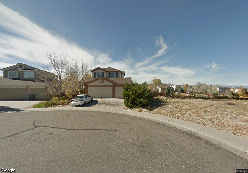
10501 Lynx Ct Lone Tree, CO 80124
Southridge NeighborhoodEstimated Value: $602,000 - $679,679
4
Beds
3
Baths
1,900
Sq Ft
$335/Sq Ft
Est. Value
About This Home
This home is located at 10501 Lynx Ct, Lone Tree, CO 80124 and is currently estimated at $636,893, approximately $335 per square foot. 10501 Lynx Ct is a home located in Douglas County with nearby schools including Wildcat Mountain Elementary School, Rocky Heights Middle School, and Rock Canyon High School.
Ownership History
Date
Name
Owned For
Owner Type
Purchase Details
Closed on
May 17, 2018
Sold by
Kroll Leonard Joseph
Bought by
Kroll Leonard Joseph and Kroll Thomas Anthony
Current Estimated Value
Purchase Details
Closed on
Oct 22, 2010
Sold by
Kroll Dennis
Bought by
Kroll Leonard
Purchase Details
Closed on
Apr 3, 2006
Sold by
Kroll Leonard J
Bought by
Kroll Dennis
Purchase Details
Closed on
Feb 23, 2005
Sold by
Derosa Anne
Bought by
Kroll Leonard J
Purchase Details
Closed on
Jul 23, 2001
Sold by
Kroll Leonard J
Bought by
Kroll Dennis
Purchase Details
Closed on
Jul 24, 1996
Sold by
Kdb Homes Inc
Bought by
Kroll Leonard J
Home Financials for this Owner
Home Financials are based on the most recent Mortgage that was taken out on this home.
Original Mortgage
$156,750
Interest Rate
8.41%
Create a Home Valuation Report for This Property
The Home Valuation Report is an in-depth analysis detailing your home's value as well as a comparison with similar homes in the area
Home Values in the Area
Average Home Value in this Area
Purchase History
| Date | Buyer | Sale Price | Title Company |
|---|---|---|---|
| Kroll Leonard Joseph | -- | None Available | |
| Kroll Leonard | -- | None Available | |
| Kroll Dennis | -- | None Available | |
| Kroll Leonard J | -- | -- | |
| Kroll Dennis | $75,000 | -- | |
| Kroll Leonard J | $165,065 | First American Heritage Titl |
Source: Public Records
Mortgage History
| Date | Status | Borrower | Loan Amount |
|---|---|---|---|
| Previous Owner | Kroll Leonard J | $156,750 |
Source: Public Records
Tax History
| Year | Tax Paid | Tax Assessment Tax Assessment Total Assessment is a certain percentage of the fair market value that is determined by local assessors to be the total taxable value of land and additions on the property. | Land | Improvement |
|---|---|---|---|---|
| 2025 | $4,430 | $43,950 | $9,440 | $34,510 |
| 2024 | $4,430 | $46,230 | $11,060 | $35,170 |
| 2023 | $4,471 | $46,230 | $11,060 | $35,170 |
| 2022 | $3,459 | $34,120 | $7,540 | $26,580 |
| 2021 | $3,594 | $34,120 | $7,540 | $26,580 |
| 2020 | $3,446 | $33,540 | $7,750 | $25,790 |
| 2019 | $3,456 | $33,540 | $7,750 | $25,790 |
| 2018 | $2,836 | $29,230 | $6,770 | $22,460 |
| 2017 | $2,876 | $29,230 | $6,770 | $22,460 |
| 2016 | $2,753 | $27,450 | $6,430 | $21,020 |
| 2015 | $2,804 | $27,450 | $6,430 | $21,020 |
| 2014 | $2,402 | $22,180 | $6,040 | $16,140 |
Source: Public Records
Map
Nearby Homes
- 7053 Leopard Dr
- 7093 Leopard Dr
- 7085 Leopard Gate
- 10456 Carriage Club Dr
- 10330 Lions Path
- 10146 Jill Ave
- 10499 Cheetah Winds
- 10541 Jaguar Glen
- 7549 Bantry Ct
- 10292 Nickolas Ave
- 9943 Cottoncreek Dr
- 10232 Nickolas Ave
- 7755 Barkway Ct
- 10155 Joseph Dr
- 10439 Cheetah Winds
- 10445 Cheetah Winds
- 10899 Bobcat Terrace
- 5639 Jaguar Way
- 10091 Astoria Ct
- 10660 Jewelberry Cir
- 10511 Lynx Ct
- 10521 Lynx Ct
- 6775 Lionshead Pkwy
- 6765 Lionshead Pkwy
- 6755 Lionshead Pkwy
- 10512 Lynx Ct
- 10520 Lynx Ct
- 6745 Lionshead Pkwy
- 6870 Tiger Walk
- 6735 Lionshead Pkwy
- 6873 Tiger Walk
- 6807 Lionshead Pkwy
- 6715 Lionshead Pkwy
- 6784 Lionshead Pkwy
- 6864 Tiger Walk
- 6774 Lionshead Pkwy
- 6867 Tiger Walk
- 6804 Lionshead Pkwy
- 6705 Lionshead Pkwy
- 6813 Lionshead Pkwy
Your Personal Tour Guide
Ask me questions while you tour the home.