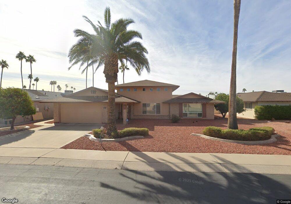
10501 W Bayside Rd Sun City, AZ 85351
Estimated Value: $606,414 - $977,000
3
Beds
2
Baths
2,699
Sq Ft
$285/Sq Ft
Est. Value
About This Home
This home is located at 10501 W Bayside Rd, Sun City, AZ 85351 and is currently estimated at $768,854, approximately $284 per square foot. 10501 W Bayside Rd is a home located in Maricopa County with nearby schools including Desert Mirage Elementary School and Ombudsman - Northwest Charter.
Ownership History
Date
Name
Owned For
Owner Type
Purchase Details
Closed on
May 1, 2008
Sold by
Dunham Caroline E
Bought by
Riess Janet L and Rowley Gerald T
Current Estimated Value
Home Financials for this Owner
Home Financials are based on the most recent Mortgage that was taken out on this home.
Original Mortgage
$376,000
Interest Rate
5.87%
Mortgage Type
New Conventional
Purchase Details
Closed on
Mar 7, 2003
Sold by
Dunham Halstead F and Dunham Caroline E
Bought by
Dunham Halstead F and Dunham Caroline E
Purchase Details
Closed on
Feb 13, 1998
Sold by
Irene Dengl Franz and Irene Dengl
Bought by
Dunham Halstead F and Dunham Caroline E
Home Financials for this Owner
Home Financials are based on the most recent Mortgage that was taken out on this home.
Original Mortgage
$227,900
Interest Rate
4.75%
Mortgage Type
New Conventional
Create a Home Valuation Report for This Property
The Home Valuation Report is an in-depth analysis detailing your home's value as well as a comparison with similar homes in the area
Home Values in the Area
Average Home Value in this Area
Purchase History
| Date | Buyer | Sale Price | Title Company |
|---|---|---|---|
| Riess Janet L | $470,000 | First American Title Ins Co | |
| Dunham Halstead F | -- | -- | |
| Dunham Halstead F | $239,900 | First American Title |
Source: Public Records
Mortgage History
| Date | Status | Borrower | Loan Amount |
|---|---|---|---|
| Previous Owner | Riess Janet L | $376,000 | |
| Previous Owner | Dunham Halstead F | $227,900 |
Source: Public Records
Tax History Compared to Growth
Tax History
| Year | Tax Paid | Tax Assessment Tax Assessment Total Assessment is a certain percentage of the fair market value that is determined by local assessors to be the total taxable value of land and additions on the property. | Land | Improvement |
|---|---|---|---|---|
| 2025 | $2,756 | $40,569 | -- | -- |
| 2024 | $3,281 | $38,637 | -- | -- |
| 2023 | $3,281 | $52,500 | $10,500 | $42,000 |
| 2022 | $3,075 | $43,310 | $8,660 | $34,650 |
| 2021 | $3,144 | $42,370 | $8,470 | $33,900 |
| 2020 | $3,066 | $37,460 | $7,490 | $29,970 |
| 2019 | $3,038 | $37,650 | $7,530 | $30,120 |
| 2018 | $3,183 | $34,800 | $6,960 | $27,840 |
| 2017 | $2,565 | $33,430 | $6,680 | $26,750 |
| 2016 | $2,409 | $32,360 | $6,470 | $25,890 |
| 2015 | $2,297 | $29,150 | $5,830 | $23,320 |
Source: Public Records
Map
Nearby Homes
- 10614 W Emerald Point
- 10601 W Bayside Rd Unit 18A
- 10626 W Emerald Point
- 13825 N Kaanapali Dr
- 10502 W Sierra Dawn Dr
- 13626 N Tan Tara Point
- 13836 N Kaanapali Dr
- 13637 N Del Webb Blvd
- 10411 W Cameo Dr
- 13605 N Del Webb Blvd
- 10329 W Floriade Dr
- 10229 W Bolivar Dr
- 13640 N Del Webb Blvd
- 10330 W Thunderbird Blvd Unit A308
- 10330 W Thunderbird Blvd Unit B110
- 10330 W Thunderbird Blvd Unit A332
- 10330 W Thunderbird Blvd Unit A125
- 10330 W Thunderbird Blvd Unit A304
- 10330 W Thunderbird Blvd Unit A127
- 10330 W Thunderbird Blvd Unit B103
- 10449 W Bayside Rd Unit 18A
- 10509 W Bayside Rd
- 10515 W Bayside Rd
- 10506 W Bayside Rd
- 10439 W Bayside Rd
- 10502 W Bayside Rd
- 10510 W Bayside Rd
- 10521 W Bayside Rd
- 10516 W Bayside Rd
- 10438 W Bayside Rd
- 10433 W Bayside Rd
- 10505 W Bolivar Dr
- 10501 W Bolivar Dr
- 10509 W Bolivar Dr
- 10447 W Bolivar Dr
- 13640 N Kaanapali Point
- 10432 W Bayside Rd
- 10529 W Bayside Rd
- 10515 W Bolivar Dr
- 10437 W Bolivar Dr