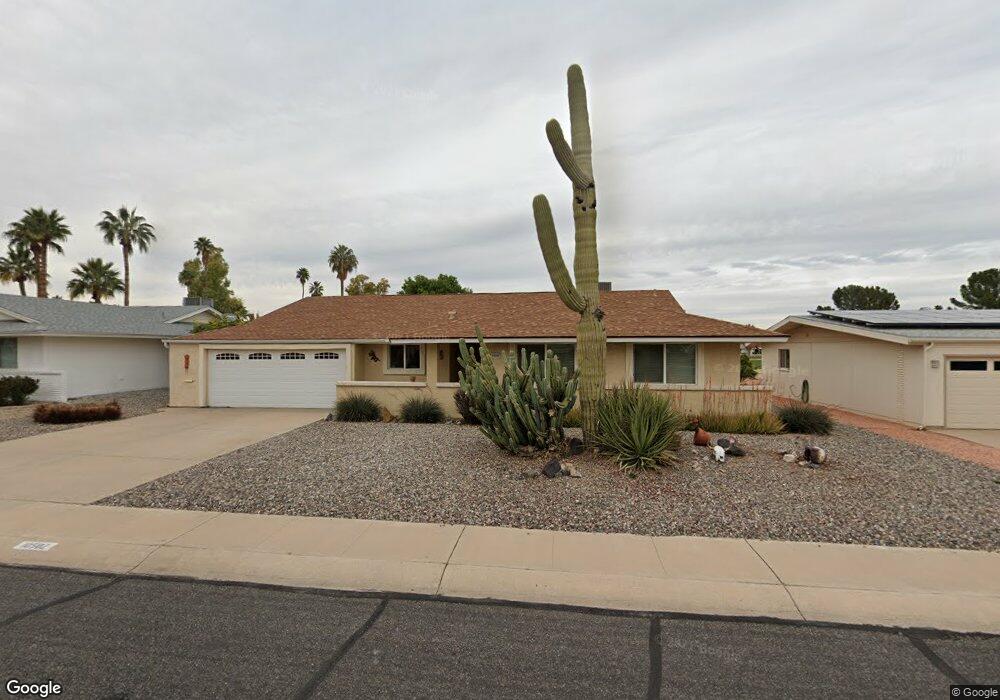
10502 W Mission Ln Sun City, AZ 85351
Estimated Value: $319,265 - $385,000
3
Beds
2
Baths
1,763
Sq Ft
$200/Sq Ft
Est. Value
About This Home
This home is located at 10502 W Mission Ln, Sun City, AZ 85351 and is currently estimated at $352,816, approximately $200 per square foot. 10502 W Mission Ln is a home located in Maricopa County with nearby schools including Ombudsman - Northwest Charter and Peoria Accelerated High School.
Ownership History
Date
Name
Owned For
Owner Type
Purchase Details
Closed on
Aug 2, 2010
Sold by
Credit Union West
Bought by
Benschneier Wiliam D and Benschneider Linda J
Current Estimated Value
Purchase Details
Closed on
Oct 9, 2009
Sold by
Holgate Cheryl Ruby
Bought by
Fox Danny L
Purchase Details
Closed on
Nov 13, 2008
Sold by
Holgate Bobbi Dee
Bought by
Holgate Cheryl Ruby
Purchase Details
Closed on
May 8, 2006
Sold by
Fox Danny L
Bought by
Fox Danny L and Holgate Cheryl
Purchase Details
Closed on
Jul 14, 2004
Sold by
Pasieczny Robert L and Elizabeth Pasieczny Revocable
Bought by
Fox Danny L
Home Financials for this Owner
Home Financials are based on the most recent Mortgage that was taken out on this home.
Original Mortgage
$101,600
Interest Rate
6.27%
Mortgage Type
Purchase Money Mortgage
Create a Home Valuation Report for This Property
The Home Valuation Report is an in-depth analysis detailing your home's value as well as a comparison with similar homes in the area
Home Values in the Area
Average Home Value in this Area
Purchase History
| Date | Buyer | Sale Price | Title Company |
|---|---|---|---|
| Benschneier Wiliam D | $140,000 | Magnus Title Agency | |
| Fox Danny L | -- | None Available | |
| Holgate Cheryl Ruby | -- | None Available | |
| Holgate Bobbi Dee | -- | None Available | |
| Fox Danny L | -- | None Available | |
| Fox Danny L | $127,000 | Ticor Title Agency Of Az Inc |
Source: Public Records
Mortgage History
| Date | Status | Borrower | Loan Amount |
|---|---|---|---|
| Previous Owner | Fox Danny L | $101,600 | |
| Closed | Fox Danny L | $23,400 |
Source: Public Records
Tax History Compared to Growth
Tax History
| Year | Tax Paid | Tax Assessment Tax Assessment Total Assessment is a certain percentage of the fair market value that is determined by local assessors to be the total taxable value of land and additions on the property. | Land | Improvement |
|---|---|---|---|---|
| 2025 | $1,421 | $17,565 | -- | -- |
| 2024 | $1,277 | $16,729 | -- | -- |
| 2023 | $1,277 | $27,110 | $5,420 | $21,690 |
| 2022 | $1,204 | $21,280 | $4,250 | $17,030 |
| 2021 | $1,242 | $19,930 | $3,980 | $15,950 |
| 2020 | $1,209 | $17,750 | $3,550 | $14,200 |
| 2019 | $1,187 | $16,910 | $3,380 | $13,530 |
| 2018 | $1,142 | $15,570 | $3,110 | $12,460 |
| 2017 | $1,104 | $14,900 | $2,980 | $11,920 |
| 2016 | $584 | $14,260 | $2,850 | $11,410 |
| 2015 | $983 | $13,130 | $2,620 | $10,510 |
Source: Public Records
Map
Nearby Homes
- 10326 W Caron Dr
- 9202 N 107th Ave Unit 8
- 10707 W Mission Ln
- 10726 W Denham Dr Unit 16
- 10726 W Kelso Dr Unit 172
- 10731 W Mission Ln Unit 200
- 10732 W Denham Dr Unit 17
- 9815 N 103rd Ave
- 10316 W Salem Dr Unit 6D
- 8803 N 105th Dr
- 10825 W Caron Dr
- 10201 W Caron Dr
- 9802 N 107th Ave
- 10221 W Puget Ave
- 10512 W Ruth Ave
- 10440 W Cheryl Dr
- 10801 W Mountain View Rd
- 10816 W Venturi Dr
- 10109 W Mountain View Rd
- 10302 W Cheryl Dr Unit D
- 10446 W Mission Ln
- 10510 W Mission Ln Unit 7
- 10440 W Mission Ln
- 10516 W Mission Ln
- 10501 W Mission Ln
- 10509 W Mission Ln
- 10445 W Mission Ln
- 10515 W Mission Ln
- 10434 W Mission Ln Unit 7
- 10522 W Mission Ln
- 10437 W Mission Ln
- 10517 W Mission Ln Unit 7
- 10504 W Kelso Dr
- 10508 W Kelso Dr
- 10444 W Kelso Dr
- 10428 W Mission Ln
- 10530 W Mission Ln Unit 7
- 10521 W Mission Ln
- 10514 W Kelso Dr
- 10431 W Mission Ln