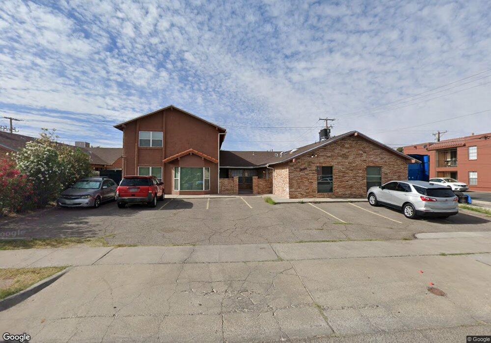
10504 Ashwood Dr El Paso, TX 79935
Pico Norte NeighborhoodEstimated Value: $160,000 - $493,000
--
Bed
4
Baths
4,488
Sq Ft
$83/Sq Ft
Est. Value
About This Home
This home is located at 10504 Ashwood Dr, El Paso, TX 79935 and is currently estimated at $370,333, approximately $82 per square foot. 10504 Ashwood Dr is a home located in El Paso County with nearby schools including East Point Elementary School, Eastwood Middle School, and Eastwood High School.
Ownership History
Date
Name
Owned For
Owner Type
Purchase Details
Closed on
Dec 2, 2015
Sold by
Anyspa Group Llc
Bought by
Gutierrez Juan Orlando
Current Estimated Value
Home Financials for this Owner
Home Financials are based on the most recent Mortgage that was taken out on this home.
Original Mortgage
$245,571
Outstanding Balance
$193,685
Interest Rate
3.79%
Mortgage Type
FHA
Estimated Equity
$176,648
Purchase Details
Closed on
Jun 21, 2014
Sold by
Parra Guillermo and Parra Juanita
Bought by
Anyspa Group Llc
Home Financials for this Owner
Home Financials are based on the most recent Mortgage that was taken out on this home.
Original Mortgage
$178,500
Interest Rate
4.23%
Mortgage Type
Assumption
Create a Home Valuation Report for This Property
The Home Valuation Report is an in-depth analysis detailing your home's value as well as a comparison with similar homes in the area
Home Values in the Area
Average Home Value in this Area
Purchase History
| Date | Buyer | Sale Price | Title Company |
|---|---|---|---|
| Gutierrez Juan Orlando | -- | None Available | |
| Anyspa Group Llc | -- | None Available |
Source: Public Records
Mortgage History
| Date | Status | Borrower | Loan Amount |
|---|---|---|---|
| Open | Gutierrez Juan Orlando | $245,571 | |
| Previous Owner | Anyspa Group Llc | $178,500 |
Source: Public Records
Tax History Compared to Growth
Tax History
| Year | Tax Paid | Tax Assessment Tax Assessment Total Assessment is a certain percentage of the fair market value that is determined by local assessors to be the total taxable value of land and additions on the property. | Land | Improvement |
|---|---|---|---|---|
| 2025 | $10,986 | $424,215 | $48,873 | $375,342 |
| 2024 | $10,986 | $400,000 | $45,391 | $354,609 |
| 2023 | $10,986 | $400,000 | $45,391 | $354,609 |
| 2022 | $9,612 | $309,527 | $45,391 | $264,136 |
| 2021 | $11,409 | $309,527 | $45,391 | $264,136 |
| 2020 | $7,691 | $243,499 | $27,876 | $215,623 |
| 2018 | $7,572 | $243,499 | $27,876 | $215,623 |
| 2017 | $7,443 | $243,499 | $27,876 | $215,623 |
| 2016 | $7,443 | $243,499 | $27,876 | $215,623 |
| 2015 | $6,967 | $243,499 | $27,876 | $215,623 |
| 2014 | $6,967 | $243,499 | $27,876 | $215,623 |
Source: Public Records
Map
Nearby Homes
- 2224 Escarpa Dr
- 10512 Album Ave
- 2412 Penwood Dr
- 2105 Pacheco Dr
- 2701 Brady Place
- 10309 Woodruff Ct
- 10304 Woodruff Ct
- 2109 Febrero Dr
- 2801 Brady Place
- 2705 Fierro Dr
- 1909 Crow Dr
- 10313 Byway Dr
- 2912 Chaswood St
- 10233 Byway Dr
- 3000 Woodall St
- 10145 Camwood Dr
- 1955 Trawood Dr Unit 12
- 3101 Vogue Dr
- 10304 Blackwood Ave
- 10712 Gay Brewer Dr
- 10504 Ashwood Dr Unit A
- 10504 Ashwood Dr Unit A-D
- 10504 Ashwood Dr
- 10508 Ashwood Dr Unit AD
- 10508 Ashwood Dr
- 10512 Ashwood Dr Unit AD
- 10512 Ashwood Dr Unit 4
- 10512 Ashwood Dr Unit A
- 10512 Ashwood Dr Unit D.
- 10512 Ashwood Dr Unit C
- 10512 Ashwood Dr Unit B
- 10514 Ashwood Dr
- 10514 Ashwood Dr
- 10514 Ashwood Dr Unit A
- 10514 Ashwood Dr Unit C
- 10514 Ashwood Dr Unit D
- 10514 Ashwood Dr Unit B
- 10517 Ashwood Dr
- 10517 Ashwood Dr
- 10516 Ashwood Dr Unit AD